CHAPTER 01
A sheen, a derrick, a much bigger promise
A trace of oil on creek water can be enough to start a search. It cannot tell you how much oil the rock will give back.
In the mountains near Waterton, that difference became the centre of an early Canadian oil story. A small company drilled. Oil appeared. A place acquired the ambitious name Oil City. And a discovery that mattered enormously to the imagination of an industry proved much harder to turn into a lasting business.
The story also left us a puzzle in the paperwork. Later accounts repeat thousands of barrels. A government report, citing the company president's affidavit, records thousands of gallons. The number looks familiar. The unit changes almost everything.
This is GeoNavigate Industry Chatter. In this episode, we follow the well commemorated as the first oil well in Western Canada: who backed it, what the surviving records actually say, and why finding petroleum is only the beginning of proving an oilfield.
Our journey begins beside Cameron Creek, before the company and before the derrick.
CHAPTER 02
The oil was already known
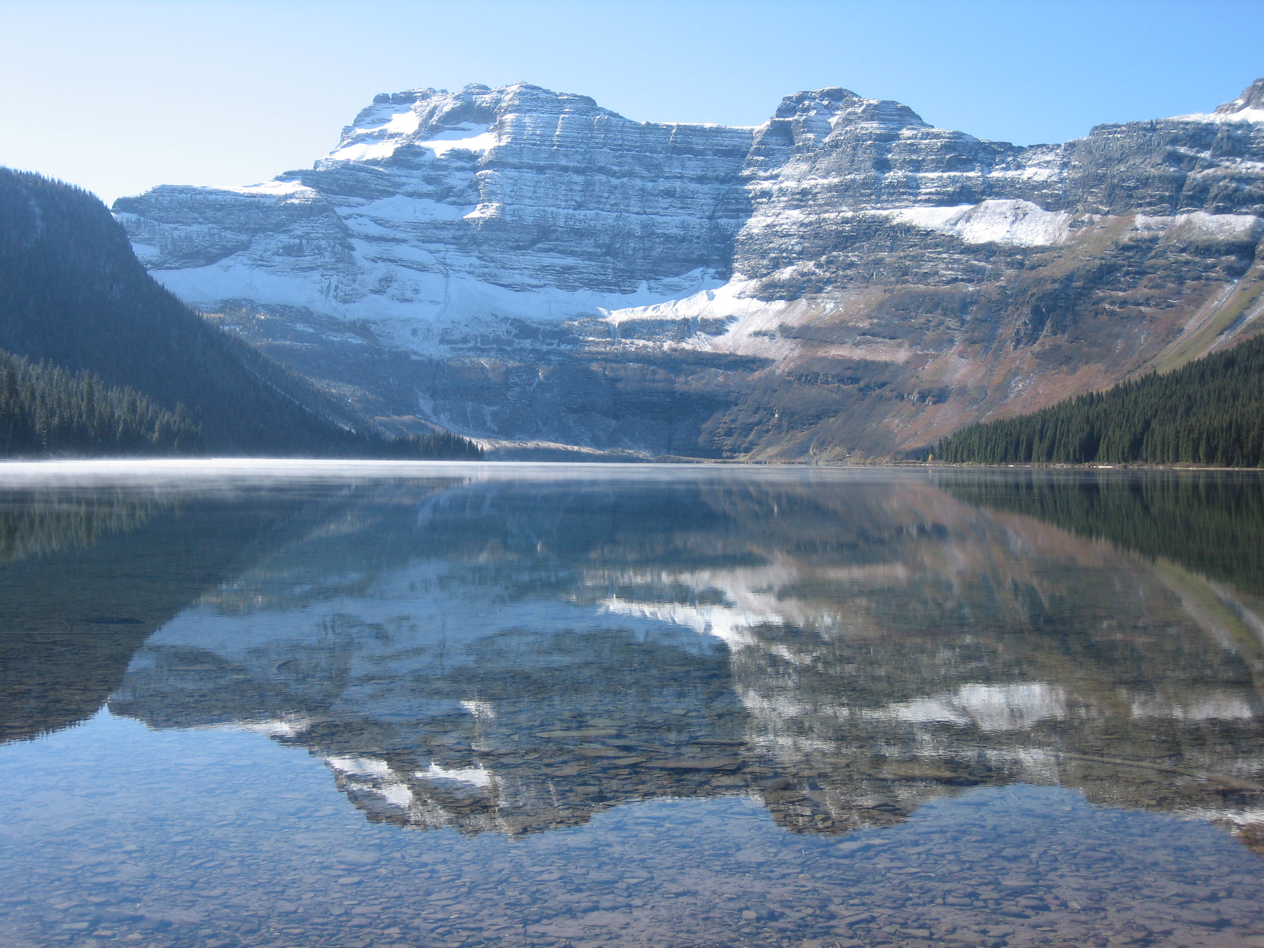
The industrial story did not begin with people arriving in a landscape where nobody knew about oil.
Alberta's historical account records Indigenous knowledge of the local seeps before the drilling venture. It describes that knowledge reaching John George Brown, better known as Kootenai Brown, and the surveyor and geologist George Dawson. Brown and the Aldridge family later collected small quantities of oil.
The creek offered a clue that a person could see and handle. Oil had reached the surface. Someone might gather it, use it, or sell a little of it. But collecting a seep and supplying a market from a drilled well are very different undertakings.
A seep shows that petroleum has found a route. It leaves open the questions that matter to a producing business: where it came from, where it accumulated, and how much connected rock could continue to deliver it.
Those questions would follow the prospectors from the creek bank to the bottom of the hole.
Chapter sources2
CHAPTER 03
The men behind the company
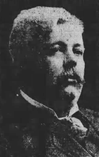
By nineteen-oh-one, John Lineham, Allan Patrick and G. K. Leeson had organized the Rocky Mountain Development Company and begun drilling.
Lineham brought experience from other businesses. His biography describes interests in cattle, lumber and property. This was a man accustomed to turning an opportunity into an enterprise. Patrick's surveying background belonged to another essential part of the frontier economy: locating land, measuring it, and making plans for its use.
Experience could help assemble people and money. It could not make the reservoir larger.
That distinction gives this company a more interesting story than a simple tale of an unlucky amateur. A successful businessman could recognize an opportunity, obtain equipment and persist through difficulty, yet still find that the rock would not support the business he imagined.
The company was an independent local venture. Its name belongs beside this early discovery. We should not quietly attach it to the family tree of a modern oil major without documents establishing that connection.
CHAPTER 04
One year for the drilling, another for the oil
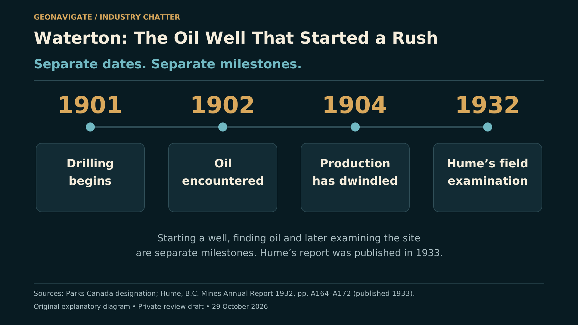
There are two dates to keep separate. Drilling began in nineteen-oh-one. The oil encounter followed in nineteen-oh-two.
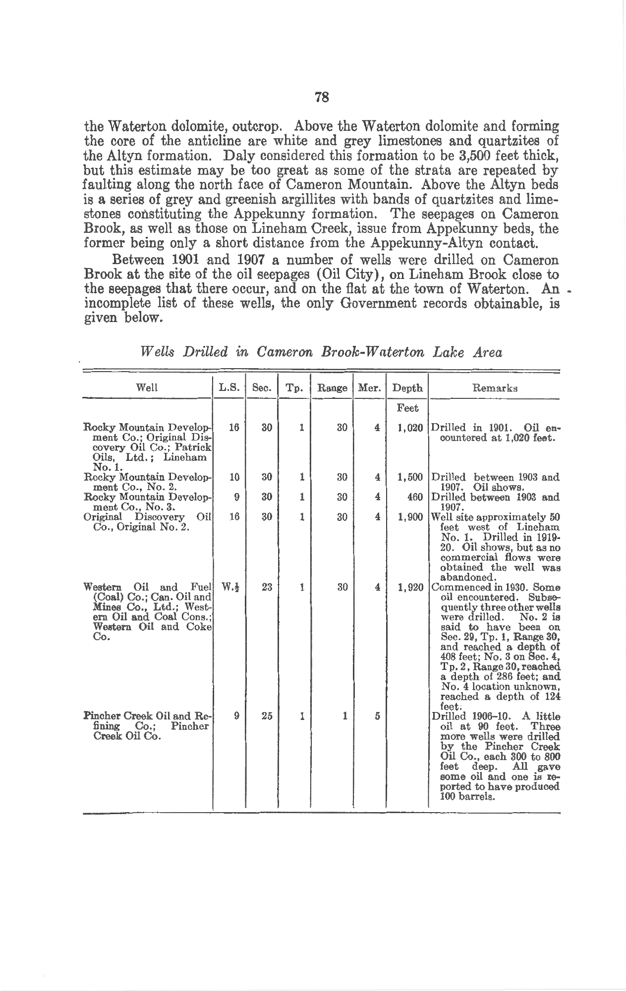
The reported encounter was about three hundred and ten metres below the surface. The early government record gives roughly one thousand and twenty feet. Other commemorative accounts differ slightly. That is a reason to speak carefully, rather than manufacture precision from a record we do not possess.
The original day-by-day drilling log has not been recovered in our research. A later well table is useful, but it is not that log.
Imagine the work in stages: equipment brought into a mountain valley, a drilling site established, a hole advanced, and each new piece of evidence interpreted while money and time continued to be spent. That is the setting of the story, not a recovered account of every shift.
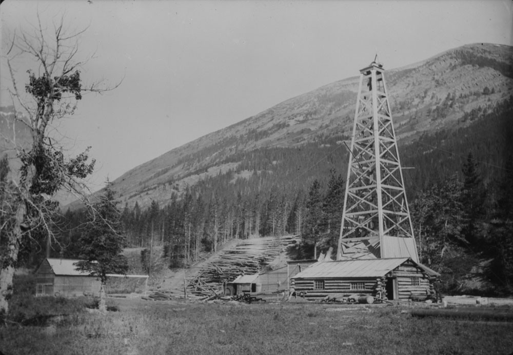
A photograph from nineteen-oh-six shows the actual well and its buildings. It is a valuable window into the operation after the discovery. It is not a moving picture of the moment oil was first encountered.
The oil was real. The scale of the success was the question.
CHAPTER 05
Read the unit beside the number
Here the surviving paperwork changes the tone.
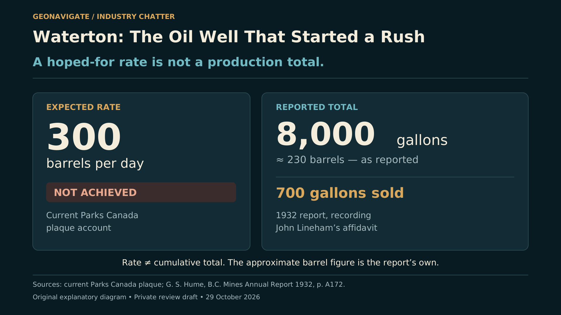
The current Parks Canada plaque says the well failed to yield the expected flow of three hundred barrels a day. That wording matters. An expectation is not a sustained test.
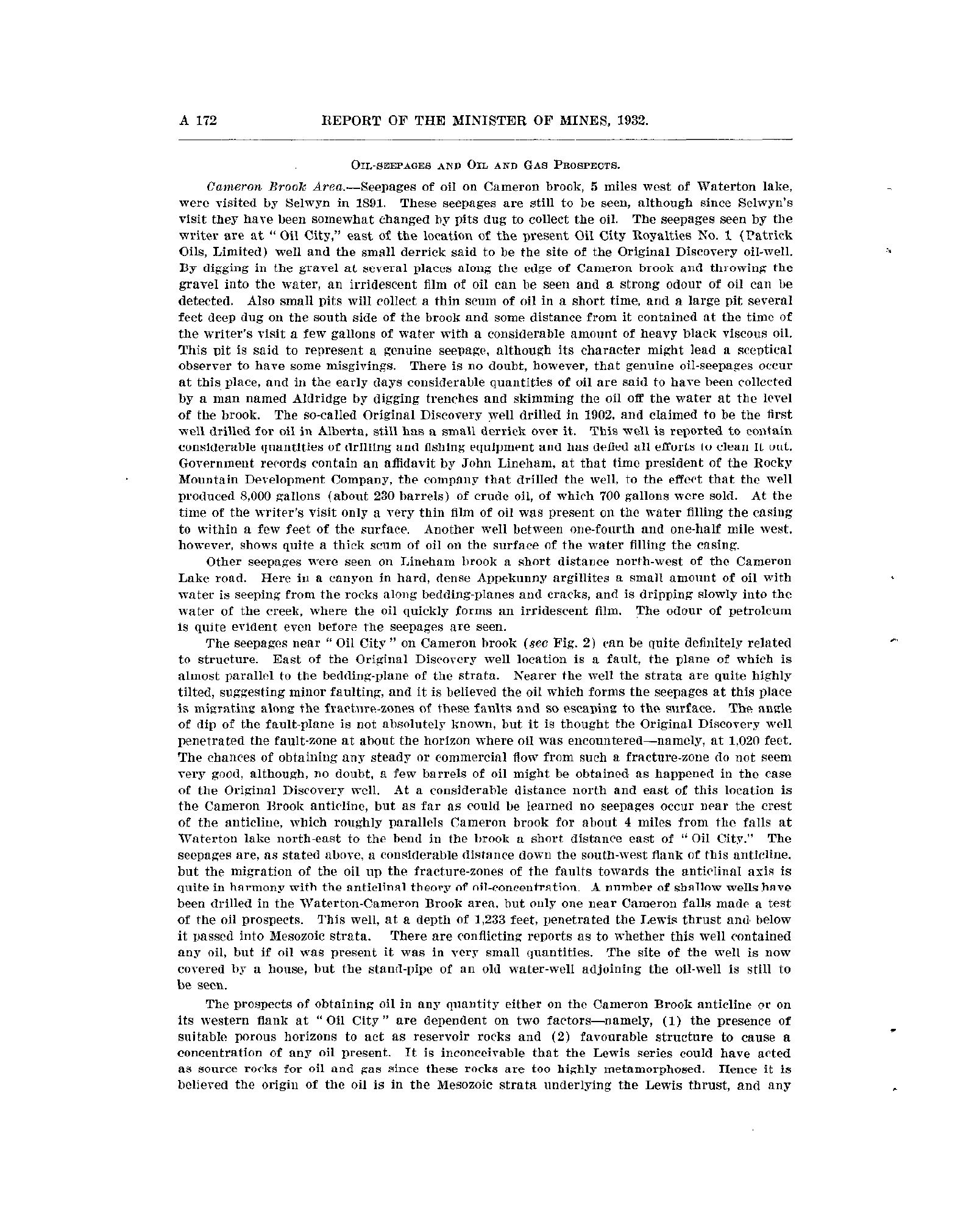
Now turn to geologist G. S. Hume's report of fieldwork in nineteen-thirty-two, published in the following year. Discussing the original discovery well, Hume cites an affidavit by John Lineham. The quantity recorded is eight thousand gallons, described in the report as about two hundred and thirty barrels. Seven hundred gallons were sold.
That is a reported total volume. It is not a daily rate.
We have inspected the printed report, not the original affidavit. The distinction should remain visible. But this is much stronger evidence than silently repeating a larger number because it appears in several later summaries.
In his official geological review in two thousand, P. A. Monahan explicitly identified the approximately two-hundred-and-thirty-barrel estimate as the most credible among the conflicting accounts.
This is not a newly discovered secret. It is a warning already present in the technical literature.
A historian and a wellsite geologist share a useful habit here: keep the observation, its unit, its source and its meaning together. Losing just one of them can turn a modest result into an extraordinary claim.
CHAPTER 06
A path for oil is not the same as a large reservoir
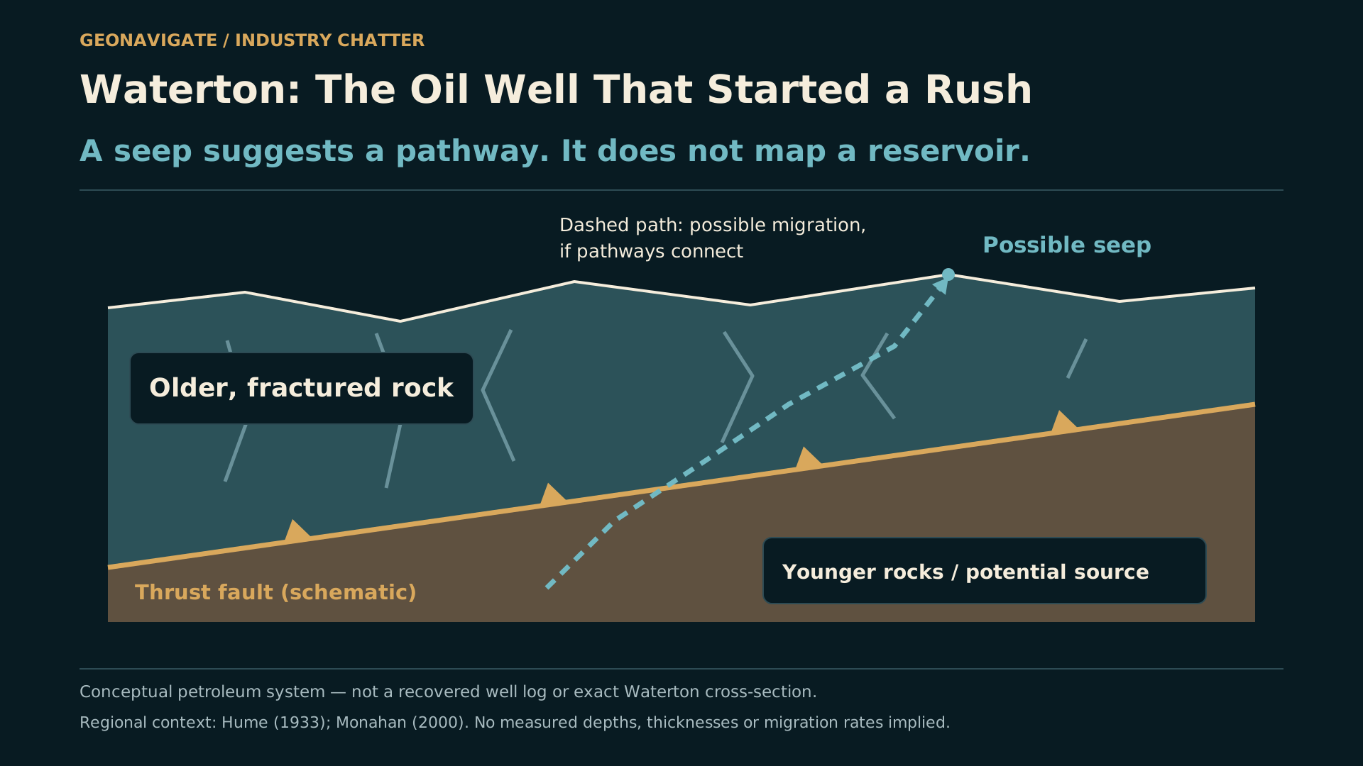
The geology offers a way to understand that gap.
The early reports discuss petroleum moving through fractures. Later regional work describes oil occurrences in the old rocks of the Purcell succession and considers younger rocks below the Lewis thrust as a possible source.
A source rock, a migration pathway and a reservoir are different parts of a petroleum system. They do not have to occupy the same place.
Think of a crack that can carry fluid through otherwise tight rock. The crack may connect the well to some oil. Whether that becomes a useful reservoir depends on the volume connected to it, the ability of fluids to move, and the way pressure changes as production continues.
Those are general principles. They are not a reconstructed pressure history for this well.
Our diagram therefore shows a conceptual pathway through fractured rock. It does not invent a pay thickness, an exact fault intersection or a downhole log. Monahan's regional review itself notes that the relationship to structure is less obvious at Waterton than in some neighbouring occurrences.
The seep was evidence worth investigating. It was never a complete reservoir model.
CHAPTER 07
What the hole could no longer tell them
The well's output dwindled. Parks Canada's heritage account places the end of its brief producing life in nineteen-oh-four. The later field report adds another part of the record: drilling and fishing equipment remained in the bore, and attempts to clean it out had not succeeded.
In oilfield language, fishing means trying to recover equipment from a well. It has nothing to do with the creek running past the site.
We should resist turning these two observations into a perfectly choreographed failure scene. The records we found do not establish the exact sequence of tool loss, obstruction and declining production. They do not prove that one lost tool explains the entire commercial outcome.
What they do show is a difficult well with a disappointing producing history.
A hole that cannot be worked as intended also limits the evidence available to the people trying to understand it. Mechanical access and geological knowledge become entangled.
CHAPTER 08
Oil City: the future in a name
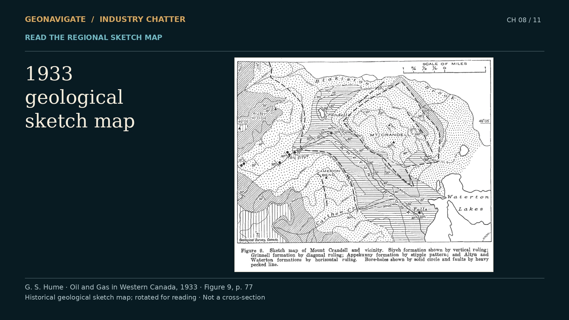
Oil City is a powerful name because it tells us what people hoped to see.
A discovery can make land, buildings and transport seem newly valuable before a field has demonstrated lasting production. The company needs supplies. People anticipate work. A camp becomes the starting point for a much larger imagined future.
But a planned town and a producing oilfield are different kinds of evidence. Our visual treatment keeps them separate. A map can show where people explored. A photograph can show buildings that existed when the photograph was made. Neither should become an invented panorama of a prosperous city.
The old geological sketch map is useful for another reason. It puts the wells and surface geology into a regional setting. It also reminds us how much interpretation lay between a point on a map and a dependable understanding of the subsurface.
The name carried confidence. The wells still had to earn it.
CHAPTER 09
The search outlasted the first disappointment
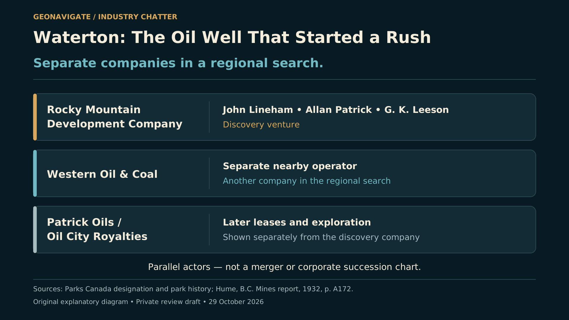
Other operators kept trying.
Western Oil and Coal worked separately near Cameron Falls. Its venture must not be folded into the Rocky Mountain Development Company's discovery as if there were only one company and one hole. Official histories describe another small oil result, without a lasting local producing field.
Later reports also name Patrick Oils and Oil City Royalties. By nineteen-thirty-two, Hume could discuss a new operation near the old discovery while still observing the earlier well.
That is continuity of interest in a place. It does not, by itself, establish a corporate merger or a successful line of succession.
The repeated attempts make sense as a human story. Oil was present. Earlier claims were encouraging. A different location, a deeper hole or a new interpretation might seem capable of changing the outcome.
Persistence can produce a breakthrough. It can also keep a difficult prospect alive long after the first expectation has failed.
Here, the records support repeated exploration and limited oil production. They do not support turning Oil City into a great commercial field.
CHAPTER 10
Who became successful?
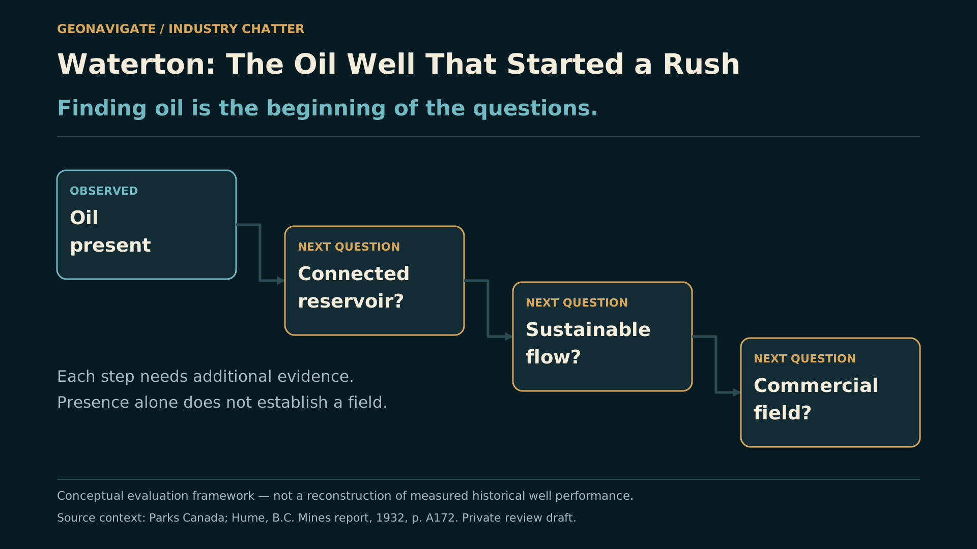
So which company became successful?
For this episode, the honest answer is narrower than a familiar rags-to-riches ending. Lineham had achieved success in other businesses. The Rocky Mountain Development Company made a historically important discovery. Those statements do not show that this particular oil venture became a durable producer or the ancestor of a modern major.
A discovery can succeed as evidence while disappointing as a business.
It can persuade other people that a region deserves investigation. It can draw attention, investment and new questions. But another discovery somewhere else belongs to its own wells, its own geology and its own company records.
That is how we should carry the story toward Turner Valley. Waterton helped encourage the wider search. It did not prove the later field's reservoir, and its company should not receive a corporate connection we cannot verify.
For anyone interpreting drilling today, the practical lesson is familiar. An oil show is worth recording carefully. The next questions concern repeatability, connected volume, flow and the conditions of the test. Excitement can start the investigation. Evidence has to carry it forward.
CHAPTER 11
The small well and the larger consequence
The site received national historic designation in nineteen-sixty-five. A monument followed in nineteen-sixty-eight.
Its importance does not require us to enlarge its production. The surviving story is already compelling: known seeps, a local company, a difficult well, real oil, ambitious expectations and a lasting influence on the search that followed.
The most revealing image may be the quietest one: a line in an old report, with the word gallons still attached to the number.
This is GeoNavigate Industry Chatter. Waterton's early well helped people imagine an oil industry. Reading its record carefully helps us understand what it actually achieved.
Next in the historical series: Turner Valley, and why its story has more than one discovery.