GEONAVIGATE INDUSTRY CHATTER
Before Alberta: Canada's First Oilfields and the Companies That Endured
8:26 · Documentary podcast
Audio MP3 · SRT captions · VTT captions
About the visuals
Historical rigs and machinery are identified by source, site and date. Unrelated drilling footage and realistic AI equipment reconstructions have been removed. Functional diagrams are explicitly conceptual; unrecorded equipment details remain unknown. Narration and timing are unchanged.
Captions are a selectable English track, not burned into the picture. The source records identify each image’s date, location and limits. These short editions retain the approved recorded narrative and chapter timing.
Transcript
The gusher and the lost fortune 0.000–27.353s
Oil Springs attracted people hoping for their own discovery. On January sixteenth, eighteen sixty-two, John Shaw brought in the field's celebrated gusher.
Oil rose above the ground under its own pressure. The museum's account describes a struggle to contain the flow and oil escaping into Black Creek.
The well's performance did not last. By early eighteen sixty-three, the initial flowing boom was fading. The museum reports that Shaw continued trying to make a living and that his eighteen seventy-one obituary described him dying in poverty.
Before the rush 27.603–114.847s
One major early business opportunity was light. A useful lamp fuel could extend the working day and illuminate a home. Asphalt could have a market, too. The challenge was to turn a troublesome substance in the ground into something people would buy.
The petroleum did not first become known when a company put its name on the land. The Oil Museum of Canada credits Anishinaabeg people with harvesting bitumen in the Oil Springs area before commercial development.
Another part of the story was unfolding farther east. Abraham Gesner, a physician and geologist from Nova Scotia, worked on making illuminating fuel from materials including coal, shale and bitumen. In eighteen forty-six, he demonstrated his lamp fuel in Charlottetown. The fuel would become known as kerosene.
In eighteen fifty-four, Charles Nelson Tripp, his brother Henry, and their investors incorporated the International Mining and Manufacturing Company.
The brothers were interested in the gum beds of Enniskillen Township, in what is now southwestern Ontario. They worked with surface bitumen and pursued products including asphalt. Their asphalt earned recognition at the Paris exhibition in eighteen fifty-five.
Yet recognition did not create a good road to the property, put enough money in the accounts, or bring distant customers closer. Provincial and museum histories describe the practical difficulties of transport and finance. The venture struggled.
In the middle of the eighteen fifties, James Miller Williams acquired the Tripp interests. Accounts differ on the exact transfer year, but the larger change is clear. The brothers had demonstrated commercial possibilities without building an enduring operation of their own.
A wagon maker connects the pieces 115.097–178.108s
Williams came from a manufacturing background, building carriages and railway cars. He brought a practical businessman's interest to the gum beds.
In eighteen fifty-eight, his hand-dug well at Oil Springs yielded petroleum. The location was then in Canada West, before Confederation created the Dominion of Canada. Today it is in Ontario.
That excavation is recognized as Canada's first commercial oil well. The word hand-dug matters. A shallow excavation and a drilled hole through rock are different things, and different kinds of first are often mixed together in retellings.
Williams's achievement extended beyond the well. The Dictionary of Canadian Biography places his refining activity at Oil Springs by eighteen fifty-seven and a Hamilton refinery by eighteen sixty. His enterprise became associated with the Canadian Oil Company name.
Here was a workable connection between resource, processing and customers. Crude oil had to become a usable product, and the product had to leave the field.
Williams became a successful businessman. He sold the oil business to his son in eighteen seventy-nine. A University of Calgary Press history records the company's sale to Imperial Oil in eighteen ninety-one.
The quiet wells last 178.358–234.638s
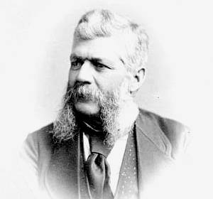
John Henry Fairbank began his Oil Springs operation in eighteen sixty-one. His family's business became an example of endurance on a very different scale from the later national corporations.
One of the most revealing parts of that history is the jerker-line pumping system, dated by Fairbank's company to eighteen sixty-three.
Picture a central source of power sending a reciprocating motion through long lines to pumps at several wells. Instead of assigning a separate engine to every small producer, the operator could share power across a group of wells.
Fairbank also worked on the route to market. He helped organize the railway connection from Petrolia to Wyoming in eighteen sixty-six. The rail link was another part of making oil worth producing.
The Oil Museum describes the Fairbank operation continuing across four generations. Its achievement is measured in longevity and workable production, rather than national size.
As the initial excitement moved on, machinery could keep moving on a quieter property. Fairbank's place in the story reminds us that a successful oil business does not have to be the loudest one in the field.
The refiners build scale 234.888–327.477s
In eighteen eighty, sixteen southwestern Ontario refiners formed the Imperial Oil Company in London, Ontario.
Its early strength lay in processing and distribution. By eighteen ninety-three, its own corporate history records twenty-three branch offices reaching from Halifax to Victoria.
In eighteen ninety-eight, seeking expansion capital, Imperial sold a majority interest to the Standard Oil group in the United States. The business gained access to a larger organization while control changed.
Its major producing interests developed later. A federal competition inquiry dates its move backward into exploration and production to nineteen fourteen. The Imperial that eventually found oil at Norman Wells and Leduc had grown through decades of refining, selling and organizing capital.
There is a trap in the company names. Williams's Canadian Oil Company and the later Canadian Oil group associated with White Rose were separate enterprises.
The later story includes a Canadian Oil Refining Company established in Petrolia in nineteen oh one, followed by combinations and reorganizations during the early nineteen hundreds.
White Rose became the familiar name at the customer end of that business. Its history takes us from the nineteenth-century refinery district toward the twentieth-century service station.
Shell's takeover unfolded in nineteen sixty-two and nineteen sixty-three. Power Corporation's history records the takeover bid in nineteen sixty-two. Shell dates its purchase of Canadian Oil's Sarnia refinery to nineteen sixty-three.
That refinery had been built by Canadian Oil in nineteen fifty-two. The physical plant helps us see what a corporate transaction can mean: useful facilities, commercial relationships and operating activity can continue after the sign changes.
The western opening 327.727–405.912s
Near Waterton, the Rocky Mountain Development Company began drilling in nineteen oh one and encountered oil in nineteen oh two. The well encouraged speculation, but its production was short-lived. By nineteen oh four, the hoped-for lasting success had largely faded.
Turner Valley was a more consequential development. Calgary Petroleum Products brought together William Stewart Herron's prospect and an investment group involving Archibald Dingman. Drilling began in nineteen thirteen.
On May fourteenth, nineteen fourteen, Dingman Number One produced wet gas with valuable liquid hydrocarbons.
A destructive plant fire followed in nineteen twenty. Imperial took over the interests in nineteen twenty-one and created Royalite to run the operation.
Then came further stages. Royalite Number Four opened deeper reserves in nineteen twenty-four. In nineteen thirty-six, Turner Valley Royalties Number One, drilled by a separate company, demonstrated the important crude-oil pool.
Imperial's northern discovery came in nineteen twenty, at the place that became Norman Wells on the Mackenzie River.
The company's account acknowledges that Sahtú people knew the area's natural seepage long before the commercial well. Again, industrial development followed earlier knowledge of petroleum.
Farther south, Leduc Number One came into production on February thirteenth, nineteen forty-seven.
The discovery helped transform the scale of Alberta's industry. It encouraged a much wider search and the investment needed to develop and move the oil that followed.
What the businesses carried forward 406.162–501.106s
Sun entered Canada in nineteen seventeen, supplying lubricating oils, kerosene and other products to war plants around Montreal. Once again, a business that would later be associated with enormous producing operations had an early Canadian history in supplying customers.
The Sun-backed Great Canadian Oil Sands plant began commercial operations in nineteen sixty-seven, near Fort McMurray.
In nineteen seventy-nine, Sun's Canadian operations and Great Canadian Oil Sands were amalgamated as Suncor.
The Petro-Canada Act established the Crown corporation in nineteen seventy-five. It began operations on January first, nineteen seventy-six.
Decades later, the Suncor and Petro-Canada histories joined. Their merger became effective on August first, two thousand nine.
The combined business brought together production, refining and the Petro-Canada retail network. The Petro-Canada name continued where customers could recognize it.
The pattern we can draw from them is that useful technology, access to money, manageable costs and a route to customers helped turn petroleum into a lasting enterprise. None guaranteed success. Reservoirs declined, markets changed, operations failed and ownership moved.
Business endurance also tells only part of the history. Indigenous knowledge and communities, the work of crews, and the effects of extraction on land and water belong in the larger account. A surviving company name does not settle every question about its legacy.
Canada's oil industry began with people finding ways to make known hydrocarbons useful, then learning how to produce them commercially. The first oilfield chapter was written around Oil Springs and Petrolia. Alberta would later change its scale.
The well made the discovery visible. The continuing work around it built the industry.
Visual sources and licences
Each adapted CC BY-SA image sequence remains under its source’s respective CC BY-SA licence. Source-specific attribution, links and changes appear below; other material retains its own source status.
The Tripp venture’s own incorporation act
Province of Canada · Act, 18 December 1854 · original statute facsimile
Source / licence 1
{
  "title": "An Act to incorporate the International Mining and Manufacturing Company",
  "creator": "Province of Canada",
  "date": "1854-12-18",
  "sourceUrl": "https://history.alberta.ca/energyheritage/images/content/oil/IntMin-ManuCo.pdf",
  "license": "Historic Crown statute; copyright term expired. Faithful facsimile from the Government of Alberta heritage collection.",
  "identity": "Actual incorporation statute, chapter XLVIII, assented 18 December 1854. Does not illustrate the appearance of the Tripp works.",
  "changes": "First PDF page rendered at 170 dpi; editorial crop and framed text only, no alteration of the source document."
}
A very different industrial scale
2018 · Jason Woodhead / Flickr · CC BY 2.0
Source / licence 1 Source / licence 2 Source / licence 3 Source / licence 4
{
  "id": "west-suncor-2018",
  "localPath": "suncor-2018.jpg",
  "title": "Suncor’s oil-sands operations, 2018",
  "caption": "An aerial photograph of Suncor’s oil-sands industrial complex in Alberta in April 2018. This modern view illustrates the later scale of the business; it is not an image of the 1967 GCOS opening.",
  "sourceUrl": "https://commons.wikimedia.org/wiki/File:Suncor_2018_(26860867137).jpg",
  "institutionalSourceUrl": "https://www.flickr.com/photos/woodhead/26860867137/",
  "imageUrl": "https://upload.wikimedia.org/wikipedia/commons/thumb/f/f5/Suncor_2018_%2826860867137%29.jpg/1280px-Suncor_2018_%2826860867137%29.jpg",
  "credit": "Jason Woodhead (jasonwoodhead23) / Flickr, via Wikimedia Commons",
  "license": "CC BY 2.0",
  "licenseUrl": "https://creativecommons.org/licenses/by/2.0/",
  "year": 2018,
  "date": "2018-04-26",
  "chapterIndexes": [
    10,
    12
  ],
  "changes": "Full-frame 1280-pixel Wikimedia thumbnail; reduced resolution, no cropping or content alteration.",
  "width": 1280,
  "height": 1044,
  "bytes": 408072
}
Gesner’s lamp-fuel demonstration
GeoNavigate · source-based explanatory graphic · conceptual, not to scale
Source / licence 1
{
  "creator": "GeoNavigate",
  "license": "Original GeoNavigate explanatory artwork",
  "sourceUrls": [
    "https://www.biographi.ca/en/bio/gesner_abraham_9E.html"
  ],
  "sourceUrl": "https://www.biographi.ca/en/bio/gesner_abraham_9E.html",
  "identity": "Original factual chronology or evidence comparison, with no equipment reconstruction.",
  "changes": "New factual diagram; no AI-generated equipment or photorealistic reconstruction.",
  "equipment_policy": "Functional/geometrical principle only; no invented rig, equipment silhouette or historical apparatus model."
}
Fire, then a new operator
GeoNavigate · source-based explanatory graphic · conceptual, not to scale
Source / licence 1
{
  "creator": "GeoNavigate",
  "license": "Original GeoNavigate explanatory artwork",
  "sourceUrls": [
    "https://www.history.alberta.ca/energyheritage/turner-valley-gas-plant/technology-and-infrastructure/drilling.aspx"
  ],
  "sourceUrl": "https://www.history.alberta.ca/energyheritage/turner-valley-gas-plant/technology-and-infrastructure/drilling.aspx",
  "identity": "Original factual chronology or evidence comparison, with no equipment reconstruction.",
  "changes": "New factual diagram; no AI-generated equipment or photorealistic reconstruction.",
  "equipment_policy": "Functional/geometrical principle only; no invented rig, equipment silhouette or historical apparatus model."
}
The businesses join
Suncor + Petro-Canada · merger effective 1 August 2009
{
  "creator": "GeoNavigate",
  "rights": "Original GeoNavigate explanatory artwork, audited for this revision.",
  "identity": "Explicitly conceptual function/geometry; no equipment reconstruction."
}
The name at the roadside
Toronto · about 1924 · William James / City of Toronto Archives
Source / licence 1 Source / licence 2
{
  "id": "early-white-rose-1924",
  "localPath": "white-rose-toronto-c1924.jpg",
  "title": "White Rose service station in Toronto",
  "caption": "A White Rose gasoline service station in Toronto, about 1924. The brand belongs to the later Canadian Oil enterprise, distinct from Williams’s Canadian Oil Company.",
  "sourceUrl": "https://commons.wikimedia.org/wiki/File:White_Rose_Gasoline_Service_Station_circa_1920.jpg",
  "imageUrl": "https://upload.wikimedia.org/wikipedia/commons/e/e5/White_Rose_Gasoline_Service_Station_circa_1920.jpg",
  "credit": "William James / City of Toronto Archives, Fonds 1244, Item 2545; via Wikimedia Commons",
  "license": "Public domain (Commons historical-photograph metadata)",
  "year": "Circa 1924",
  "chapterIndexes": [
    7
  ],
  "width": 848,
  "height": 792,
  "bytes": 157054,
  "presentationNote": "Original aspect ratio retained; no crop or image alteration."
}
John Shaw’s well strikes oil
Oil Springs · 16 January 1862 · Oil Museum of Canada
{
  "creator": "GeoNavigate",
  "rights": "Original GeoNavigate explanatory artwork, audited for this revision.",
  "identity": "Explicitly conceptual function/geometry; no equipment reconstruction."
}
Leduc changes the scale
13 February 1947 · Provincial Archives of Alberta · P2721
Source / licence 1 Source / licence 2 Source / licence 3 Source / licence 4
{
  "id": "west-leduc-no1-1947",
  "localPath": "leduc-no1-1947.jpg",
  "title": "Leduc No. 1, 13 February 1947",
  "caption": "Imperial’s Leduc No. 1 on 13 February 1947. This is an archival photograph of the discovery well on the day of its public production event, not a later reconstruction. Provincial Archives of Alberta, P2721.",
  "sourceUrl": "https://commons.wikimedia.org/wiki/File:Imperial_Leduc_No._1_oil_well,_Leduc,_Alberta_(34748205822).jpg",
  "institutionalSourceUrl": "https://www.flickr.com/photos/alberta_archives/34748205822/",
  "imageUrl": "https://upload.wikimedia.org/wikipedia/commons/0/04/Imperial_Leduc_No._1_oil_well%2C_Leduc%2C_Alberta_%2834748205822%29.jpg",
  "credit": "Provincial Archives of Alberta, P2721 / Flickr Commons",
  "license": "No known copyright restrictions (institutional Flickr Commons release)",
  "licenseUrl": "https://www.flickr.com/commons/usage/",
  "year": 1947,
  "date": "1947-02-13",
  "chapterIndexes": [
    9
  ],
  "changes": "None; original image downloaded intact.",
  "width": 2222,
  "height": 2850,
  "bytes": 469358
}
One source of power · several wells
GeoNavigate · source-based explanatory graphic · conceptual, not to scale
Source / licence 1
{
  "creator": "GeoNavigate",
  "license": "Original GeoNavigate explanatory artwork",
  "sourceUrls": [
    "https://fairbankoil.com/oil-technology-history/"
  ],
  "sourceUrl": "https://fairbankoil.com/oil-technology-history/",
  "identity": "Functional shared-power network only: powerhouse → reciprocating jerker rods → individual well pumps. No specific crank, field-wheel, pumpjack or rod layout is drawn.",
  "changes": "New factual diagram; no AI-generated equipment or photorealistic reconstruction.",
  "equipment_policy": "Functional/geometrical principle only; no invented rig, equipment silhouette or historical apparatus model."
}
Imperial’s early business was refining
GeoNavigate · source-based explanatory graphic · conceptual, not to scale
Source / licence 1
{
  "creator": "GeoNavigate",
  "license": "Original GeoNavigate explanatory artwork",
  "sourceUrls": [
    "https://www.imperialoil.ca/company/about/our-history"
  ],
  "sourceUrl": "https://www.imperialoil.ca/company/about/our-history",
  "identity": "Original factual chronology or evidence comparison, with no equipment reconstruction.",
  "changes": "New factual diagram; no AI-generated equipment or photorealistic reconstruction.",
  "equipment_policy": "Functional/geometrical principle only; no invented rig, equipment silhouette or historical apparatus model."
}
Imperial’s distribution network expands
GeoNavigate · source-based explanatory graphic · conceptual, not to scale
Source / licence 1
{
  "creator": "GeoNavigate",
  "license": "Original GeoNavigate explanatory artwork",
  "sourceUrls": [
    "https://www.imperialoil.ca/company/about/our-history"
  ],
  "sourceUrl": "https://www.imperialoil.ca/company/about/our-history",
  "identity": "Original factual chronology or evidence comparison, with no equipment reconstruction.",
  "changes": "New factual diagram; no AI-generated equipment or photorealistic reconstruction.",
  "equipment_policy": "Functional/geometrical principle only; no invented rig, equipment silhouette or historical apparatus model."
}
Sources and credits
GeoNavigate · historical sources and image credits accompany this film
Source / licence 1
{
  "creator": "GeoNavigate",
  "rights": "Original programme closing graphic",
  "sourceUrl": "https://geonavigate.ca",
  "changes": "Public closing replaces the earlier review-status card at exactly the same frames."
}
John Henry Fairbank
Portrait before 1914 · Petrolia Heritage collection
Source / licence 1 Source / licence 2
{
  "id": "early-fairbank-portrait",
  "localPath": "john-henry-fairbank-before-1914.jpg",
  "title": "John Henry Fairbank",
  "caption": "An undated historical portrait of John Henry Fairbank. The source dates the image to before his death in 1914.",
  "sourceUrl": "https://commons.wikimedia.org/wiki/File:JohnHenryFairbank.jpg",
  "imageUrl": "https://upload.wikimedia.org/wikipedia/commons/b/b8/JohnHenryFairbank.jpg",
  "credit": "Photographer unknown; Petrolia Heritage collection, via Wikimedia Commons",
  "license": "Public domain (Commons PD-Canada metadata)",
  "year": "Before 1914; exact date unknown",
  "chapterIndexes": [
    5
  ],
  "width": 250,
  "height": 395,
  "bytes": 9399,
  "presentationNote": "Small archival original: preserve full aspect ratio and show in a framed portrait/detail layout; do not upscale to fill a screen."
}
Recognition did not build the road
GeoNavigate · source-based explanatory graphic · conceptual, not to scale
Source / licence 1
{
  "creator": "GeoNavigate",
  "license": "Original GeoNavigate explanatory artwork",
  "sourceUrls": [
    "https://history.alberta.ca/energyheritage/oil/early-industrialization-and-exploration-1776-1920/oil-in-canada-exploitation-and-entrepreneurs/default.aspx"
  ],
  "sourceUrl": "https://history.alberta.ca/energyheritage/oil/early-industrialization-and-exploration-1776-1920/oil-in-canada-exploitation-and-entrepreneurs/default.aspx",
  "identity": "Conceptual functional relationship; no equipment or site layout is asserted.",
  "changes": "New factual diagram; no AI-generated equipment or photorealistic reconstruction.",
  "equipment_policy": "Functional/geometrical principle only; no invented rig, equipment silhouette or historical apparatus model."
}
Petroleum was known before commercial development
GeoNavigate · source-based explanatory graphic · conceptual, not to scale
Source / licence 1
{
  "creator": "GeoNavigate",
  "license": "Original GeoNavigate explanatory artwork",
  "sourceUrls": [
    "https://www.oilmuseum.ca/join-support/about/our-story/"
  ],
  "sourceUrl": "https://www.oilmuseum.ca/join-support/about/our-story/",
  "identity": "Original factual chronology or evidence comparison, with no equipment reconstruction.",
  "changes": "New factual diagram; no AI-generated equipment or photorealistic reconstruction.",
  "equipment_policy": "Functional/geometrical principle only; no invented rig, equipment silhouette or historical apparatus model."
}
The Tripp venture’s own incorporation act
Province of Canada · Act, 18 December 1854 · original statute facsimile
Source / licence 1
{
  "title": "An Act to incorporate the International Mining and Manufacturing Company",
  "creator": "Province of Canada",
  "date": "1854-12-18",
  "sourceUrl": "https://history.alberta.ca/energyheritage/images/content/oil/IntMin-ManuCo.pdf",
  "license": "Historic Crown statute; copyright term expired. Faithful facsimile from the Government of Alberta heritage collection.",
  "identity": "Actual incorporation statute, chapter XLVIII, assented 18 December 1854. Does not illustrate the appearance of the Tripp works.",
  "changes": "First PDF page rendered at 170 dpi; editorial crop and framed text only, no alteration of the source document."
}
One source of power · several wells
GeoNavigate · source-based explanatory graphic · conceptual, not to scale
Source / licence 1
{
  "creator": "GeoNavigate",
  "license": "Original GeoNavigate explanatory artwork",
  "sourceUrls": [
    "https://fairbankoil.com/oil-technology-history/"
  ],
  "sourceUrl": "https://fairbankoil.com/oil-technology-history/",
  "identity": "Functional shared-power network only: powerhouse → reciprocating jerker rods → individual well pumps. No specific crank, field-wheel, pumpjack or rod layout is drawn.",
  "changes": "New factual diagram; no AI-generated equipment or photorealistic reconstruction.",
  "equipment_policy": "Functional/geometrical principle only; no invented rig, equipment silhouette or historical apparatus model."
}
A useful fuel had a customer
GeoNavigate · source-based explanatory graphic · conceptual, not to scale
Source / licence 1
{
  "creator": "GeoNavigate",
  "license": "Original GeoNavigate explanatory artwork",
  "sourceUrls": [
    "https://www.biographi.ca/en/bio/gesner_abraham_9E.html"
  ],
  "sourceUrl": "https://www.biographi.ca/en/bio/gesner_abraham_9E.html",
  "identity": "Conceptual functional relationship; no equipment or site layout is asserted.",
  "changes": "New factual diagram; no AI-generated equipment or photorealistic reconstruction.",
  "equipment_policy": "Functional/geometrical principle only; no invented rig, equipment silhouette or historical apparatus model."
}
The struggle to contain the flow
Conceptual flow path · not an exact reconstruction of Shaw’s well
{
  "creator": "GeoNavigate",
  "rights": "Original GeoNavigate explanatory artwork, audited for this revision.",
  "identity": "Explicitly conceptual function/geometry; no equipment reconstruction."
}
Norman Wells and the Mackenzie
2019 · Quintin Soloviev / Wikimedia · CC BY 4.0
Source / licence 1 Source / licence 2 Source / licence 3
{
  "id": "west-norman-wells-2019",
  "localPath": "norman-wells-2019.jpg",
  "title": "Norman Wells beside the Mackenzie River, 2019",
  "caption": "An aerial view of Norman Wells and the Mackenzie River, photographed on 28 September 2019. The photograph documents the community and landscape before Imperial’s announced 2026 production shut-in.",
  "sourceUrl": "https://commons.wikimedia.org/wiki/File:Norman_Wells,_Northwest_Territories.jpg",
  "imageUrl": "https://upload.wikimedia.org/wikipedia/commons/8/83/Norman_Wells%2C_Northwest_Territories.jpg",
  "credit": "Quintin Soloviev / Wikimedia Commons",
  "license": "CC BY 4.0",
  "licenseUrl": "https://creativecommons.org/licenses/by/4.0/",
  "year": 2019,
  "date": "2019-09-28",
  "chapterIndexes": [
    9
  ],
  "changes": "None; original image downloaded intact.",
  "width": 2771,
  "height": 1663,
  "bytes": 629379
}
Sixteen refiners join forces
Imperial formed in London, Ontario · 1880
{
  "creator": "GeoNavigate",
  "rights": "Original GeoNavigate explanatory artwork, audited for this revision.",
  "identity": "Explicitly conceptual function/geometry; no equipment reconstruction."
}
An actual refinery · Imperial Sarnia, c. 1910
Sarnia refinery · about 1910 · Nerlich & Co. · CC0
Source / licence 1 Source / licence 2 Source / licence 3
{
  "id": "early-imperial-sarnia",
  "localPath": "imperial-sarnia-refinery-c1910.jpg",
  "title": "Imperial Oil’s Sarnia refinery, about 1910",
  "caption": "A colour postcard view of Imperial Oil’s refinery between the St. Clair River and Christina Street South in Sarnia, about 1910. The scene postdates Imperial’s 1880 founding.",
  "sourceUrl": "https://commons.wikimedia.org/wiki/File:Imperial_Oil_Company,_Sarnia,_Ontario,_Canada.jpg",
  "imageUrl": "https://upload.wikimedia.org/wikipedia/commons/8/81/Imperial_Oil_Company%2C_Sarnia%2C_Ontario%2C_Canada.jpg",
  "credit": "Nerlich & Co.; Southwestern Ontario Digital Archive, via Wikimedia Commons",
  "license": "CC0 1.0 — https://creativecommons.org/publicdomain/zero/1.0/",
  "year": "Circa 1910",
  "chapterIndexes": [
    6
  ],
  "width": 972,
  "height": 600,
  "bytes": 108162,
  "presentationNote": "Original aspect ratio retained; no crop or image alteration.",
  "licenseUrl": "https://creativecommons.org/publicdomain/zero/1.0/"
}
A company name tells only part of the history
GeoNavigate · source-based explanatory graphic · conceptual, not to scale
Source / licence 1 Source / licence 2
{
  "creator": "GeoNavigate",
  "license": "Original GeoNavigate explanatory artwork",
  "sourceUrls": [
    "https://www.oilmuseum.ca/join-support/about/our-story/",
    "https://www.biographi.ca/en/bio/williams_james_miller_11E.html"
  ],
  "sourceUrl": "https://www.oilmuseum.ca/join-support/about/our-story/",
  "identity": "Conceptual functional relationship; no equipment or site layout is asserted.",
  "changes": "New factual diagram; no AI-generated equipment or photorealistic reconstruction.",
  "equipment_policy": "Functional/geometrical principle only; no invented rig, equipment silhouette or historical apparatus model."
}
James Miller Williams
Portrait, 1873 · Notman & Fraser / Library and Archives Canada
Source / licence 1 Source / licence 2
{
  "id": "early-williams-portrait",
  "localPath": "james-miller-williams-1873.jpg",
  "title": "James Miller Williams, 1873",
  "caption": "James Miller Williams photographed by Notman & Fraser in 1873, years after his 1858 Oil Springs commercial well.",
  "sourceUrl": "https://commons.wikimedia.org/wiki/File:JamesMillerWilliams23.jpg",
  "imageUrl": "https://upload.wikimedia.org/wikipedia/commons/8/85/JamesMillerWilliams23.jpg",
  "credit": "Notman & Fraser / Library and Archives Canada, via Wikimedia Commons",
  "license": "Public domain (Commons PD-Canada metadata)",
  "year": "1873",
  "chapterIndexes": [
    3
  ],
  "width": 300,
  "height": 280,
  "bytes": 10298,
  "presentationNote": "Small archival original: preserve full aspect ratio and show in a framed portrait/detail layout; do not upscale to fill a screen."
}
Bitumen, asphalt and a difficult business
GeoNavigate · source-based explanatory graphic · conceptual, not to scale
Source / licence 1 Source / licence 2
{
  "creator": "GeoNavigate",
  "license": "Original GeoNavigate explanatory artwork",
  "sourceUrls": [
    "https://history.alberta.ca/energyheritage/oil/early-industrialization-and-exploration-1776-1920/oil-in-canada-exploitation-and-entrepreneurs/default.aspx",
    "https://history.alberta.ca/energyheritage/images/content/oil/IntMin-ManuCo.pdf"
  ],
  "sourceUrl": "https://history.alberta.ca/energyheritage/oil/early-industrialization-and-exploration-1776-1920/oil-in-canada-exploitation-and-entrepreneurs/default.aspx",
  "identity": "Original factual chronology or evidence comparison, with no equipment reconstruction.",
  "changes": "New factual diagram; no AI-generated equipment or photorealistic reconstruction.",
  "equipment_policy": "Functional/geometrical principle only; no invented rig, equipment silhouette or historical apparatus model."
}
John Shaw · Oil Springs
GeoNavigate · source-based explanatory graphic · conceptual, not to scale
Source / licence 1
{
  "creator": "GeoNavigate",
  "license": "Original GeoNavigate explanatory artwork",
  "sourceUrls": [
    "https://www.lambtonmuseums.ca/en/oil-museum-of-canada/john-shaw.aspx"
  ],
  "sourceUrl": "https://www.lambtonmuseums.ca/en/oil-museum-of-canada/john-shaw.aspx",
  "identity": "Original factual chronology or evidence comparison, with no equipment reconstruction.",
  "changes": "New factual diagram; no AI-generated equipment or photorealistic reconstruction.",
  "equipment_policy": "Functional/geometrical principle only; no invented rig, equipment silhouette or historical apparatus model."
}
The refinery continues after the sign changes
GeoNavigate · source-based explanatory graphic · conceptual, not to scale
Source / licence 1
{
  "creator": "GeoNavigate",
  "license": "Original GeoNavigate explanatory artwork",
  "sourceUrls": [
    "https://www.shell.ca/en_ca/about-us/projects-and-sites/sarnia-manufacturing-centre.html"
  ],
  "sourceUrl": "https://www.shell.ca/en_ca/about-us/projects-and-sites/sarnia-manufacturing-centre.html",
  "identity": "Original factual chronology or evidence comparison, with no equipment reconstruction.",
  "changes": "New factual diagram; no AI-generated equipment or photorealistic reconstruction.",
  "equipment_policy": "Functional/geometrical principle only; no invented rig, equipment silhouette or historical apparatus model."
}
John Henry Fairbank
Portrait before 1914 · Petrolia Heritage collection
Source / licence 1 Source / licence 2
{
  "id": "early-fairbank-portrait",
  "localPath": "john-henry-fairbank-before-1914.jpg",
  "title": "John Henry Fairbank",
  "caption": "An undated historical portrait of John Henry Fairbank. The source dates the image to before his death in 1914.",
  "sourceUrl": "https://commons.wikimedia.org/wiki/File:JohnHenryFairbank.jpg",
  "imageUrl": "https://upload.wikimedia.org/wikipedia/commons/b/b8/JohnHenryFairbank.jpg",
  "credit": "Photographer unknown; Petrolia Heritage collection, via Wikimedia Commons",
  "license": "Public domain (Commons PD-Canada metadata)",
  "year": "Before 1914; exact date unknown",
  "chapterIndexes": [
    5
  ],
  "width": 250,
  "height": 395,
  "bytes": 9399,
  "presentationNote": "Small archival original: preserve full aspect ratio and show in a framed portrait/detail layout; do not upscale to fill a screen."
}
Sun’s Canadian business changes scale
GeoNavigate · source-based explanatory graphic · conceptual, not to scale
Source / licence 1 Source / licence 2
{
  "creator": "GeoNavigate",
  "license": "Original GeoNavigate explanatory artwork",
  "sourceUrls": [
    "https://www.suncor.com/en-ca/who-we-are/history",
    "https://www.suncor.com/en-ca/who-we-are/history/the-biggest-gamble"
  ],
  "sourceUrl": "https://www.suncor.com/en-ca/who-we-are/history",
  "identity": "Original factual chronology or evidence comparison, with no equipment reconstruction.",
  "changes": "New factual diagram; no AI-generated equipment or photorealistic reconstruction.",
  "equipment_policy": "Functional/geometrical principle only; no invented rig, equipment silhouette or historical apparatus model."
}
One source of power · several wells
GeoNavigate · source-based explanatory graphic · conceptual, not to scale
Source / licence 1
{
  "creator": "GeoNavigate",
  "license": "Original GeoNavigate explanatory artwork",
  "sourceUrls": [
    "https://fairbankoil.com/oil-technology-history/"
  ],
  "sourceUrl": "https://fairbankoil.com/oil-technology-history/",
  "identity": "Functional shared-power network only: powerhouse → reciprocating jerker rods → individual well pumps. No specific crank, field-wheel, pumpjack or rod layout is drawn.",
  "changes": "New factual diagram; no AI-generated equipment or photorealistic reconstruction.",
  "equipment_policy": "Functional/geometrical principle only; no invented rig, equipment silhouette or historical apparatus model."
}
Bitumen, asphalt and a difficult business
GeoNavigate · source-based explanatory graphic · conceptual, not to scale
Source / licence 1 Source / licence 2
{
  "creator": "GeoNavigate",
  "license": "Original GeoNavigate explanatory artwork",
  "sourceUrls": [
    "https://history.alberta.ca/energyheritage/oil/early-industrialization-and-exploration-1776-1920/oil-in-canada-exploitation-and-entrepreneurs/default.aspx",
    "https://history.alberta.ca/energyheritage/images/content/oil/IntMin-ManuCo.pdf"
  ],
  "sourceUrl": "https://history.alberta.ca/energyheritage/oil/early-industrialization-and-exploration-1776-1920/oil-in-canada-exploitation-and-entrepreneurs/default.aspx",
  "identity": "Original factual chronology or evidence comparison, with no equipment reconstruction.",
  "changes": "New factual diagram; no AI-generated equipment or photorealistic reconstruction.",
  "equipment_policy": "Functional/geometrical principle only; no invented rig, equipment silhouette or historical apparatus model."
}
A business beyond the well
Sarnia refinery · about 1910 · Nerlich & Co. · CC0
Source / licence 1 Source / licence 2 Source / licence 3
{
  "id": "early-imperial-sarnia",
  "localPath": "imperial-sarnia-refinery-c1910.jpg",
  "title": "Imperial Oil’s Sarnia refinery, about 1910",
  "caption": "A colour postcard view of Imperial Oil’s refinery between the St. Clair River and Christina Street South in Sarnia, about 1910. The scene postdates Imperial’s 1880 founding.",
  "sourceUrl": "https://commons.wikimedia.org/wiki/File:Imperial_Oil_Company,_Sarnia,_Ontario,_Canada.jpg",
  "imageUrl": "https://upload.wikimedia.org/wikipedia/commons/8/81/Imperial_Oil_Company%2C_Sarnia%2C_Ontario%2C_Canada.jpg",
  "credit": "Nerlich & Co.; Southwestern Ontario Digital Archive, via Wikimedia Commons",
  "license": "CC0 1.0 — https://creativecommons.org/publicdomain/zero/1.0/",
  "year": "Circa 1910",
  "chapterIndexes": [
    6
  ],
  "width": 972,
  "height": 600,
  "bytes": 108162,
  "presentationNote": "Original aspect ratio retained; no crop or image alteration.",
  "licenseUrl": "https://creativecommons.org/publicdomain/zero/1.0/"
}
Finding oil was only the beginning
Original explanatory graphic · no production quantities implied
{
  "creator": "GeoNavigate",
  "rights": "Original GeoNavigate explanatory artwork, audited for this revision.",
  "identity": "Explicitly conceptual function/geometry; no equipment reconstruction."
}
A geologist looks for a useful fuel
Abraham Gesner · 1836 map of Nova Scotia · McGill University Library
Source / licence 1 Source / licence 2
{
  "id": "early-gesner-map",
  "localPath": "gesner-geological-map-1836.jpg",
  "title": "Abraham Gesner’s geological map of Nova Scotia",
  "caption": "Gesner’s 1836 geological map, published in Remarks on the Geology and Mineralogy of Nova Scotia. This is an original historical map, showing the geological knowledge of its period.",
  "sourceUrl": "https://commons.wikimedia.org/wiki/File:1836_Geological_map_by_Abraham_Gesner.jpg",
  "imageUrl": "https://upload.wikimedia.org/wikipedia/commons/e/e7/1836_Geological_map_by_Abraham_Gesner.jpg",
  "credit": "Abraham Gesner; digitized by McGill University Library; via Wikimedia Commons",
  "license": "Public domain (author died 1864; original published 1836)",
  "year": "1836",
  "chapterIndexes": [
    1
  ],
  "width": 2480,
  "height": 1829,
  "bytes": 1216985,
  "presentationNote": "Original aspect ratio retained; no crop or image alteration."
}
Two dates in Petro-Canada’s beginning
GeoNavigate · source-based explanatory graphic · conceptual, not to scale
Source / licence 1
{
  "creator": "GeoNavigate",
  "license": "Original GeoNavigate explanatory artwork",
  "sourceUrls": [
    "https://publications.gc.ca/collections/collection_2024/spac-pspc/SP4-1-1980-eng.pdf"
  ],
  "sourceUrl": "https://publications.gc.ca/collections/collection_2024/spac-pspc/SP4-1-1980-eng.pdf",
  "identity": "Original factual chronology or evidence comparison, with no equipment reconstruction.",
  "changes": "New factual diagram; no AI-generated equipment or photorealistic reconstruction.",
  "equipment_policy": "Functional/geometrical principle only; no invented rig, equipment silhouette or historical apparatus model."
}
The work after the rush
Petrolia rig-moving crew · 1870s · Not the 1862 gusher
Source / licence 1 Source / licence 2
{
  "id": "early-petrolia-rig",
  "localPath": "petrolia-rig-crew-1870s.jpg",
  "title": "Moving a drilling rig in Petrolia",
  "caption": "A crew with horses moving a drilling rig in Petrolia in the 1870s. This depicts later oilfield work, not Williams’s 1858 excavation or Shaw’s 1862 gusher.",
  "sourceUrl": "https://commons.wikimedia.org/wiki/File:Petrolia_derrick.jpg",
  "imageUrl": "https://upload.wikimedia.org/wikipedia/commons/2/2b/Petrolia_derrick.jpg",
  "credit": "Photographer unknown; reproduced in Hope Morritt, Rivers of Oil, p. 109; via Wikimedia Commons",
  "license": "Public domain (Commons historical-photograph metadata)",
  "year": "1870s",
  "chapterIndexes": [
    0,
    4,
    5,
    6
  ],
  "width": 314,
  "height": 480,
  "bytes": 56164,
  "presentationNote": "Small archival original: preserve full aspect ratio and show in a framed portrait/detail layout; do not upscale to fill a screen."
}
John Shaw · Oil Springs
GeoNavigate · source-based explanatory graphic · conceptual, not to scale
Source / licence 1
{
  "creator": "GeoNavigate",
  "license": "Original GeoNavigate explanatory artwork",
  "sourceUrls": [
    "https://www.lambtonmuseums.ca/en/oil-museum-of-canada/john-shaw.aspx"
  ],
  "sourceUrl": "https://www.lambtonmuseums.ca/en/oil-museum-of-canada/john-shaw.aspx",
  "identity": "Original factual chronology or evidence comparison, with no equipment reconstruction.",
  "changes": "New factual diagram; no AI-generated equipment or photorealistic reconstruction.",
  "equipment_policy": "Functional/geometrical principle only; no invented rig, equipment silhouette or historical apparatus model."
}
Royalite No. 4 · production equipment in 1926
Frédéric Gadmer · 13 May 1926 · Musée Albert-Kahn A49050 · CC BY-SA 4.0
Source / licence 1 Source / licence 2 Source / licence 3
{
  "title": "Royalite No. 4 production installation, Turner Valley",
  "creator": "Frédéric Gadmer",
  "date": "1926-05-13",
  "sourceUrl": "https://commons.wikimedia.org/wiki/File:Canada,_Foot_Hills_Turner_Valley,_Puits_Royalite_4,_ensemble_des_installations_du_Puits_-_A49050.jpg",
  "institutionalCatalogueUrl": "https://collections.albert-kahn.hauts-de-seine.fr/document/canada-foot-hills-turner-valley-puits-royalite-4-ensemble-des-installations-du-puits/617a7a42cf8b8968b337d9c2",
  "license": "CC BY-SA 4.0",
  "licenseUrl": "https://creativecommons.org/licenses/by-sa/4.0/",
  "identity": "Actual Royalite No. 4 wellhead/production installation in 1926, after the 1924 discovery and fire. Does not show the 1924 drilling derrick or Turner Valley Royalties No. 1.",
  "changes": "Full autochrome frame retained, including plate identification; bounded editorial camera motion. No invented fire, moving parts or equipment alteration. The adapted image sequence is CC BY-SA 4.0."
}
Earlier knowledge, then a commercial well
GeoNavigate · source-based explanatory graphic · conceptual, not to scale
Source / licence 1
{
  "creator": "GeoNavigate",
  "license": "Original GeoNavigate explanatory artwork",
  "sourceUrls": [
    "https://www.imperialoil.ca/news/imperial-stories/the-end-of-an-era-at-norman-wells"
  ],
  "sourceUrl": "https://www.imperialoil.ca/news/imperial-stories/the-end-of-an-era-at-norman-wells",
  "identity": "Original factual chronology or evidence comparison, with no equipment reconstruction.",
  "changes": "New factual diagram; no AI-generated equipment or photorealistic reconstruction.",
  "equipment_policy": "Functional/geometrical principle only; no invented rig, equipment silhouette or historical apparatus model."
}
Dingman No. 1
14 May 1914 · Provincial Archives of Alberta · P1883
Source / licence 1 Source / licence 2 Source / licence 3 Source / licence 4
{
  "id": "west-dingman-no1-1914",
  "localPath": "dingman-no1-1914.jpg",
  "title": "Dingman No. 1 flows, 14 May 1914",
  "caption": "An archival view inside Dingman No. 1 at Turner Valley on 14 May 1914, the date of its wet-gas discovery. The archive titles the image “Dingman No. 1 oil well blows.” Provincial Archives of Alberta, P1883.",
  "sourceUrl": "https://commons.wikimedia.org/wiki/File:Dingman_No._1_oil_well_blows,_Turner_Valley,_Alberta_(34748206312).jpg",
  "institutionalSourceUrl": "https://www.flickr.com/photos/alberta_archives/34748206312/",
  "imageUrl": "https://upload.wikimedia.org/wikipedia/commons/f/fd/Dingman_No._1_oil_well_blows%2C_Turner_Valley%2C_Alberta_%2834748206312%29.jpg",
  "credit": "Provincial Archives of Alberta, P1883 / Flickr Commons",
  "license": "No known copyright restrictions (institutional Flickr Commons release)",
  "licenseUrl": "https://www.flickr.com/commons/usage/",
  "year": 1914,
  "date": "1914-05-14",
  "chapterIndexes": [
    8
  ],
  "changes": "None; original image downloaded intact.",
  "width": 3000,
  "height": 1744,
  "bytes": 477493
}
The Tripp venture’s own incorporation act
Province of Canada · Act, 18 December 1854 · original statute facsimile
Source / licence 1
{
  "title": "An Act to incorporate the International Mining and Manufacturing Company",
  "creator": "Province of Canada",
  "date": "1854-12-18",
  "sourceUrl": "https://history.alberta.ca/energyheritage/images/content/oil/IntMin-ManuCo.pdf",
  "license": "Historic Crown statute; copyright term expired. Faithful facsimile from the Government of Alberta heritage collection.",
  "identity": "Actual incorporation statute, chapter XLVIII, assented 18 December 1854. Does not illustrate the appearance of the Tripp works.",
  "changes": "First PDF page rendered at 170 dpi; editorial crop and framed text only, no alteration of the source document."
}
Two companies with similar names
Williams’s Canadian Oil Company ≠ the later White Rose group
{
  "creator": "GeoNavigate",
  "rights": "Original GeoNavigate explanatory artwork, audited for this revision.",
  "identity": "Explicitly conceptual function/geometry; no equipment reconstruction."
}
A route from Petrolia to the railway
GeoNavigate · source-based explanatory graphic · conceptual, not to scale
Source / licence 1
{
  "creator": "GeoNavigate",
  "license": "Original GeoNavigate explanatory artwork",
  "sourceUrls": [
    "https://www.lambtonmuseums.ca/en/oil-museum-of-canada/john-henry-fairbank.aspx"
  ],
  "sourceUrl": "https://www.lambtonmuseums.ca/en/oil-museum-of-canada/john-henry-fairbank.aspx",
  "identity": "Original factual chronology or evidence comparison, with no equipment reconstruction.",
  "changes": "New factual diagram; no AI-generated equipment or photorealistic reconstruction.",
  "equipment_policy": "Functional/geometrical principle only; no invented rig, equipment silhouette or historical apparatus model."
}
The name stays on the forecourt
Quebec City · 2017 · Wilfredor / Wikimedia · CC BY-SA 4.0
Source / licence 1 Source / licence 2 Source / licence 3
{
  "id": "west-petro-canada-quebec-2017",
  "localPath": "petro-canada-quebec-2017.jpg",
  "title": "The Petro-Canada brand in Quebec City, 2017",
  "caption": "A Petro-Canada filling station in Quebec City, photographed on 2 September 2017. The image shows the consumer brand after Petro-Canada’s 2009 merger with Suncor.",
  "sourceUrl": "https://commons.wikimedia.org/wiki/File:Petro-Canada_station_at_night,_Quebec_City.jpg",
  "imageUrl": "https://upload.wikimedia.org/wikipedia/commons/thumb/9/95/Petro-Canada_station_at_night%2C_Quebec_City.jpg/1280px-Petro-Canada_station_at_night%2C_Quebec_City.jpg",
  "credit": "Wilfredor / Wikimedia Commons",
  "license": "CC BY-SA 4.0",
  "licenseUrl": "https://creativecommons.org/licenses/by-sa/4.0/",
  "year": 2017,
  "date": "2017-09-02",
  "chapterIndexes": [
    11,
    12
  ],
  "changes": "Full-frame 1280-pixel Wikimedia thumbnail; reduced resolution, no cropping or content alteration.",
  "width": 1280,
  "height": 811,
  "bytes": 201781
}
The gusher did not secure his future
The museum cites Shaw’s 1871 obituary · no invented eyewitness quotation
{
  "creator": "GeoNavigate",
  "rights": "Original GeoNavigate explanatory artwork, audited for this revision.",
  "identity": "Explicitly conceptual function/geometry; no equipment reconstruction."
}
Two dates in Petro-Canada’s beginning
GeoNavigate · source-based explanatory graphic · conceptual, not to scale
Source / licence 1
{
  "creator": "GeoNavigate",
  "license": "Original GeoNavigate explanatory artwork",
  "sourceUrls": [
    "https://publications.gc.ca/collections/collection_2024/spac-pspc/SP4-1-1980-eng.pdf"
  ],
  "sourceUrl": "https://publications.gc.ca/collections/collection_2024/spac-pspc/SP4-1-1980-eng.pdf",
  "identity": "Original factual chronology or evidence comparison, with no equipment reconstruction.",
  "changes": "New factual diagram; no AI-generated equipment or photorealistic reconstruction.",
  "equipment_policy": "Functional/geometrical principle only; no invented rig, equipment silhouette or historical apparatus model."
}
One source of power · several wells
GeoNavigate · source-based explanatory graphic · conceptual, not to scale
Source / licence 1
{
  "creator": "GeoNavigate",
  "license": "Original GeoNavigate explanatory artwork",
  "sourceUrls": [
    "https://fairbankoil.com/oil-technology-history/"
  ],
  "sourceUrl": "https://fairbankoil.com/oil-technology-history/",
  "identity": "Functional shared-power network only: powerhouse → reciprocating jerker rods → individual well pumps. No specific crank, field-wheel, pumpjack or rod layout is drawn.",
  "changes": "New factual diagram; no AI-generated equipment or photorealistic reconstruction.",
  "equipment_policy": "Functional/geometrical principle only; no invented rig, equipment silhouette or historical apparatus model."
}
Williams’s well was hand-dug
GeoNavigate · source-based explanatory graphic · conceptual, not to scale
Source / licence 1 Source / licence 2
{
  "creator": "GeoNavigate",
  "license": "Original GeoNavigate explanatory artwork",
  "sourceUrls": [
    "https://www.biographi.ca/en/bio/williams_james_miller_11E.html",
    "https://www.oilmuseum.ca/join-support/about/our-story/"
  ],
  "sourceUrl": "https://www.biographi.ca/en/bio/williams_james_miller_11E.html",
  "identity": "Conceptual distinction between excavation and boring. No dimensions, strata, support system, tools or measured geometry of Williams’s1858 well are asserted.",
  "changes": "New factual diagram; no AI-generated equipment or photorealistic reconstruction.",
  "equipment_policy": "Functional/geometrical principle only; no invented rig, equipment silhouette or historical apparatus model."
}
A route from Petrolia to the railway
GeoNavigate · source-based explanatory graphic · conceptual, not to scale
Source / licence 1
{
  "creator": "GeoNavigate",
  "license": "Original GeoNavigate explanatory artwork",
  "sourceUrls": [
    "https://www.lambtonmuseums.ca/en/oil-museum-of-canada/john-henry-fairbank.aspx"
  ],
  "sourceUrl": "https://www.lambtonmuseums.ca/en/oil-museum-of-canada/john-henry-fairbank.aspx",
  "identity": "Original factual chronology or evidence comparison, with no equipment reconstruction.",
  "changes": "New factual diagram; no AI-generated equipment or photorealistic reconstruction.",
  "equipment_policy": "Functional/geometrical principle only; no invented rig, equipment silhouette or historical apparatus model."
}
The story moves west and north
Original location guide · approximate locations, not a surveyed map
{
  "creator": "GeoNavigate",
  "rights": "Original GeoNavigate explanatory artwork, audited for this revision.",
  "identity": "Explicitly conceptual function/geometry; no equipment reconstruction."
}
Different wells · different discoveries
GeoNavigate · source-based explanatory graphic · conceptual, not to scale
Source / licence 1 Source / licence 2
{
  "creator": "GeoNavigate",
  "license": "Original GeoNavigate explanatory artwork",
  "sourceUrls": [
    "https://www.pc.gc.ca/apps/dfhd/page_nhs_eng.aspx?id=1872",
    "https://www.history.alberta.ca/energyheritage/turner-valley-gas-plant/technology-and-infrastructure/drilling.aspx"
  ],
  "sourceUrl": "https://www.pc.gc.ca/apps/dfhd/page_nhs_eng.aspx?id=1872",
  "identity": "Original factual chronology or evidence comparison, with no equipment reconstruction.",
  "changes": "New factual diagram; no AI-generated equipment or photorealistic reconstruction.",
  "equipment_policy": "Functional/geometrical principle only; no invented rig, equipment silhouette or historical apparatus model."
}
From the field to a usable product
GeoNavigate · source-based explanatory graphic · conceptual, not to scale
Source / licence 1
{
  "creator": "GeoNavigate",
  "license": "Original GeoNavigate explanatory artwork",
  "sourceUrls": [
    "https://www.biographi.ca/en/bio/williams_james_miller_11E.html"
  ],
  "sourceUrl": "https://www.biographi.ca/en/bio/williams_james_miller_11E.html",
  "identity": "Conceptual functional relationship; no equipment or site layout is asserted.",
  "changes": "New factual diagram; no AI-generated equipment or photorealistic reconstruction.",
  "equipment_policy": "Functional/geometrical principle only; no invented rig, equipment silhouette or historical apparatus model."
}
Leduc No. 1 · photographed in 1947
13 February 1947 · Provincial Archives of Alberta · P2721
Source / licence 1 Source / licence 2 Source / licence 3 Source / licence 4
{
  "id": "west-leduc-no1-1947",
  "localPath": "leduc-no1-1947.jpg",
  "title": "Leduc No. 1, 13 February 1947",
  "caption": "Imperial’s Leduc No. 1 on 13 February 1947. This is an archival photograph of the discovery well on the day of its public production event, not a later reconstruction. Provincial Archives of Alberta, P2721.",
  "sourceUrl": "https://commons.wikimedia.org/wiki/File:Imperial_Leduc_No._1_oil_well,_Leduc,_Alberta_(34748205822).jpg",
  "institutionalSourceUrl": "https://www.flickr.com/photos/alberta_archives/34748205822/",
  "imageUrl": "https://upload.wikimedia.org/wikipedia/commons/0/04/Imperial_Leduc_No._1_oil_well%2C_Leduc%2C_Alberta_%2834748205822%29.jpg",
  "credit": "Provincial Archives of Alberta, P2721 / Flickr Commons",
  "license": "No known copyright restrictions (institutional Flickr Commons release)",
  "licenseUrl": "https://www.flickr.com/commons/usage/",
  "year": 1947,
  "date": "1947-02-13",
  "chapterIndexes": [
    9
  ],
  "changes": "None; original image downloaded intact.",
  "width": 2222,
  "height": 2850,
  "bytes": 469358
}
Williams’s well was hand-dug
GeoNavigate · source-based explanatory graphic · conceptual, not to scale
Source / licence 1 Source / licence 2
{
  "creator": "GeoNavigate",
  "license": "Original GeoNavigate explanatory artwork",
  "sourceUrls": [
    "https://www.biographi.ca/en/bio/williams_james_miller_11E.html",
    "https://www.oilmuseum.ca/join-support/about/our-story/"
  ],
  "sourceUrl": "https://www.biographi.ca/en/bio/williams_james_miller_11E.html",
  "identity": "Conceptual distinction between excavation and boring. No dimensions, strata, support system, tools or measured geometry of Williams’s1858 well are asserted.",
  "changes": "New factual diagram; no AI-generated equipment or photorealistic reconstruction.",
  "equipment_policy": "Functional/geometrical principle only; no invented rig, equipment silhouette or historical apparatus model."
}
The crew at Dingman No. 1
May 1914 · Provincial Archives of Alberta · P1303
Source / licence 1 Source / licence 2 Source / licence 3 Source / licence 4
{
  "id": "west-dingman-drillers-1914",
  "localPath": "dingman-drillers-1914.jpg",
  "title": "The drillers at Dingman No. 1, May 1914",
  "caption": "The drilling crew at Dingman No. 1 in Turner Valley, Alberta, in May 1914. Provincial Archives of Alberta, P1303.",
  "sourceUrl": "https://commons.wikimedia.org/wiki/File:Dingman_no._1_oil_well_drillers,_Turner_Valley,_Alberta_(34068647654).jpg",
  "institutionalSourceUrl": "https://www.flickr.com/photos/alberta_archives/34068647654/",
  "imageUrl": "https://upload.wikimedia.org/wikipedia/commons/5/56/Dingman_no._1_oil_well_drillers%2C_Turner_Valley%2C_Alberta_%2834068647654%29.jpg",
  "credit": "Provincial Archives of Alberta, P1303 / Flickr Commons",
  "license": "No known copyright restrictions (institutional Flickr Commons release)",
  "licenseUrl": "https://www.flickr.com/commons/usage/",
  "year": 1914,
  "date": "May 1914",
  "chapterIndexes": [
    8
  ],
  "changes": "None; original image downloaded intact.",
  "width": 2400,
  "height": 2981,
  "bytes": 653462
}
Sun’s Canadian business changes scale
GeoNavigate · source-based explanatory graphic · conceptual, not to scale
Source / licence 1 Source / licence 2
{
  "creator": "GeoNavigate",
  "license": "Original GeoNavigate explanatory artwork",
  "sourceUrls": [
    "https://www.suncor.com/en-ca/who-we-are/history",
    "https://www.suncor.com/en-ca/who-we-are/history/the-biggest-gamble"
  ],
  "sourceUrl": "https://www.suncor.com/en-ca/who-we-are/history",
  "identity": "Original factual chronology or evidence comparison, with no equipment reconstruction.",
  "changes": "New factual diagram; no AI-generated equipment or photorealistic reconstruction.",
  "equipment_policy": "Functional/geometrical principle only; no invented rig, equipment silhouette or historical apparatus model."
}
Petroleum was known before commercial development
GeoNavigate · source-based explanatory graphic · conceptual, not to scale
Source / licence 1
{
  "creator": "GeoNavigate",
  "license": "Original GeoNavigate explanatory artwork",
  "sourceUrls": [
    "https://www.oilmuseum.ca/join-support/about/our-story/"
  ],
  "sourceUrl": "https://www.oilmuseum.ca/join-support/about/our-story/",
  "identity": "Original factual chronology or evidence comparison, with no equipment reconstruction.",
  "changes": "New factual diagram; no AI-generated equipment or photorealistic reconstruction.",
  "equipment_policy": "Functional/geometrical principle only; no invented rig, equipment silhouette or historical apparatus model."
}
Sun’s Canadian business changes scale
GeoNavigate · source-based explanatory graphic · conceptual, not to scale
Source / licence 1 Source / licence 2
{
  "creator": "GeoNavigate",
  "license": "Original GeoNavigate explanatory artwork",
  "sourceUrls": [
    "https://www.suncor.com/en-ca/who-we-are/history",
    "https://www.suncor.com/en-ca/who-we-are/history/the-biggest-gamble"
  ],
  "sourceUrl": "https://www.suncor.com/en-ca/who-we-are/history",
  "identity": "Original factual chronology or evidence comparison, with no equipment reconstruction.",
  "changes": "New factual diagram; no AI-generated equipment or photorealistic reconstruction.",
  "equipment_policy": "Functional/geometrical principle only; no invented rig, equipment silhouette or historical apparatus model."
}
One source of power · several wells
GeoNavigate · source-based explanatory graphic · conceptual, not to scale
Source / licence 1
{
  "creator": "GeoNavigate",
  "license": "Original GeoNavigate explanatory artwork",
  "sourceUrls": [
    "https://fairbankoil.com/oil-technology-history/"
  ],
  "sourceUrl": "https://fairbankoil.com/oil-technology-history/",
  "identity": "Functional shared-power network only: powerhouse → reciprocating jerker rods → individual well pumps. No specific crank, field-wheel, pumpjack or rod layout is drawn.",
  "changes": "New factual diagram; no AI-generated equipment or photorealistic reconstruction.",
  "equipment_policy": "Functional/geometrical principle only; no invented rig, equipment silhouette or historical apparatus model."
}
A useful fuel had a customer
GeoNavigate · source-based explanatory graphic · conceptual, not to scale
Source / licence 1
{
  "creator": "GeoNavigate",
  "license": "Original GeoNavigate explanatory artwork",
  "sourceUrls": [
    "https://www.biographi.ca/en/bio/gesner_abraham_9E.html"
  ],
  "sourceUrl": "https://www.biographi.ca/en/bio/gesner_abraham_9E.html",
  "identity": "Conceptual functional relationship; no equipment or site layout is asserted.",
  "changes": "New factual diagram; no AI-generated equipment or photorealistic reconstruction.",
  "equipment_policy": "Functional/geometrical principle only; no invented rig, equipment silhouette or historical apparatus model."
}
Williams’s well was hand-dug
GeoNavigate · source-based explanatory graphic · conceptual, not to scale
Source / licence 1 Source / licence 2
{
  "creator": "GeoNavigate",
  "license": "Original GeoNavigate explanatory artwork",
  "sourceUrls": [
    "https://www.biographi.ca/en/bio/williams_james_miller_11E.html",
    "https://www.oilmuseum.ca/join-support/about/our-story/"
  ],
  "sourceUrl": "https://www.biographi.ca/en/bio/williams_james_miller_11E.html",
  "identity": "Conceptual distinction between excavation and boring. No dimensions, strata, support system, tools or measured geometry of Williams’s1858 well are asserted.",
  "changes": "New factual diagram; no AI-generated equipment or photorealistic reconstruction.",
  "equipment_policy": "Functional/geometrical principle only; no invented rig, equipment silhouette or historical apparatus model."
}
The continuing work around the well
GeoNavigate · source-based explanatory graphic · conceptual, not to scale
Source / licence 1 Source / licence 2 Source / licence 3
{
  "creator": "GeoNavigate",
  "license": "Original GeoNavigate explanatory artwork",
  "sourceUrls": [
    "https://www.biographi.ca/en/bio/williams_james_miller_11E.html",
    "https://fairbankoil.com/oil-technology-history/",
    "https://www.imperialoil.ca/company/about/our-history"
  ],
  "sourceUrl": "https://www.biographi.ca/en/bio/williams_james_miller_11E.html",
  "identity": "Conceptual functional relationship; no equipment or site layout is asserted.",
  "changes": "New factual diagram; no AI-generated equipment or photorealistic reconstruction.",
  "equipment_policy": "Functional/geometrical principle only; no invented rig, equipment silhouette or historical apparatus model."
}
White Rose
Toronto · 1958 · Alexandra Studio / Toronto History · CC BY 2.0
Source / licence 1 Source / licence 2 Source / licence 3
{
  "id": "early-white-rose-1958",
  "localPath": "white-rose-bloor-1958.jpg",
  "title": "White Rose on Bloor Street West, 1958",
  "caption": "A White Rose gas station on Bloor Street West in Toronto in 1958, before the Shell takeover of 1962–63.",
  "sourceUrl": "https://commons.wikimedia.org/wiki/File:White_Rose_gas_station,_Bloor_Street_West_(6035115661).jpg",
  "imageUrl": "https://upload.wikimedia.org/wikipedia/commons/c/c7/White_Rose_gas_station%2C_Bloor_Street_West_%286035115661%29.jpg",
  "credit": "Alexandra Studio; Toronto History on Flickr, via Wikimedia Commons",
  "license": "CC BY 2.0 — https://creativecommons.org/licenses/by/2.0/",
  "year": "1958",
  "chapterIndexes": [
    7
  ],
  "width": 1034,
  "height": 802,
  "bytes": 185995,
  "presentationNote": "Original aspect ratio retained; no crop or image alteration.",
  "licenseUrl": "https://creativecommons.org/licenses/by/2.0/"
}
Bitumen, asphalt and a difficult business
GeoNavigate · source-based explanatory graphic · conceptual, not to scale
Source / licence 1 Source / licence 2
{
  "creator": "GeoNavigate",
  "license": "Original GeoNavigate explanatory artwork",
  "sourceUrls": [
    "https://history.alberta.ca/energyheritage/oil/early-industrialization-and-exploration-1776-1920/oil-in-canada-exploitation-and-entrepreneurs/default.aspx",
    "https://history.alberta.ca/energyheritage/images/content/oil/IntMin-ManuCo.pdf"
  ],
  "sourceUrl": "https://history.alberta.ca/energyheritage/oil/early-industrialization-and-exploration-1776-1920/oil-in-canada-exploitation-and-entrepreneurs/default.aspx",
  "identity": "Original factual chronology or evidence comparison, with no equipment reconstruction.",
  "changes": "New factual diagram; no AI-generated equipment or photorealistic reconstruction.",
  "equipment_policy": "Functional/geometrical principle only; no invented rig, equipment silhouette or historical apparatus model."
}
The Williams enterprise changes hands
GeoNavigate · source-based explanatory graphic · conceptual, not to scale
Source / licence 1 Source / licence 2
{
  "creator": "GeoNavigate",
  "license": "Original GeoNavigate explanatory artwork",
  "sourceUrls": [
    "https://www.biographi.ca/en/bio/williams_james_miller_11E.html",
    "https://ucp.manifoldapp.org/read/17ef5056-f9c1-4270-88ad-379d05a2a2fc/section/1844bb03-b9c2-4c94-8975-f721ac338ded"
  ],
  "sourceUrl": "https://www.biographi.ca/en/bio/williams_james_miller_11E.html",
  "identity": "Original factual chronology or evidence comparison, with no equipment reconstruction.",
  "changes": "New factual diagram; no AI-generated equipment or photorealistic reconstruction.",
  "equipment_policy": "Functional/geometrical principle only; no invented rig, equipment silhouette or historical apparatus model."
}
Sun’s Canadian business changes scale
GeoNavigate · source-based explanatory graphic · conceptual, not to scale
Source / licence 1 Source / licence 2
{
  "creator": "GeoNavigate",
  "license": "Original GeoNavigate explanatory artwork",
  "sourceUrls": [
    "https://www.suncor.com/en-ca/who-we-are/history",
    "https://www.suncor.com/en-ca/who-we-are/history/the-biggest-gamble"
  ],
  "sourceUrl": "https://www.suncor.com/en-ca/who-we-are/history",
  "identity": "Original factual chronology or evidence comparison, with no equipment reconstruction.",
  "changes": "New factual diagram; no AI-generated equipment or photorealistic reconstruction.",
  "equipment_policy": "Functional/geometrical principle only; no invented rig, equipment silhouette or historical apparatus model."
}
Fire, then a new operator
GeoNavigate · source-based explanatory graphic · conceptual, not to scale
Source / licence 1
{
  "creator": "GeoNavigate",
  "license": "Original GeoNavigate explanatory artwork",
  "sourceUrls": [
    "https://www.history.alberta.ca/energyheritage/turner-valley-gas-plant/technology-and-infrastructure/drilling.aspx"
  ],
  "sourceUrl": "https://www.history.alberta.ca/energyheritage/turner-valley-gas-plant/technology-and-infrastructure/drilling.aspx",
  "identity": "Original factual chronology or evidence comparison, with no equipment reconstruction.",
  "changes": "New factual diagram; no AI-generated equipment or photorealistic reconstruction.",
  "equipment_policy": "Functional/geometrical principle only; no invented rig, equipment silhouette or historical apparatus model."
}
The first western rush fades
Waterton well-site marker · 2010 · Plazak / Wikimedia · CC BY-SA 3.0
Source / licence 1 Source / licence 2 Source / licence 3
{
  "id": "west-waterton-marker-2010",
  "localPath": "waterton-marker-2010.jpg",
  "title": "Waterton oil-well site, photographed in 2010",
  "caption": "The marker at the First Oil Well in Western Canada National Historic Site, beside Cameron Creek in Waterton Lakes National Park. This is a 2010 view of the surviving site, not a photograph of the 1902 drilling rig.",
  "sourceUrl": "https://commons.wikimedia.org/wiki/File:Oilwell-WatertonNP-Alberta.jpg",
  "imageUrl": "https://upload.wikimedia.org/wikipedia/commons/9/9a/Oilwell-WatertonNP-Alberta.jpg",
  "credit": "Plazak / Wikimedia Commons",
  "license": "CC BY-SA 3.0",
  "licenseUrl": "https://creativecommons.org/licenses/by-sa/3.0/",
  "year": 2010,
  "date": "2010-08-09",
  "chapterIndexes": [
    8
  ],
  "changes": "None; original image downloaded intact.",
  "width": 2100,
  "height": 1524,
  "bytes": 634237
}
Williams’s well was hand-dug
GeoNavigate · source-based explanatory graphic · conceptual, not to scale
Source / licence 1 Source / licence 2
{
  "creator": "GeoNavigate",
  "license": "Original GeoNavigate explanatory artwork",
  "sourceUrls": [
    "https://www.biographi.ca/en/bio/williams_james_miller_11E.html",
    "https://www.oilmuseum.ca/join-support/about/our-story/"
  ],
  "sourceUrl": "https://www.biographi.ca/en/bio/williams_james_miller_11E.html",
  "identity": "Conceptual distinction between excavation and boring. No dimensions, strata, support system, tools or measured geometry of Williams’s1858 well are asserted.",
  "changes": "New factual diagram; no AI-generated equipment or photorealistic reconstruction.",
  "equipment_policy": "Functional/geometrical principle only; no invented rig, equipment silhouette or historical apparatus model."
}
The continuing work around the well
GeoNavigate · source-based explanatory graphic · conceptual, not to scale
Source / licence 1 Source / licence 2 Source / licence 3
{
  "creator": "GeoNavigate",
  "license": "Original GeoNavigate explanatory artwork",
  "sourceUrls": [
    "https://www.biographi.ca/en/bio/williams_james_miller_11E.html",
    "https://fairbankoil.com/oil-technology-history/",
    "https://www.imperialoil.ca/company/about/our-history"
  ],
  "sourceUrl": "https://www.biographi.ca/en/bio/williams_james_miller_11E.html",
  "identity": "Conceptual functional relationship; no equipment or site layout is asserted.",
  "changes": "New factual diagram; no AI-generated equipment or photorealistic reconstruction.",
  "equipment_policy": "Functional/geometrical principle only; no invented rig, equipment silhouette or historical apparatus model."
}
Imperial’s early business was refining
GeoNavigate · source-based explanatory graphic · conceptual, not to scale
Source / licence 1
{
  "creator": "GeoNavigate",
  "license": "Original GeoNavigate explanatory artwork",
  "sourceUrls": [
    "https://www.imperialoil.ca/company/about/our-history"
  ],
  "sourceUrl": "https://www.imperialoil.ca/company/about/our-history",
  "identity": "Original factual chronology or evidence comparison, with no equipment reconstruction.",
  "changes": "New factual diagram; no AI-generated equipment or photorealistic reconstruction.",
  "equipment_policy": "Functional/geometrical principle only; no invented rig, equipment silhouette or historical apparatus model."
}
Williams’s well was hand-dug
GeoNavigate · source-based explanatory graphic · conceptual, not to scale
Source / licence 1 Source / licence 2
{
  "creator": "GeoNavigate",
  "license": "Original GeoNavigate explanatory artwork",
  "sourceUrls": [
    "https://www.biographi.ca/en/bio/williams_james_miller_11E.html",
    "https://www.oilmuseum.ca/join-support/about/our-story/"
  ],
  "sourceUrl": "https://www.biographi.ca/en/bio/williams_james_miller_11E.html",
  "identity": "Conceptual distinction between excavation and boring. No dimensions, strata, support system, tools or measured geometry of Williams’s1858 well are asserted.",
  "changes": "New factual diagram; no AI-generated equipment or photorealistic reconstruction.",
  "equipment_policy": "Functional/geometrical principle only; no invented rig, equipment silhouette or historical apparatus model."
}
Imperial’s refining network · c. 1910
Sarnia refinery · about 1910 · Nerlich & Co. · CC0
Source / licence 1 Source / licence 2 Source / licence 3
{
  "id": "early-imperial-sarnia",
  "localPath": "imperial-sarnia-refinery-c1910.jpg",
  "title": "Imperial Oil’s Sarnia refinery, about 1910",
  "caption": "A colour postcard view of Imperial Oil’s refinery between the St. Clair River and Christina Street South in Sarnia, about 1910. The scene postdates Imperial’s 1880 founding.",
  "sourceUrl": "https://commons.wikimedia.org/wiki/File:Imperial_Oil_Company,_Sarnia,_Ontario,_Canada.jpg",
  "imageUrl": "https://upload.wikimedia.org/wikipedia/commons/8/81/Imperial_Oil_Company%2C_Sarnia%2C_Ontario%2C_Canada.jpg",
  "credit": "Nerlich & Co.; Southwestern Ontario Digital Archive, via Wikimedia Commons",
  "license": "CC0 1.0 — https://creativecommons.org/publicdomain/zero/1.0/",
  "year": "Circa 1910",
  "chapterIndexes": [
    6
  ],
  "width": 972,
  "height": 600,
  "bytes": 108162,
  "presentationNote": "Original aspect ratio retained; no crop or image alteration.",
  "licenseUrl": "https://creativecommons.org/publicdomain/zero/1.0/"
}
Equipment corrections by interval
| Shot | Seconds | Correction |
|---|
| 1 | 0.000–3.792 | Remove later museum/1870s rig imagery from the Shaw1862–1871 account; source-based chronology contains no invented Shaw equipment. |
| 5 | 15.208–21.292 | Remove later museum/1870s rig imagery from the Shaw1862–1871 account; source-based chronology contains no invented Shaw equipment. |
| 7 | 27.333–32.083 | Remove a realistic AI workshop with unrecorded lamps, tools and workers; retain the narrated commercial relationship as a labelled functional diagram. |
| 9 | 36.833–41.542 | Remove a realistic AI workshop with unrecorded lamps, tools and workers; retain the narrated commercial relationship as a labelled functional diagram. |
| 10 | 41.542–46.875 | Remove modern museum machinery from the account of prior Indigenous knowledge. The source identifies the knowledge and harvesting, not the displayed apparatus or a historical tool model. |
| 11 | 46.875–52.250 | Remove modern museum machinery from the account of prior Indigenous knowledge. The source identifies the knowledge and harvesting, not the displayed apparatus or a historical tool model. |
| 13 | 57.708–63.208 | Replace imagined workshop equipment with the documented demonstration date and material-to-product distinction. |
| 15 | 68.667–72.250 | Replace AI Tripp plant/bitumen-working scene with the actual1854 incorporation statute; no appearance of the plant is claimed. |
| 16 | 72.250–75.875 | Replace AI Tripp plant/bitumen-working scene with the actual1854 incorporation statute; no appearance of the plant is claimed. |
| 17 | 75.875–78.125 | Remove AI surface-working, spade and plant machinery; the graphic shows documented product and company events only. |
| 18 | 78.125–88.625 | Remove AI surface-working, spade and plant machinery; the graphic shows documented product and company events only. |
| 19 | 88.625–94.875 | Remove an invented barrel-transport scene; the account documents constraints, not the depicted vehicle or handling equipment. |
| 20 | 94.875–101.083 | Remove AI surface-working, spade and plant machinery; the graphic shows documented product and company events only. |
| 22 | 105.667–110.250 | Replace AI Tripp plant/bitumen-working scene with the actual1854 incorporation statute; no appearance of the plant is claimed. |
| 26 | 122.042–124.292 | Remove AI spade/dug-well machinery, workers and unverified museum apparatus; use only the source-supported excavation-versus-drilling distinction. |
| 27 | 124.292–132.500 | Remove AI spade/dug-well machinery, workers and unverified museum apparatus; use only the source-supported excavation-versus-drilling distinction. |
| 28 | 132.500–139.000 | Remove AI spade/dug-well machinery, workers and unverified museum apparatus; use only the source-supported excavation-versus-drilling distinction. |
| 29 | 139.000–145.500 | Remove AI spade/dug-well machinery, workers and unverified museum apparatus; use only the source-supported excavation-versus-drilling distinction. |
| 33 | 159.375–163.500 | Remove invented1850s barrel footage; replace with the documented Williams business connections. |
| 36 | 172.875–178.125 | Sarnia1910 refinery is not established as the Williams facility sold in 1891; replace with a transaction chronology. |
| 39 | 187.833–194.375 | Replace a mechanically unsupported crank-and-branch layout, and museum equipment not identified as the Fairbank apparatus, with the verified functional power path. |
| 40 | 194.375–200.375 | Replace a mechanically unsupported crank-and-branch layout, and museum equipment not identified as the Fairbank apparatus, with the verified functional power path. |
| 41 | 200.375–206.417 | Replace a mechanically unsupported crank-and-branch layout, and museum equipment not identified as the Fairbank apparatus, with the verified functional power path. |
| 42 | 206.417–211.125 | An1870s rig-moving crew and AI barrels do not document the 1866 railway; show the stated connection without invented machinery. |
| 43 | 211.125–215.833 | An1870s rig-moving crew and AI barrels do not document the 1866 railway; show the stated connection without invented machinery. |
| 45 | 220.250–224.667 | Replace non-specific museum machinery under Fairbank continuity with the identified Fairbank portrait. |
| 46 | 224.667–229.667 | Replace a mechanically unsupported crank-and-branch layout, and museum equipment not identified as the Fairbank apparatus, with the verified functional power path. |
| 47 | 229.667–234.625 | Replace a mechanically unsupported crank-and-branch layout, and museum equipment not identified as the Fairbank apparatus, with the verified functional power path. |
| 49 | 240.917–245.583 | Sarnia1910 equipment does not document the1893 branch network; use the operator’s exact dated count and geographic endpoints. |
| 51 | 250.208–255.958 | Replace later Sarnia equipment under earlier corporate formation/control events with the exact dated business facts. |
| 52 | 255.958–261.708 | Replace later Sarnia equipment under earlier corporate formation/control events with the exact dated business facts. |
| 65 | 321.083–327.458 | A1958 Toronto filling station is not the1952 Sarnia refinery; replace with the identified facility chronology. |
| 72 | 358.000–361.750 | The1914 Dingman flow photograph does not depict the 1920 plant fire or1921 takeover; replace with the documented event sequence. |
| 73 | 361.750–365.542 | The1914 Dingman flow photograph does not depict the 1920 plant fire or1921 takeover; replace with the documented event sequence. |
| 74 | 365.542–371.875 | Remove unrelated1944 CANOL pipe haul. Show actual Royalite No. 4 production installation photographed 13 May 1926, explicitly after the 1924 discovery and not the destroyed drilling rig. |
| 75 | 371.875–378.208 | Make the second half of the paragraph distinguish Turner Valley RoyaltiesNo. 1 from the preceding actual Royalite No. 4 photograph. |
| 78 | 388.292–392.917 | June 1942 wartime tanks do not establish the 1920 discovery equipment; remove them from the discovery/prior-knowledge passage. |
| 83 | 410.792–415.708 | Remove imagined lamp workshop and2018 equipment imagery from1917/1967/1979 events. The new graphic distinguishes corporate and plant milestones without asserting equipment identity. |
| 84 | 415.708–420.583 | Remove imagined lamp workshop and2018 equipment imagery from1917/1967/1979 events. The new graphic distinguishes corporate and plant milestones without asserting equipment identity. |
| 85 | 420.583–427.042 | Remove imagined lamp workshop and2018 equipment imagery from1917/1967/1979 events. The new graphic distinguishes corporate and plant milestones without asserting equipment identity. |
| 86 | 427.042–433.000 | Remove imagined lamp workshop and2018 equipment imagery from1917/1967/1979 events. The new graphic distinguishes corporate and plant milestones without asserting equipment identity. |
| 87 | 433.000–436.833 | A2017 retail station is not evidence of1975–1976 starting equipment; show the statutory and operating dates. |
| 88 | 436.833–440.708 | A2017 retail station is not evidence of1975–1976 starting equipment; show the statutory and operating dates. |
| 93 | 455.708–460.750 | Remove invented barrel handling and unverified museum apparatus from the conclusion; retain its causal business point without fictional or misassigned machinery. |
| 94 | 460.750–465.792 | Remove CANOL wartime refinery footage from the general conclusion. This identified Imperial Sarnia refinery c. 1910 is used only as a dated example of actual downstream operations. |
| 97 | 475.292–479.708 | Remove the modern museum apparatus from the wider legacy passage; no equipment provenance can be inferred from a general industry conclusion. |
| 99 | 484.167–490.500 | Remove AI spade/dug-well machinery, workers and unverified museum apparatus; use only the source-supported excavation-versus-drilling distinction. |
| 101 | 496.833–501.125 | Remove invented barrel handling and unverified museum apparatus from the conclusion; retain its causal business point without fictional or misassigned machinery. |
Research sources
- A01 · Oil Museum of Canada — the Oil Springs story — Museum interpretation credits Anishinaabeg use of bitumen and preserves competing accounts of Williams's immediate purpose. Search-indexed exhibit text; dynamic page.
- A02 · Dictionary of Canadian Biography — Abraham Gesner — Scholarly biography: illuminating-fuel research, the 1846 demonstration and raw materials. Kerosene refining is distinct from a liquid-oil-field discovery.
- A03 · Province of Canada — 1854 incorporation act — Original statute incorporating the International Mining and Manufacturing Company, 18 December 1854.
- A04 · Alberta's Energy Heritage — exploitation and entrepreneurs — Tripp's gum-bed enterprise, asphalt recognition, financial and transport difficulties. Exact transfer year differs among sources; narration uses mid-1850s.
- A05 · Dictionary of Canadian Biography — James Miller Williams — Manufacturing background, refining by 1857, Hamilton refinery by 1860, business success and 1879 transfer to his son.
- A06 · Oil Museum of Canada — Our Story — The museum preserves the site of the hand-dug 1858 commercial well. Narration uses the defensible Canadian-first description.
- A07 · Graham D. Taylor, Imperial Standard — University of Calgary Press — Archival scholarly history records the Williams company's sale to Imperial in 1891. Distinguishes it from the later White Rose company.
- A08 · Lambton County Archives — The Shaw Gusher Question — Archival correction based on contemporary newspapers: John Shaw, not Hugh Nixon Shaw, brought in the 1862 gusher. Some older plaques retain the error.
- A09 · Oil Museum of Canada — John Shaw — 16 January 1862, uncontrolled losses, subsequent decline and the 1871 obituary describing poverty. No uncertain flow-rate estimate is repeated. Legacy museum URL affected by the October 2026 migration; historical text verified through search indexing.
- A10 · Fairbank Oil — technology history — Operator account of the 1863 jerker-line system and shared power. The episode explains the principle without a universal invention claim.
- A11 · Oil Museum of Canada — Fairbank's Oil Fields — 1861 origin and family continuity over four generations. No undated production totals or global oldest-company claim.
- A12 · Oil Museum of Canada — John Henry Fairbank — Transport work, 1866 Petrolia–Wyoming railway connection and 1873 Home Oil refinery, separate from the later western Home Oil. Legacy museum URL affected by the October 2026 migration; historical text verified through search indexing.
- A13 · Imperial Oil — Our history — Sixteen refiners formed Imperial in 1880; 23 branch offices by 1893; majority Standard Oil interest in 1898. Later discoveries do not make Imperial the first Canadian producer.
- A14 · Government of Canada — petroleum competition inquiry, volume 1 — Corporate development, Imperial's move into upstream interests in 1914 and the 1963 Shell transaction.
- A15 · Dictionary of Canadian Biography — Joseph Emanuel Armstrong — The Canadian Oil Refining Company established in Petrolia in 1901 belongs to the separate later Canadian Oil/White Rose history.
- A16 · Shell Canada — Sarnia Manufacturing Centre — Canadian Oil built the Sarnia refinery in 1952; Shell purchased it in 1963. Facility continuity is distinguished from corporate-name continuity.
- A17 · Power Corporation — history, 1951–1967 — Seller/shareholder account records Shell's 1962 takeover bid; the episode distinguishes that stage from the 1963 acquisition.
- A18 · Parks Canada — First Oil Well in Western Canada — Rocky Mountain Development Company's 1901 drilling, 1902 oil encounter and short-lived Waterton production. No disputed sustained flow rate.
- A19 · Alberta's Energy Heritage — Turner Valley discovery — Herron, Dingman, Calgary Petroleum Products, drilling from 1913 and wet gas on 14 May 1914.
- A20 · Alberta's Energy Heritage — Turner Valley, challenging times — Imperial acquisition and Royalite creation in 1921 after the 1920 fire; processing, pipelines and the separate Turner Valley Royalties discovery.
- A21 · Parks Canada — Turner Valley Oilfield — Distinct 1914 wet-gas, 1924 Royalite No. 4 and 1936 crude-oil milestones.
- A22 · Imperial — The end of an era at Norman Wells — Operator announcement of 1 September 2026: August 1920 discovery, earlier Sahtú knowledge and production shut-in after 106 years. Closure status is attributed; reclamation is not described as complete.
- A23 · Alberta Register of Historic Places — Leduc No. 1 — 13 February 1947 and significance to Alberta's industrial expansion. Narration avoids turning the scoped dry-hole story into a claim of no prior Imperial discoveries.
- A24 · Suncor — Our history — Sun's 1917 Canadian entry supplying petroleum products to Montreal-area war plants; an earlier business lineage, not the date of Suncor incorporation.
- A25 · Suncor — The biggest gamble — Great Canadian Oil Sands plant in 1967 and 1979 amalgamation of Sun's Canadian operations and GCOS into Suncor.
- A26 · Petro-Canada — Our story — 1975 statutory creation and the continuing Petro-Canada business. The consumer timeline's 2010 merger panel is not used for the effective date.
- A27 · Government of Canada — Crown corporations, 1980 — Contemporary government account separates 1975 establishment from the start of operations on 1 January 1976.
- A28 · Shell Canada — About us — Canadian operations since 1911. A separate international-company history from the Ontario pioneer companies.
- A29 · Ontario Heritage Trust — provincial plaque inventory — Petrolia's early production/refining and growth in the mid-1860s; exact King-well claims are omitted because accounts differ.
- A30 · Suncor — A leading energy company — Explicit effective merger date: 1 August 2009. Historical size rankings are not repeated as current facts.
- A31 · Alberta's Energy Heritage — Great Canadian Oil Sands plant — Provincial heritage account explicitly dates the beginning of GCOS plant operations to 1967, distinct from later Suncor corporate formation.