CHAPTER 01
The flame beside the derrick
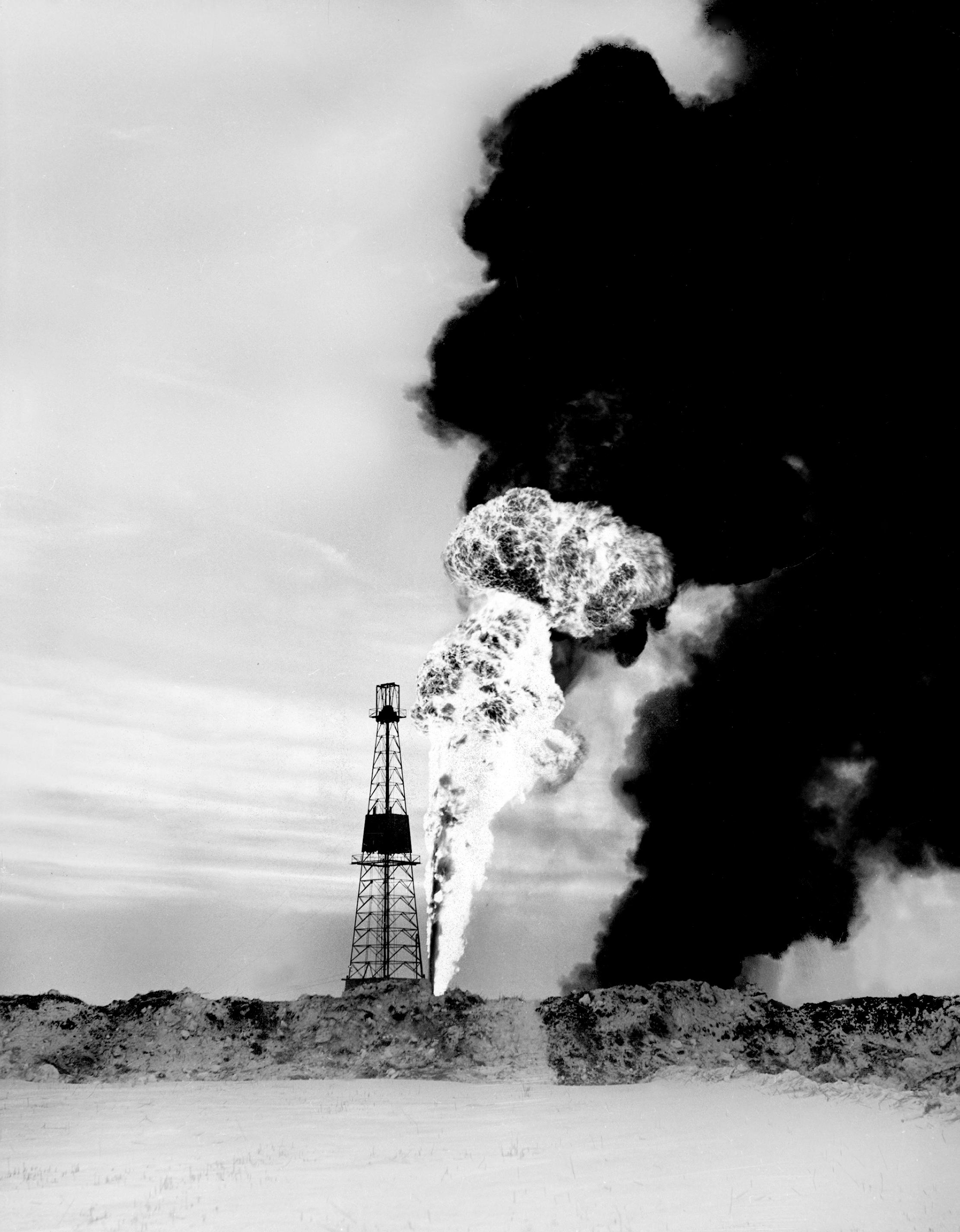
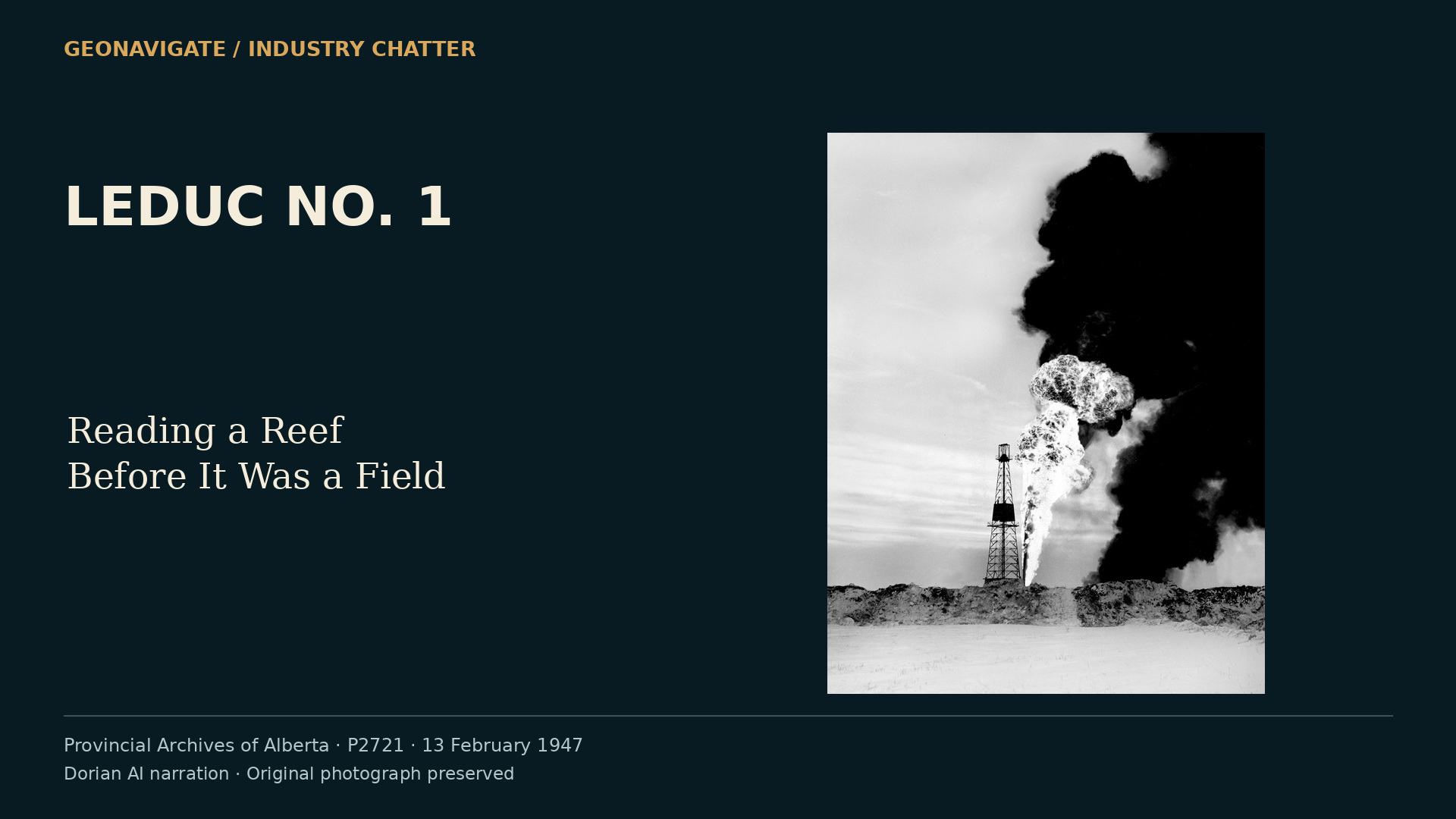
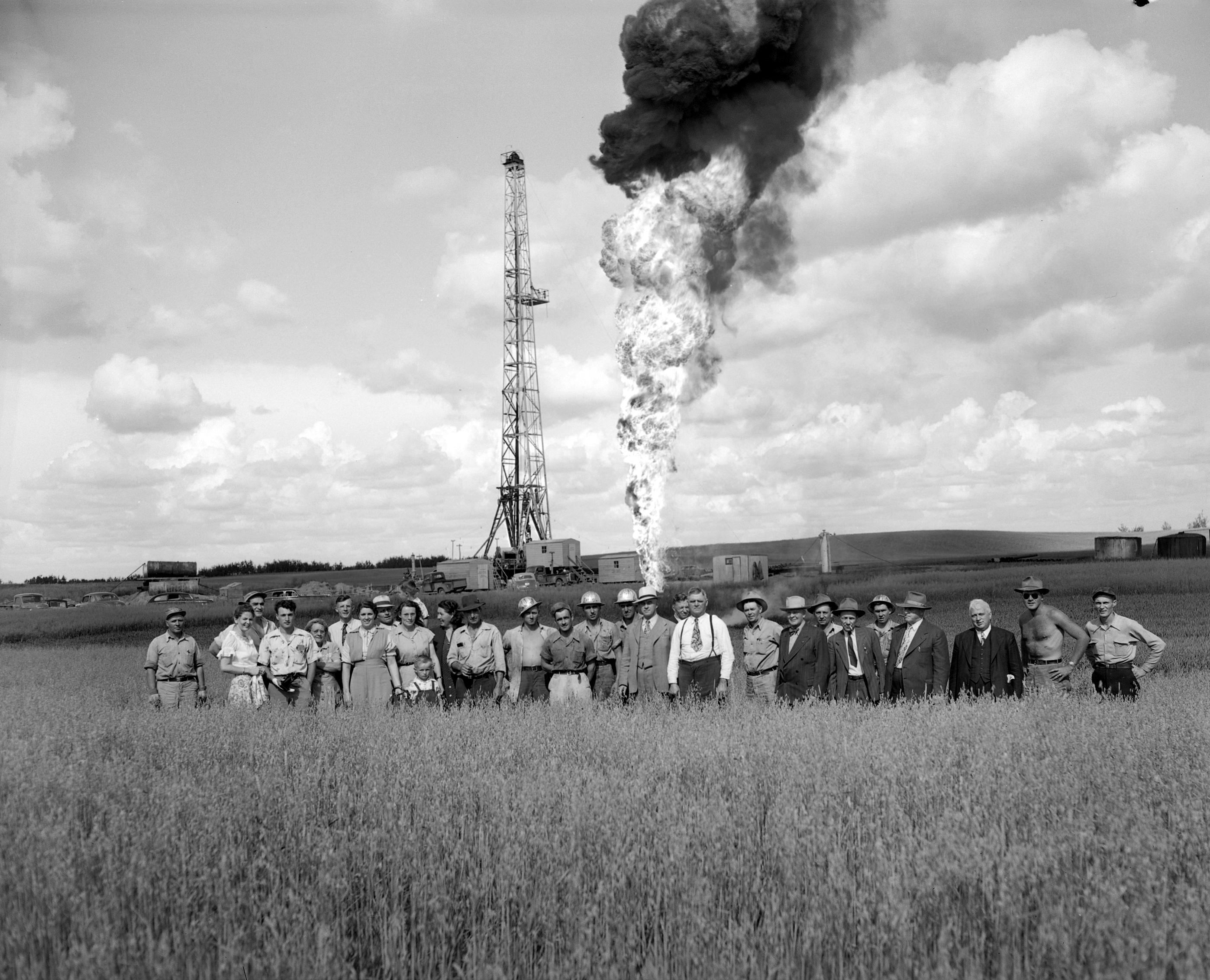
On February thirteenth, nineteen forty-seven, visitors gathered at an oil well southwest of Edmonton. The photographs preserve a winter scene of people and a steel derrick. A flame rose beside the installation as the discovery was demonstrated.
That afternoon became one of the defining images of Alberta's oil history. Beneath the celebration, however, the geological story was still opening. The first productive interval and the deeper reef that later transformed the field were different targets.
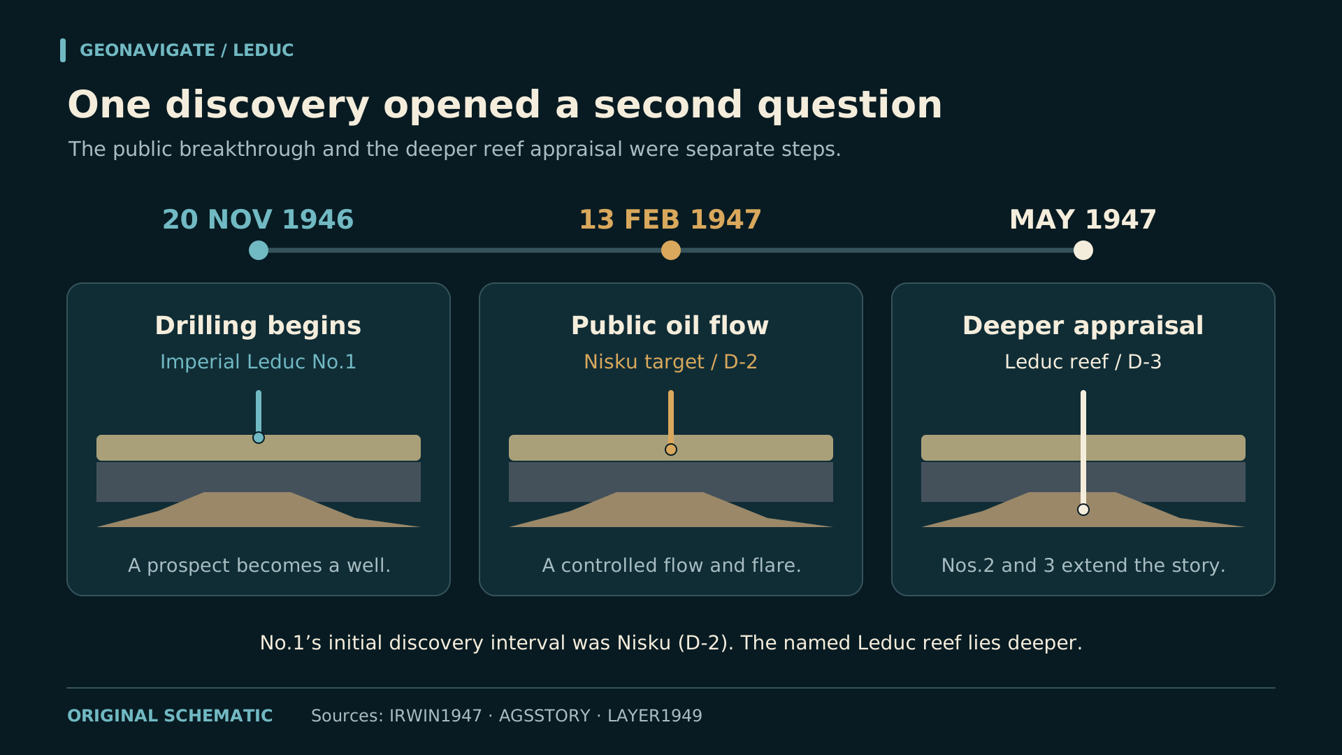
The first success came from the zone then called D two, now the Nisku Formation. Follow-up drilling would establish production from D three, the deeper carbonate buildup later named the Leduc Formation. Keeping those two zones separate changes how we read the discovery.
This is GeoNavigate Industry Chatter, narrated by the AI voice Dorian. Our story is Leduc Number One: Reading a Reef Before It Was a Field.
We will follow the evidence from a seismic prospect to a rock sample, from a sample to a flowing test, and from a successful well to the much harder task of understanding a connected reservoir.
CHAPTER 02
A prospect beneath the plains
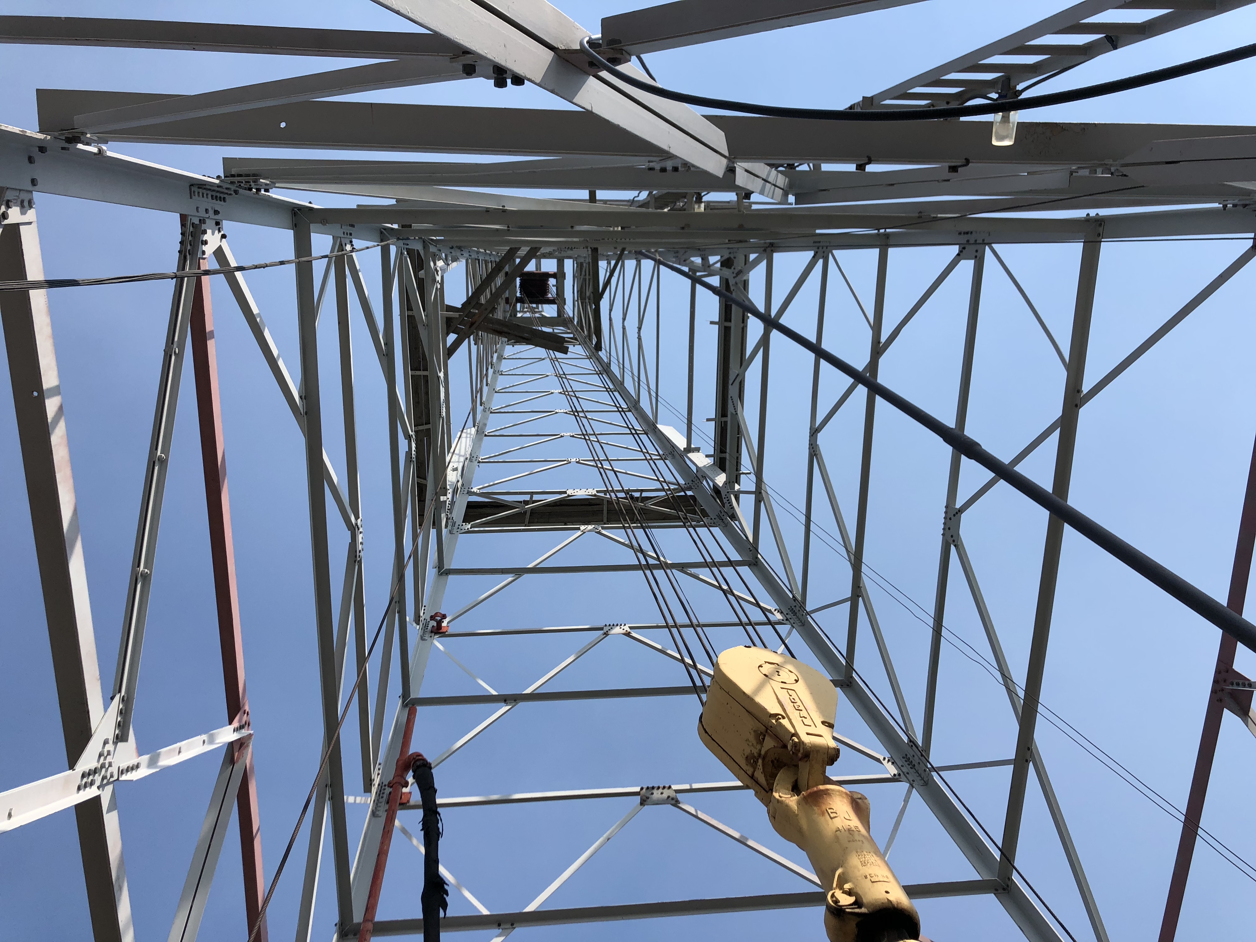
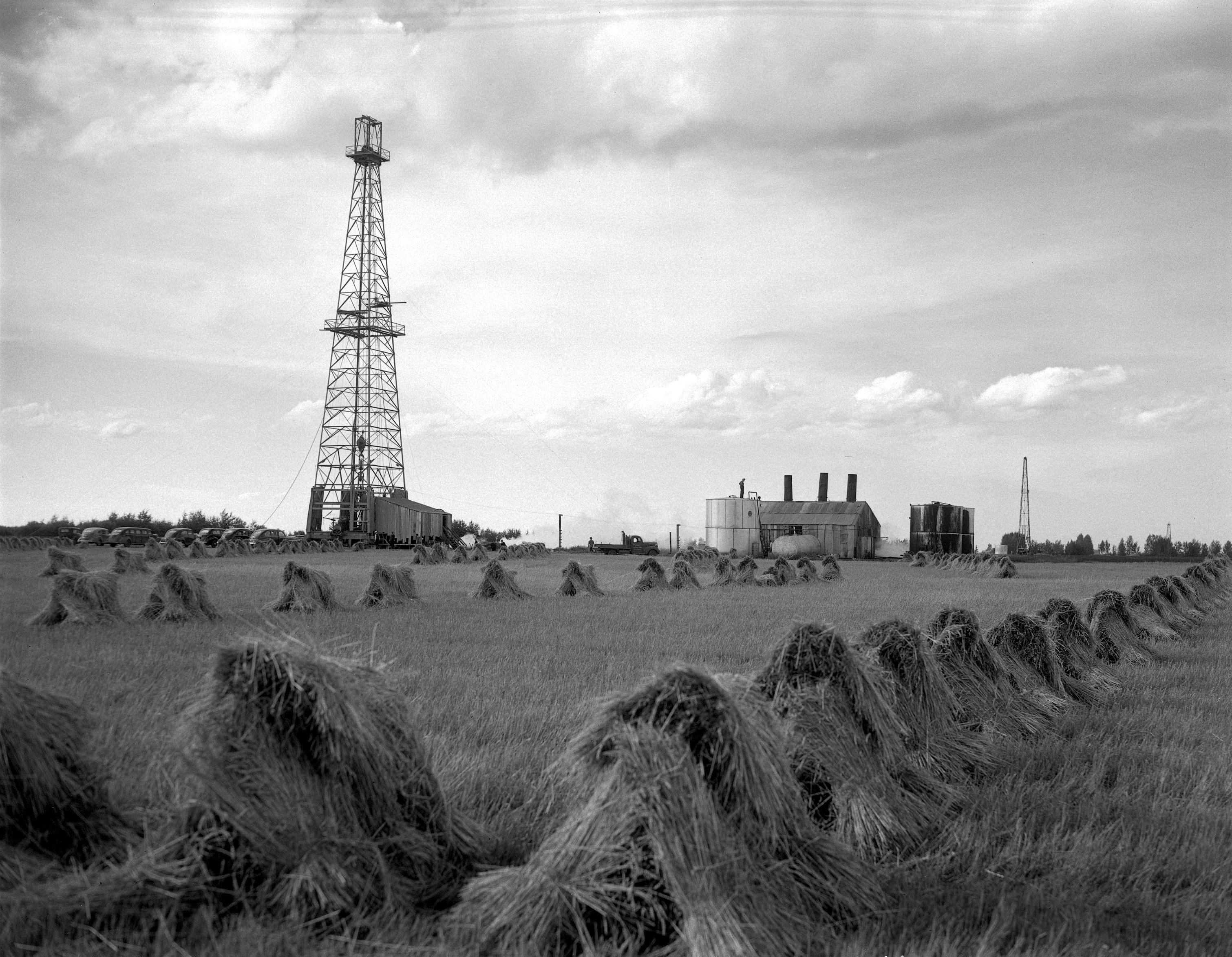
The search moved across a landscape where the important rocks were largely hidden. Glacial deposits covered the plains. A farm field could give little direct view of the Devonian succession far below it. Exploration needed a way to connect scattered observations beneath that cover.
Imperial Oil had the organization and capital to continue a regional search, drawing on geologists, geophysical crews and drilling teams. The prospect near Leduc became one decision within that wider effort, with technical interpretations guiding where an expensive hole would begin.
The discovery is often remembered as the end of a long run of unsuccessful wells and a final gamble. That story conveys the disappointment preceding success, but it compresses a complicated exploration history. Different crews, locations and geological targets belonged to that wider search.
The surviving technical account gives us a more useful sequence to investigate: reconnaissance, detailed seismic work, a selected location and a drilling programme capable of testing the interpretation.
For the people approving the well, the decision concerned a prospect. For those of us looking backward, it is tempting to place the completed field map on their desk. Their uncertainty was real, and it deserves a place in the story.
CHAPTER 03
What the seismic could suggest
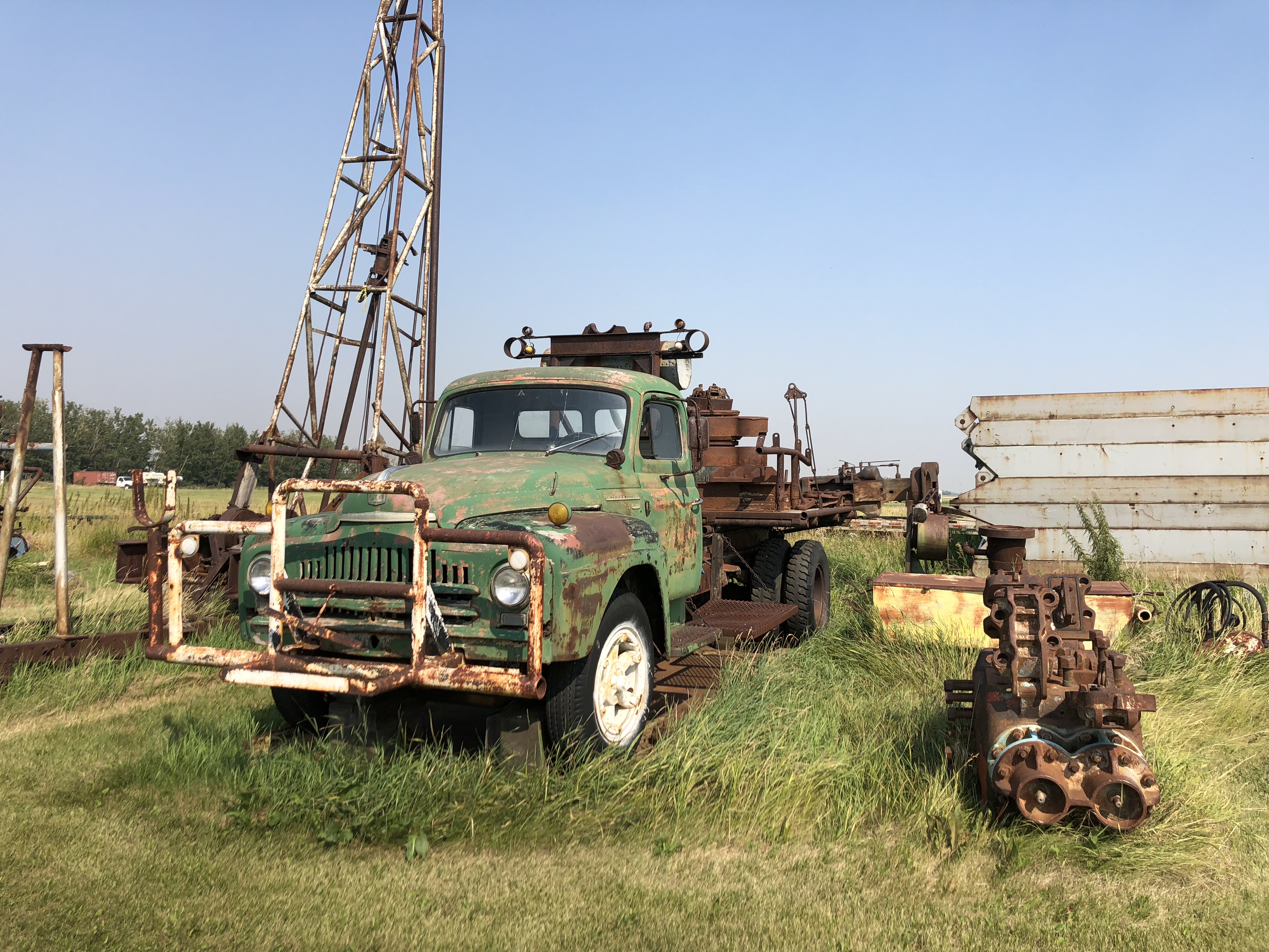
In nineteen forty-six, seismic work helped direct the search beneath central Alberta. A technical paper by D. B. Layer and Imperial's geological staff later credited reconnaissance by a Carter Oil crew and detailed work by a Heiland Exploration crew in locating the discovery well.
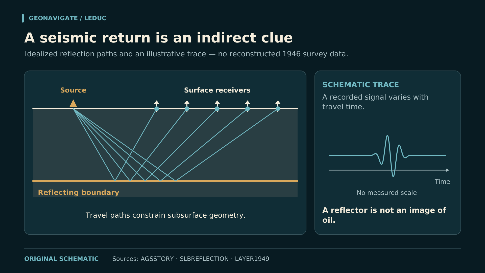
Reflection seismic begins with a disturbance that travels through the ground. Some energy returns from boundaries where rock properties change. Receivers record those arrivals. Their timing helps an interpreter investigate the arrangement of the rocks below.
Our animation is a conceptual explanation of that process. The moving wave paths and simplified trace are teaching devices. They are not a recovered seismic record from the nineteen forty-six survey.
A promising geological feature still leaves crucial questions. Is the rock porous? Are its pores connected? What fluid occupies them? Seismic interpretation helps define a drilling question; rock samples and well tests supply different kinds of evidence.
Even a promising interpretation remained a proposition to test. A seismic prospect did not yet supply a sample, a measured producing interval or a demonstrated flow rate. The drill would provide the next direct encounter with the succession.
CHAPTER 04
The hole becomes a rock record
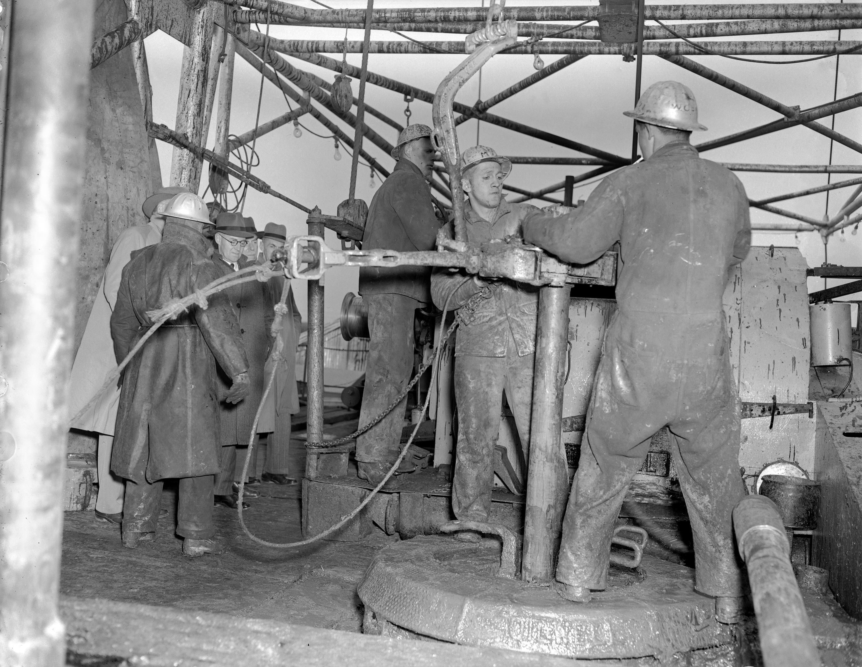
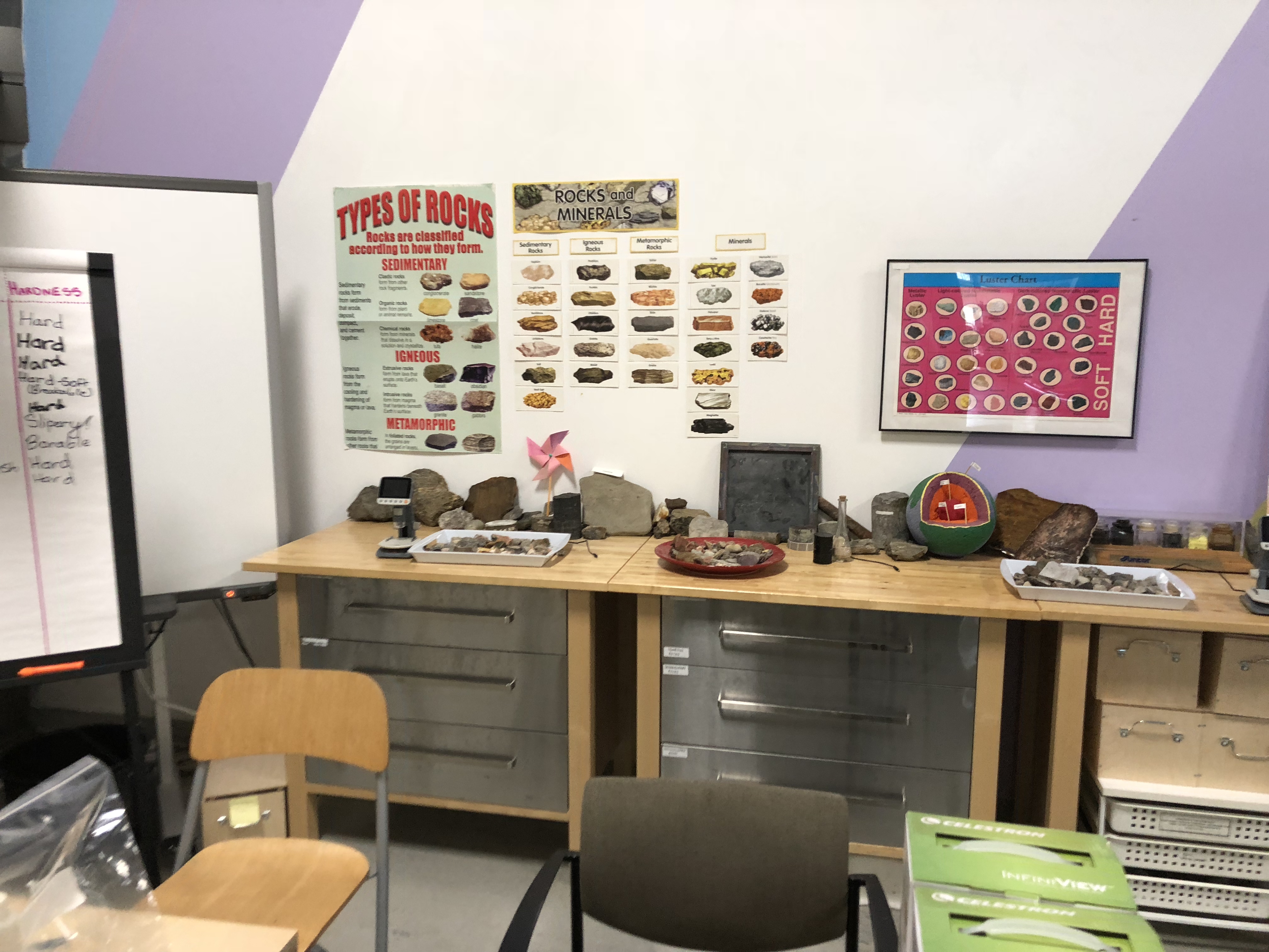
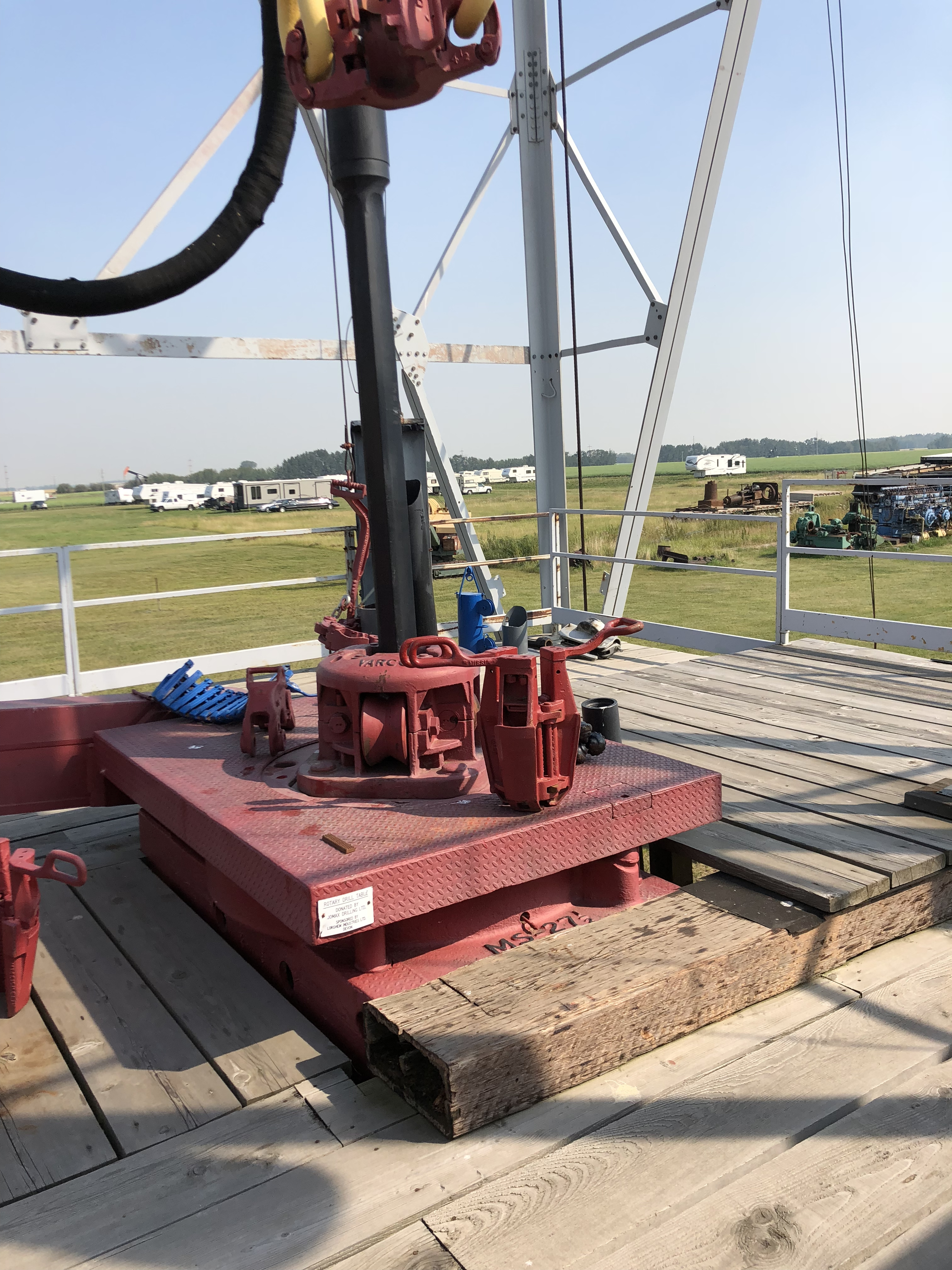
Drilling began on November twentieth, nineteen forty-six. Toolpusher Vern Hunter and the crew worked through the succession with a rotary rig. Each additional interval brought material to examine and a reason to compare the developing well with the interpretation that had justified it.
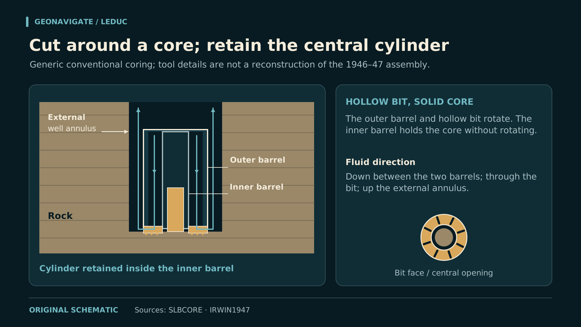
Cuttings provide fragments. A conventional core preserves a cylinder of rock and more of its internal arrangement. Bedding, fossils, fractures and changes in texture can then be examined together, with depth control linking the observations to a particular interval.
In the generic coring animation, an annular bit cuts around the central rock cylinder. That cylinder enters the inner barrel. Circulating fluid passes between the inner and outer barrels and returns outside the tool with the cuttings.
The animation explains a general mechanism. The discovery well's provincial report records continuous coring without specifying the precise tool assembly.
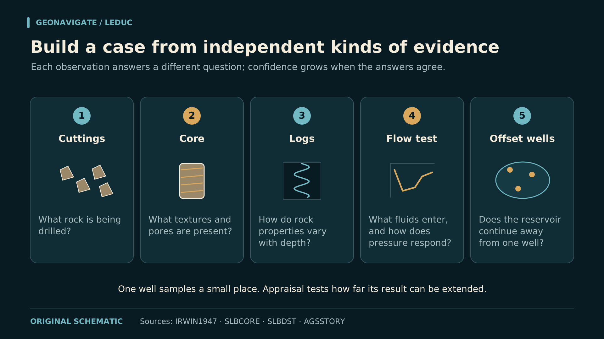
A sample can reveal promising texture and an oil show. The next questions concern scale and connection: how much of the interval shares that texture, and can fluids move through the formation into the well?
CHAPTER 05
D two above D three
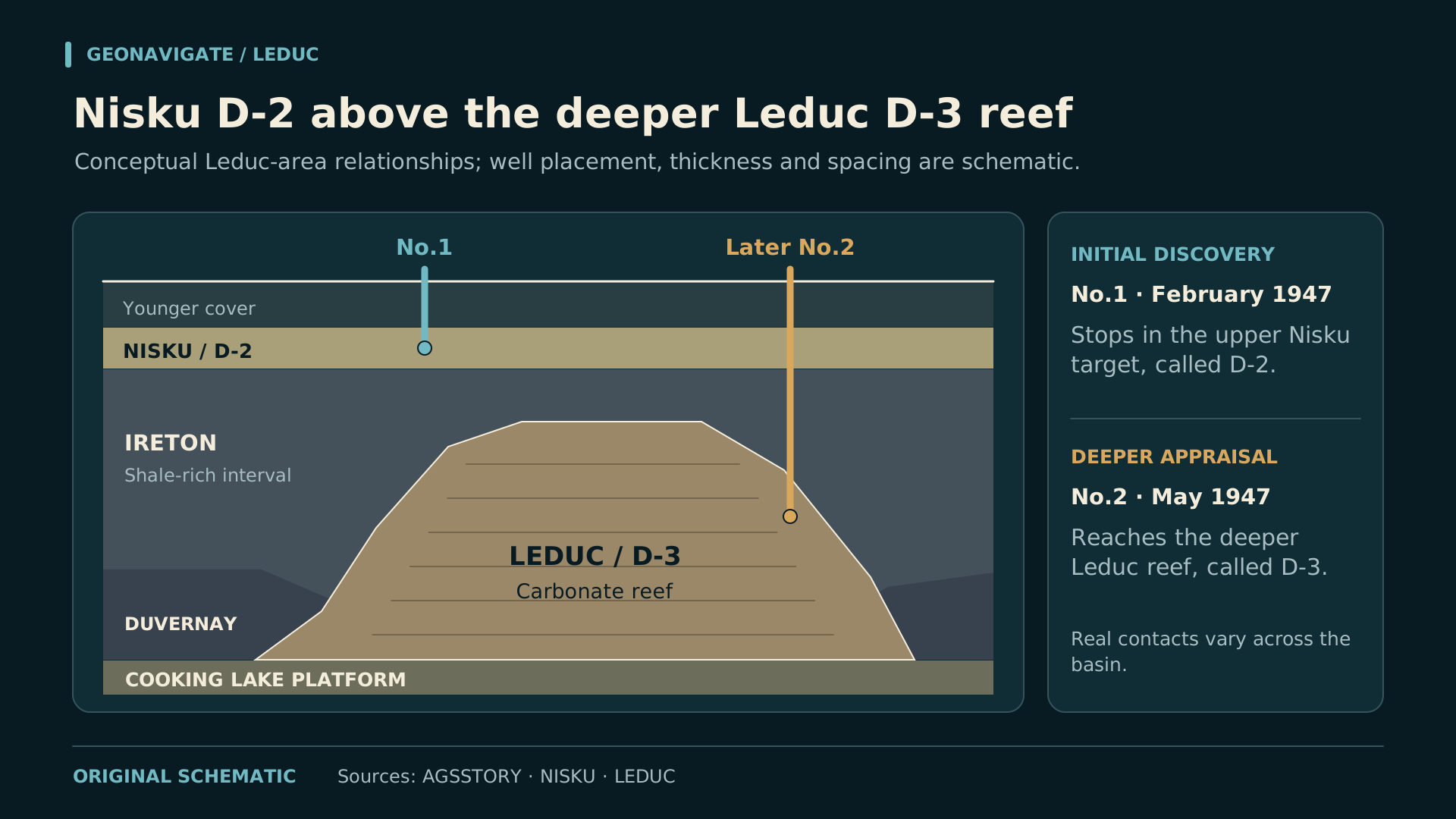
The old zone names are essential to the story. D two was the first productive zone of the Leduc field. The Nisku name later replaced that informal designation. D three referred to the deeper reef interval that became the Leduc Formation.
Leduc Number One established the Nisku discovery. Later wells, including Leduc Number Two and Number Three, opened the deeper Leduc reservoir. The D three discovery followed in May nineteen forty-seven, after the famous February celebration.
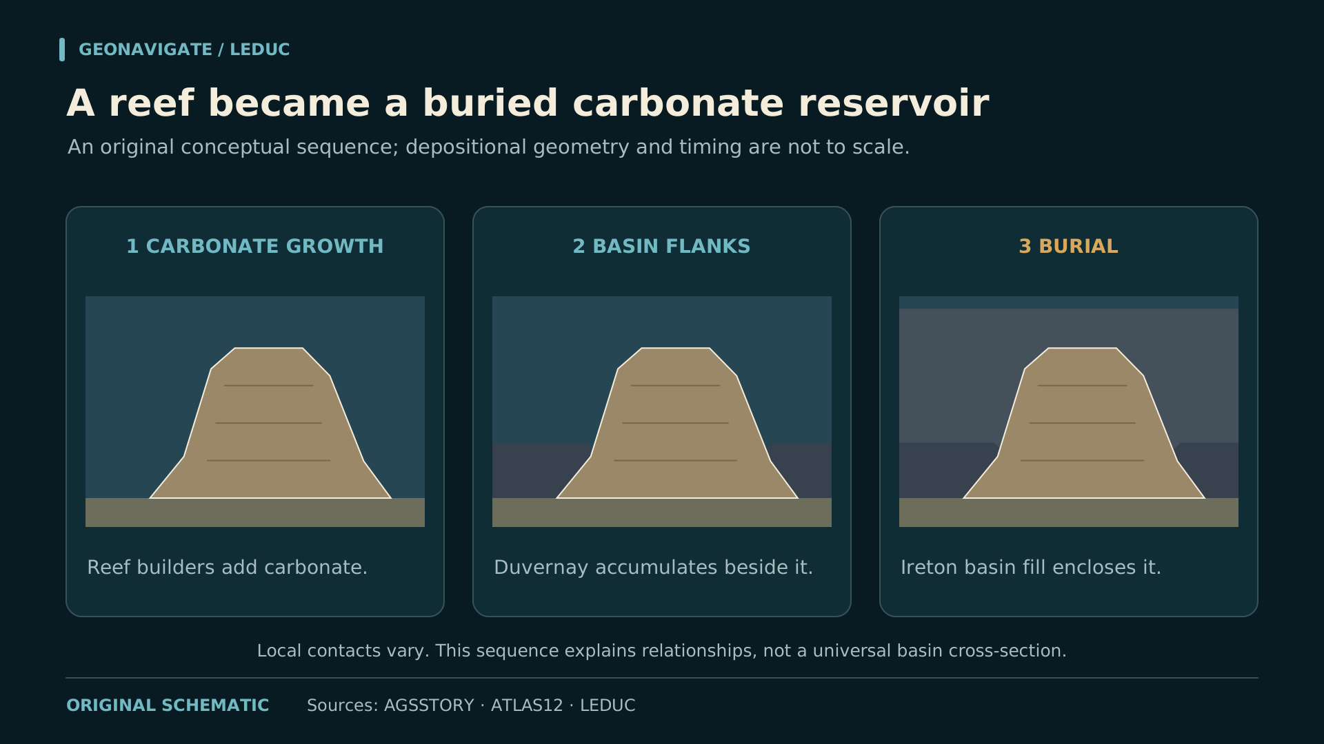
The diagram keeps the relationships visible. A younger Nisku carbonate interval lies above shale and the older Leduc buildup. The reef grew above a carbonate platform and was surrounded and eventually buried by finer sediment.
The section is deliberately conceptual. It carries no measured distance between the historical wells, and its thicknesses do not substitute for a well log. Its purpose is to keep the two reservoirs and their order clear.
Later formation names help us describe the rock precisely. They can also make a discovery story seem more complete than it was at the time. The early D two and D three terminology preserves a sense of that developing geological picture.
CHAPTER 06
A public demonstration of a tested well
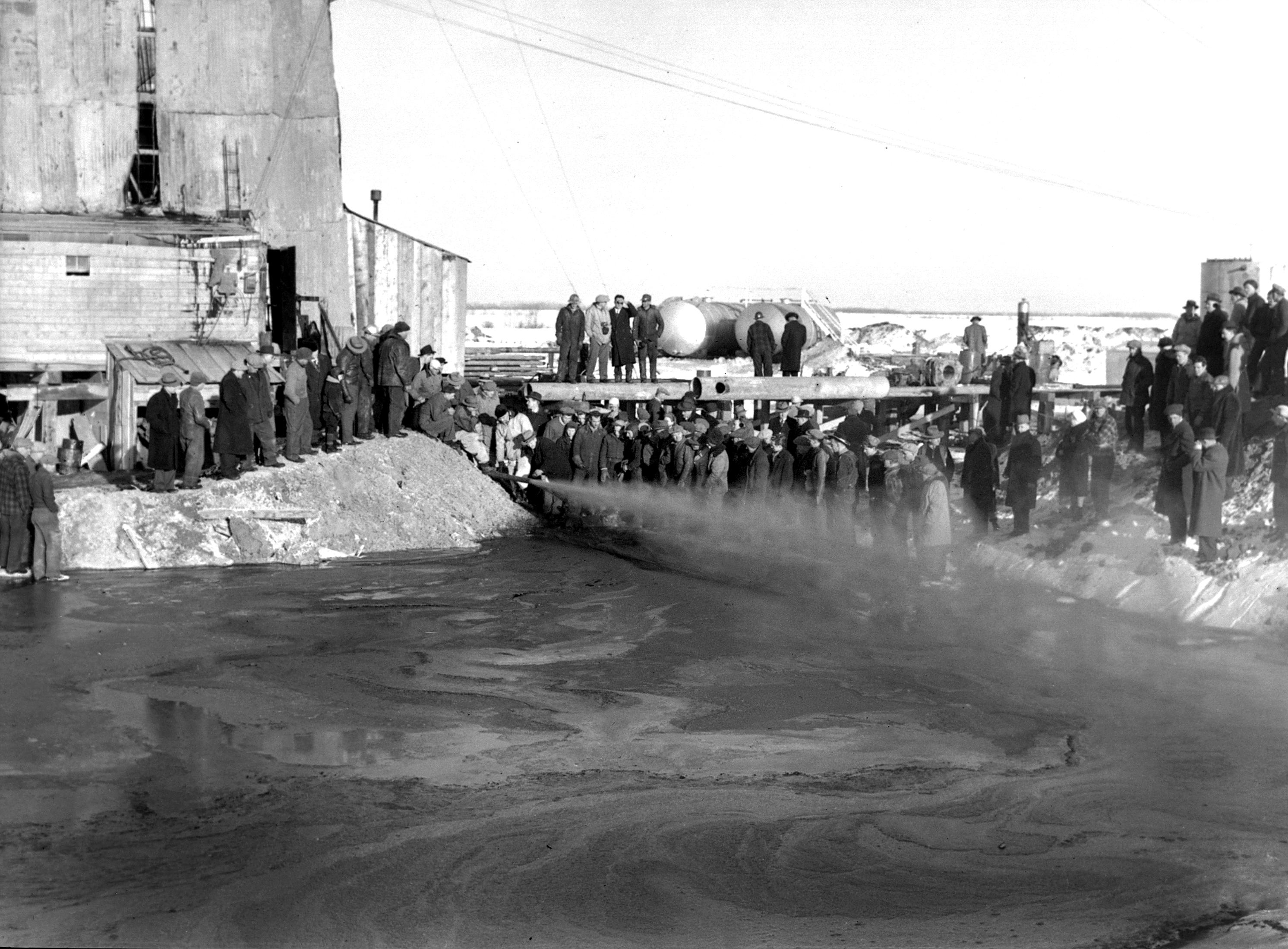
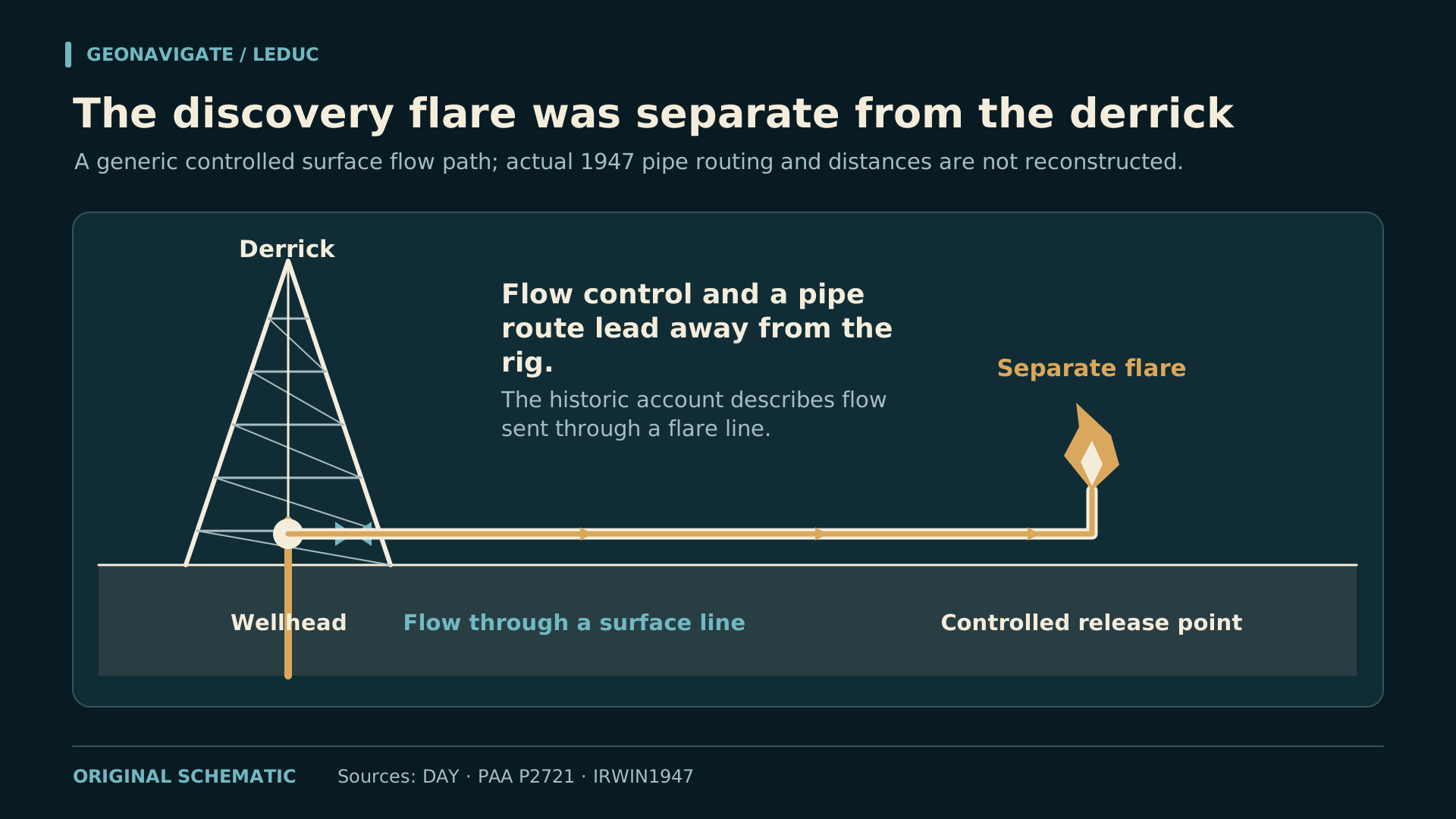
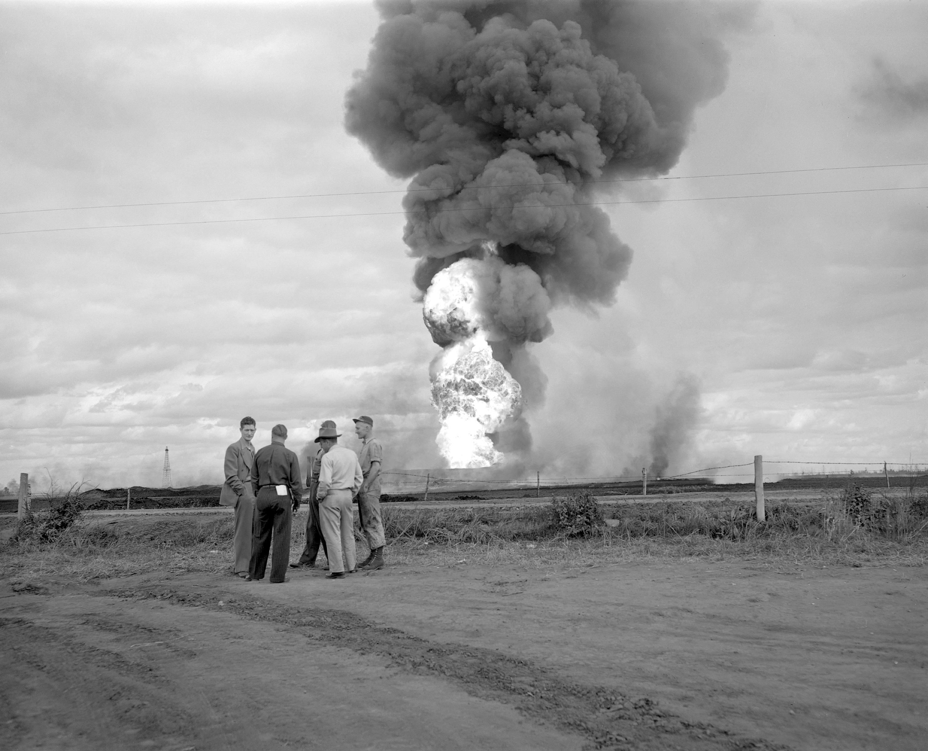
By the time visitors arrived on February thirteenth, the well had already provided evidence that it could produce. The public event gave that developing result a visible moment. Photographs of the gathering and the flare became part of the memory of the discovery.
Vern Hunter's later recollection is especially useful for interpreting the scene. He described a controlled flow carried through piping to the flare line. The flame visible beside the derrick belongs in that surface arrangement.
The distinction matters when recreating the event. An oil jet erupting through the top of a derrick would tell a different operational story. Our video uses the dated photographs and a clearly labelled flow-path explanation to keep the actual account recognizable.
The crowd could see a successful demonstration. The subsurface questions continued: the character of the producing interval, the behaviour of the fluid, and the continuity of the reservoir away from the hole.
A discovery day gives an industry a date to remember. A well record gives geologists and engineers something they can continue to test. At Leduc, both forms of evidence survive, and they explain different parts of the achievement.
CHAPTER 07
Read the first test figures carefully
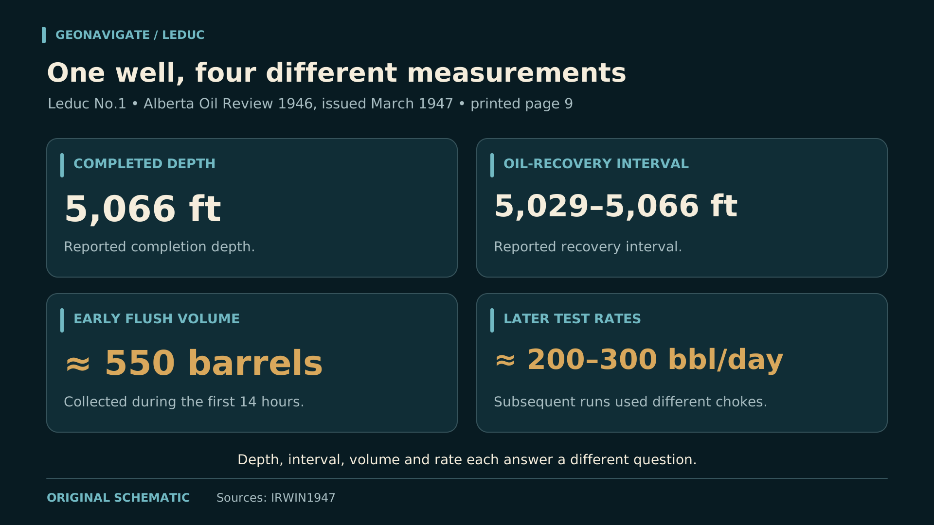
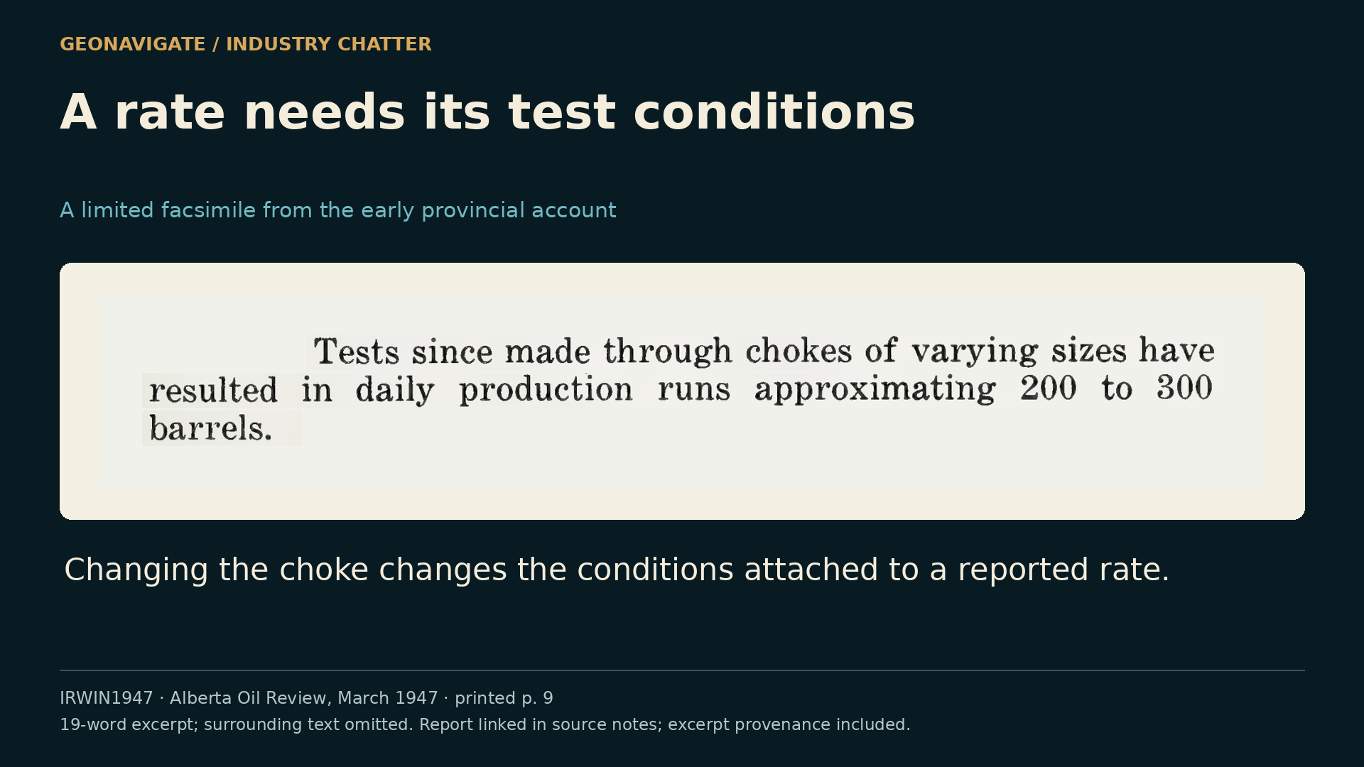
Alberta's Oil Review, published in March nineteen forty-seven, records completion at five thousand and sixty-six feet. Oil came from five thousand and twenty-nine to five thousand and sixty-six feet.
Initial flush production was approximately five hundred and fifty barrels in fourteen hours.
Later test runs through different chokes produced about two hundred to three hundred barrels daily.
Two of the drillstem tests showed small water indications, although the report recorded none during drilling.
Those figures preserve different conditions. They establish a useful starting record without defining a permanent production rate or explaining every fluid observation.
Chapter sources13
CHAPTER 08
A test asks whether the rock is connected
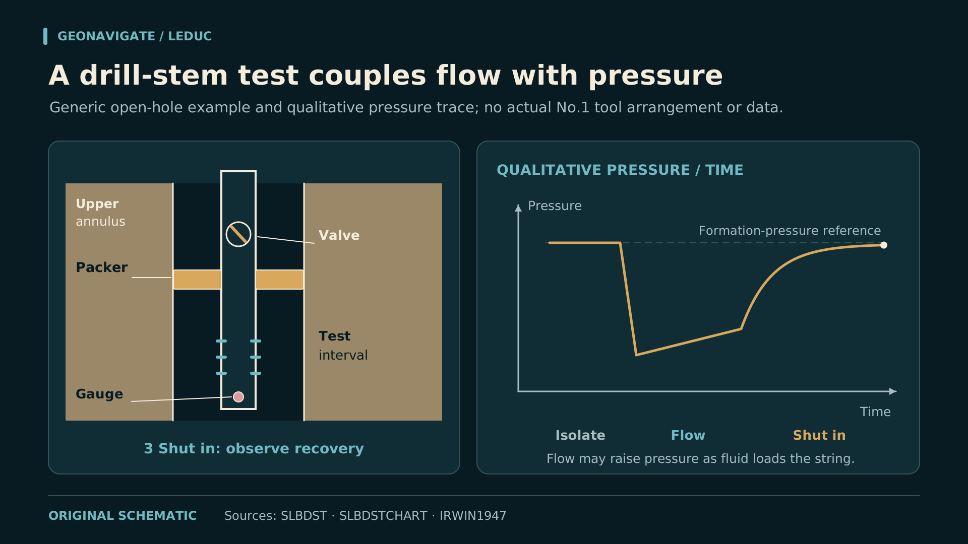
A drillstem test creates a controlled opportunity to observe how a formation responds. In a generic test assembly, a packer isolates the interval and a valve allows formation fluid to enter the test string. Pressure gauges record the response.
Opening the valve changes the pressure conditions. As fluid enters the string, the pressure trace evolves. During a shut-in period, the response toward formation pressure provides another part of the evidence. Flow and recovery are read together.
Our animation shows those broad relationships, with a qualitative pressure trace. It is neither an operating procedure nor a copy of a Leduc Number One pressure chart. Actual interpretation requires the recorded times, pressures, tool configuration and recovered fluids.
The geological value lies in the connection between a rock interval and a fluid response. A promising-looking pore in a sample is a small observation. A test investigates whether the formation around the well can communicate through its connected pore system.
That is why the rock description and the test report should sit beside each other. They answer related questions at different scales, and disagreement between them is often where the next useful investigation begins.
CHAPTER 09
Return to the Devonian sea

To understand the deeper reservoir, we have to return to a much older landscape: a shallow marine setting in the Late Devonian. Carbonate sediment accumulated around communities of organisms whose skeletons helped build the developing reef complexes.
Stromatoporoids, ancient reef-building sponges, were especially important. Their growth forms varied across the environment. Corals, brachiopods and other organisms contributed to the community and to the skeletal material that became part of the rock.
The paleoenvironment illustration offers an interpreted view of that setting. The image is labelled as AI illustration. The precise arrangement and colours of the organisms are illustrative; the geological explanation rests on the fossil and sedimentary evidence.
Around the buildups, different sediments accumulated. In the Leduc type area, Duvernay and Ireton basin sediments enclosed the carbonate, and later shale deposition covered it. The growing reef and the surrounding basin formed parts of the same evolving system.
Burial changed that original landscape again. What the drill eventually entered was an ancient environment transformed into rock, then altered through a long history of fluids, cementation and chemical change.
CHAPTER 10
A reef needs connected pore space
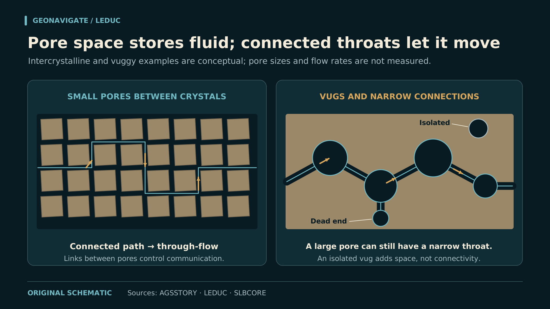
A reef origin does not give every piece of rock the same reservoir quality. Original skeletal spaces may survive, become filled with cement, or be modified by later alteration. Neighbouring intervals can therefore share a broad geological name and behave differently when tested.
Dolomitization was important in many Leduc buildups. Magnesium-bearing fluids altered the original carbonate. The resulting textures and pore systems reflect both the starting material and the history of fluid movement through it. Other reefs retained substantial limestone.
The pore-flow animation separates available space from connected pathways. Fluid can occupy a large cavity with little communication to surrounding pores. Smaller spaces joined through a continuous network can transmit fluid more effectively than isolated holes.
For the geologist examining core, that means recording more than the presence of a visible opening. Its setting, distribution and connections matter. Laboratory measurements and pressure behaviour can then test what the visible texture suggests.
The best reservoir description joins those observations. It explains where the pore space occurs, how it connects, how the rock changes across the interval, and what remains uncertain between the places actually sampled.
CHAPTER 11
An appraisal map grows one well at a time
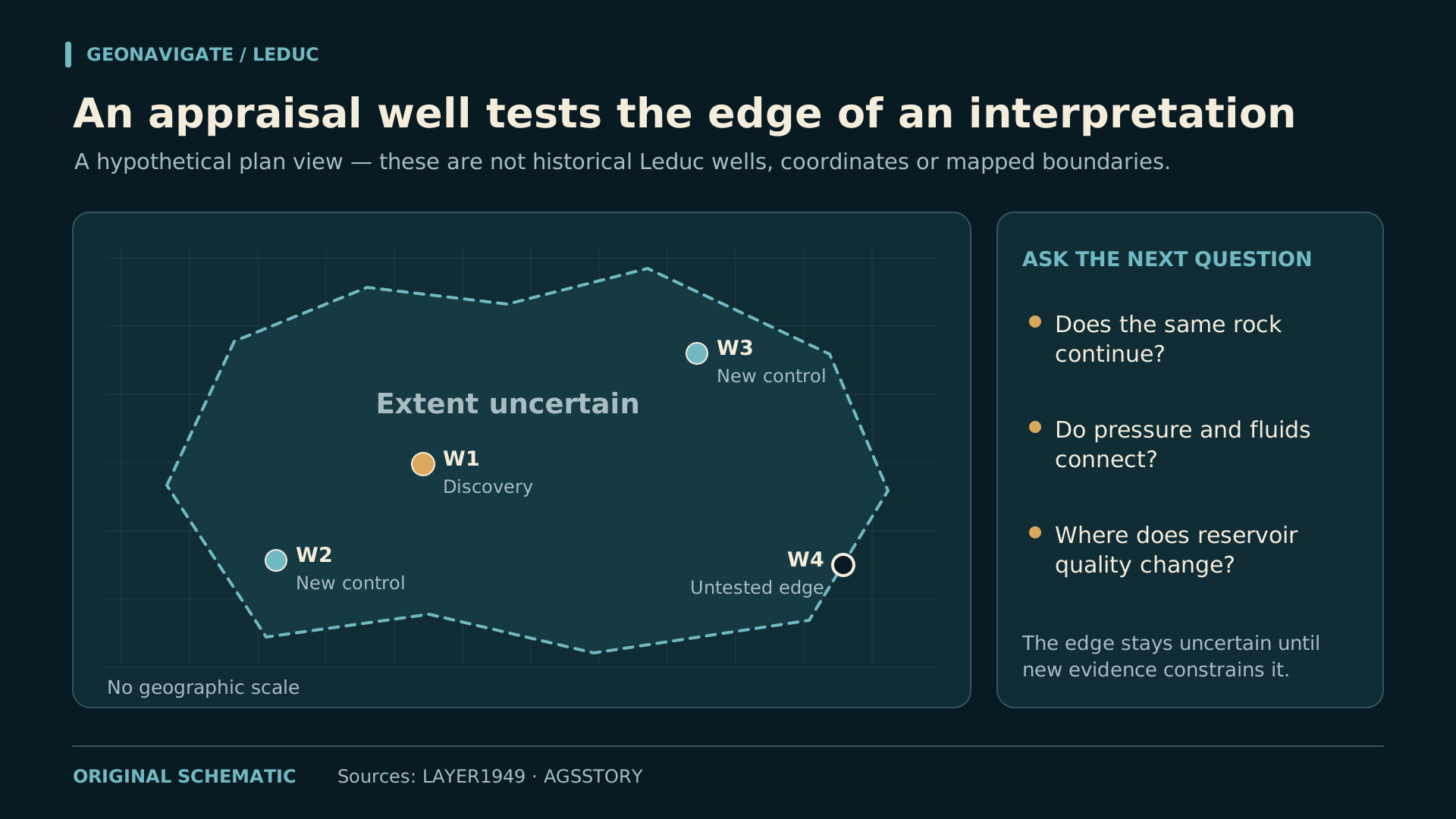
The provincial report records Leduc Number Two spudding on February twelfth, a day before Number One's public celebration. Appraisal was already under way.
The deeper discovery expanded the geological question. Wells had to establish the carbonate buildup, its limits, the distribution of reservoir quality and the relationships between the productive zones. Each new result could support or revise the emerging interpretation.
In their nineteen forty-nine paper, Layer and Imperial's geological staff described D two as a broad blanket-type deposit with variable porosity, while D three appeared reefal. They also acknowledged that development was still too incomplete to settle the structural picture.
Our animated appraisal map uses hypothetical well positions to show the logic. A confirmed result adds local control; an uncertain boundary remains uncertain until more evidence constrains it. The changing outline is not a historical map of the Leduc field.
That distinction remains useful today. Drawing a smooth line through sparse control does not add another measurement. A good geological map communicates both the interpreted shape and the observations that support it.
CHAPTER 12
The oil leg changes with development
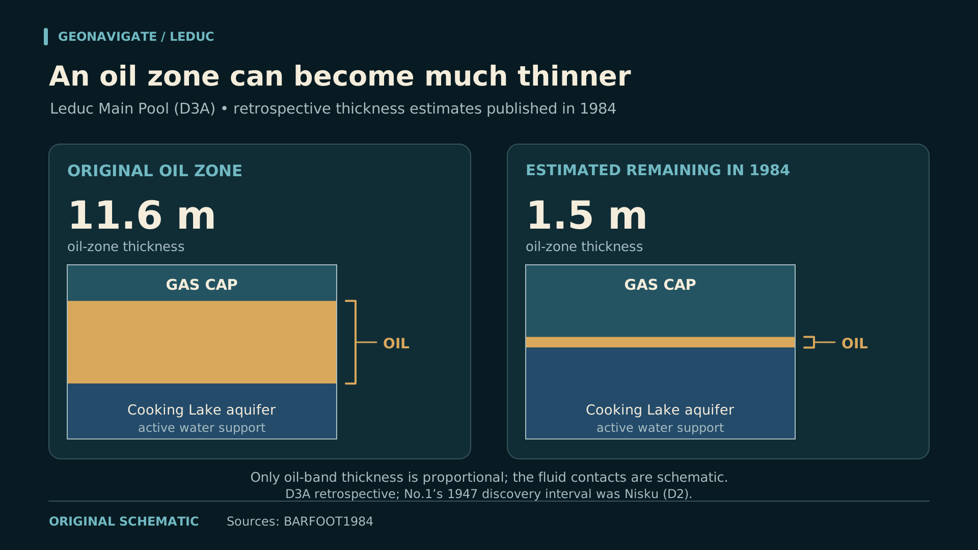
Decades later, a technical account reveals another stage of the story. A nineteen eighty-four paper by Esso Resources staff examined the Leduc D three A pool. This was the deeper reservoir, distinct from the Nisku interval discovered in Number One.
The authors described a relatively thin oil leg between a large gas cap and the active Cooking Lake aquifer. That arrangement made reservoir management a continuing effort to understand the position and behaviour of the oil between the other fluids.
They reported an original oil-leg thickness of eleven point six metres. By nineteen eighty-four, the remaining thickness in the Main Pool was estimated at one point five metres. Those figures describe that historical assessment, not the current state of the field.
The animation illustrates the narrowing space occupied by oil between gas and water. Its geometry is conceptual, and it predicts no future recovery. The historical measurements belong to the named pool and the period of the paper.
A field's geological framework persists while its fluid distribution changes. The discovery opened an opportunity; decades of production created a different set of questions about the reservoir that remained.
CHAPTER 13
A producing well needs a route to market
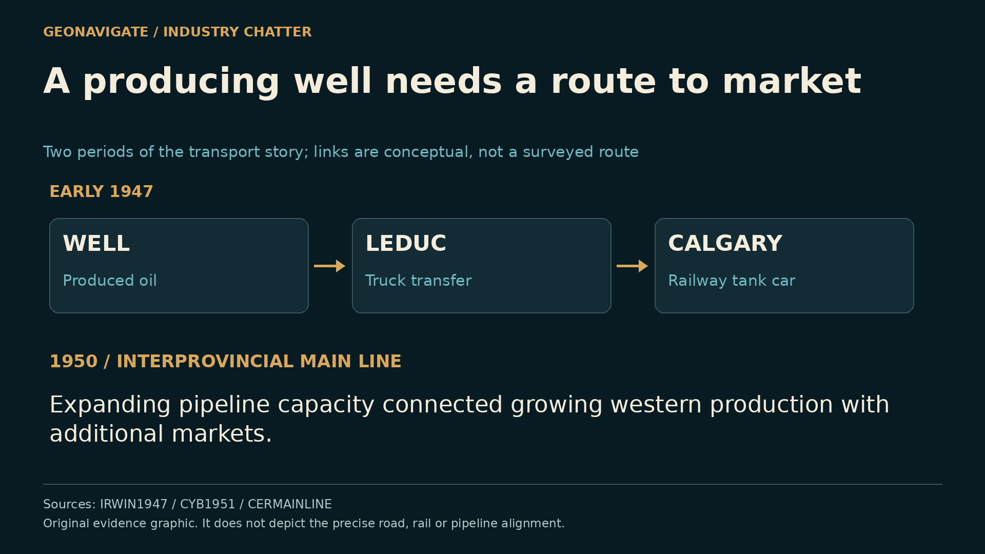
Imperial's success involved more than the producing interval. Exploration teams identified a prospect; drilling and testing established an opportunity; appraisal developed it. Transport, refining and sales then had to turn the recovered fluid into a sustained business.
Early oil moved by truck to Leduc, then by railway tank car to Calgary. Even this initial production needed a working route to its refinery.
As production grew, transportation capacity became a larger issue. The Canada Year Book later described the restriction imposed before the new pipeline was available. The first Interprovincial main line was built in nineteen fifty, expanding access to markets beyond the local region.
Refinery investment around Edmonton added another part of that industrial system. A successful field could encourage new facilities, skilled employment and further exploration, while those facilities improved the practical value of additional discoveries.
That is the company story behind the famous well. Geological judgement created an opening, and an organization capable of developing, moving and processing the product helped turn that opening into a durable industry.
CHAPTER 14
What the discovery still teaches
Return to the two zones. Leduc Number One demonstrated the Nisku opportunity in February nineteen forty-seven. The deeper Leduc reef became a producing discovery through subsequent drilling. Together they opened a much broader exploration story beneath the plains.
The seismic prospect, the rock sample, the test response and the appraisal map were different forms of evidence. Each made the next decision better informed. None supplied the whole reservoir history by itself.
The companion includes original photographs, the provincial test account and the technical source notes. It also links to Glenbow's official presentation of A Mile Below the Wheat, Imperial's colour film released in nineteen forty-nine. Its date remains separate from the discovery-day photographs.
For a wellsite geologist, the habit is familiar: place the observations in order, keep their depths and conditions attached, and let the interpretation change when a new result demands it. That is how a promising hole becomes a field that can be understood.
This is GeoNavigate Industry Chatter. Next in the historical series is Atlantic Number Three and the problem of well control. At Leduc, the enduring achievement began with a discovery and continued with the work of learning what it meant.