CHAPTER 01
Six months before the smoke
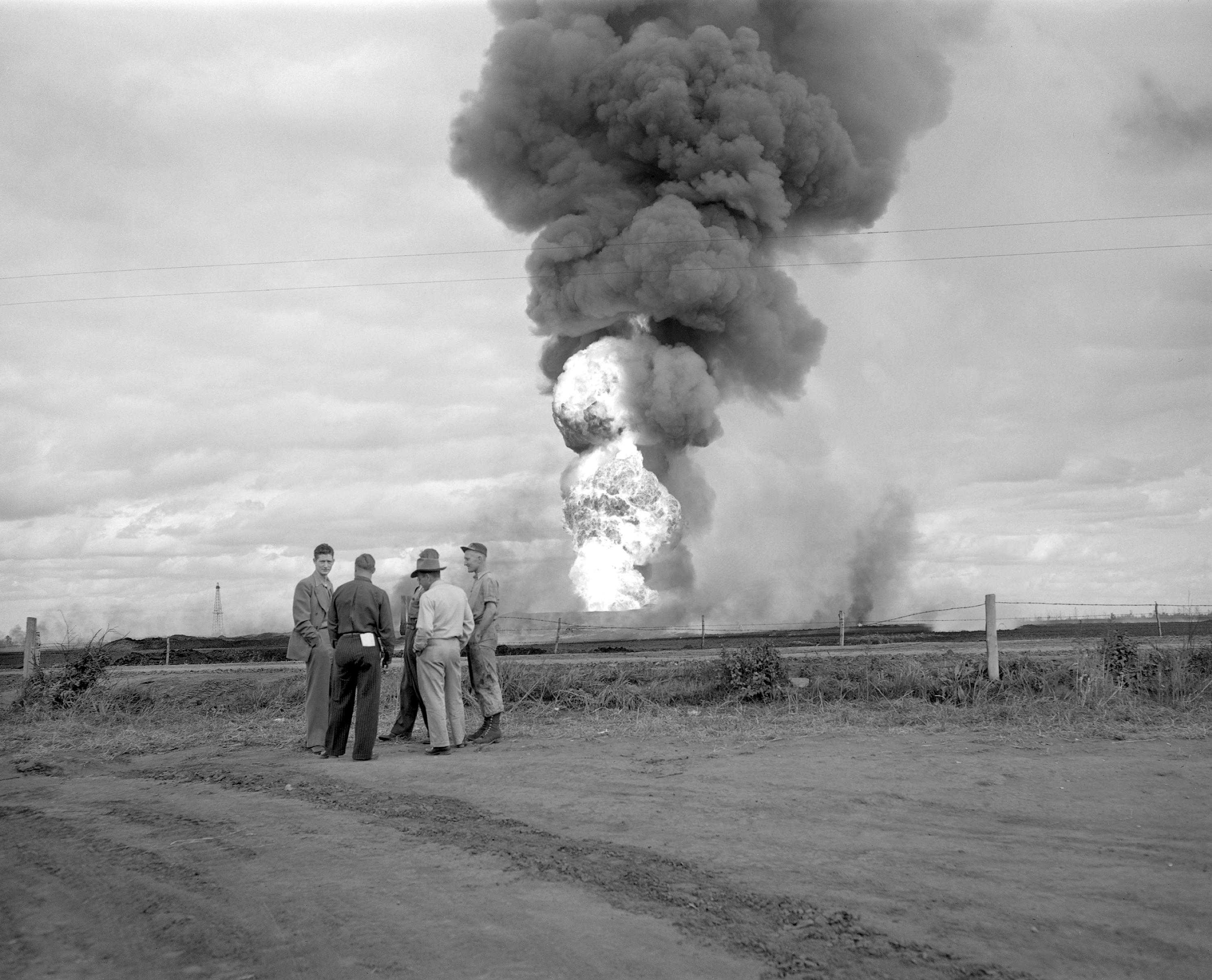
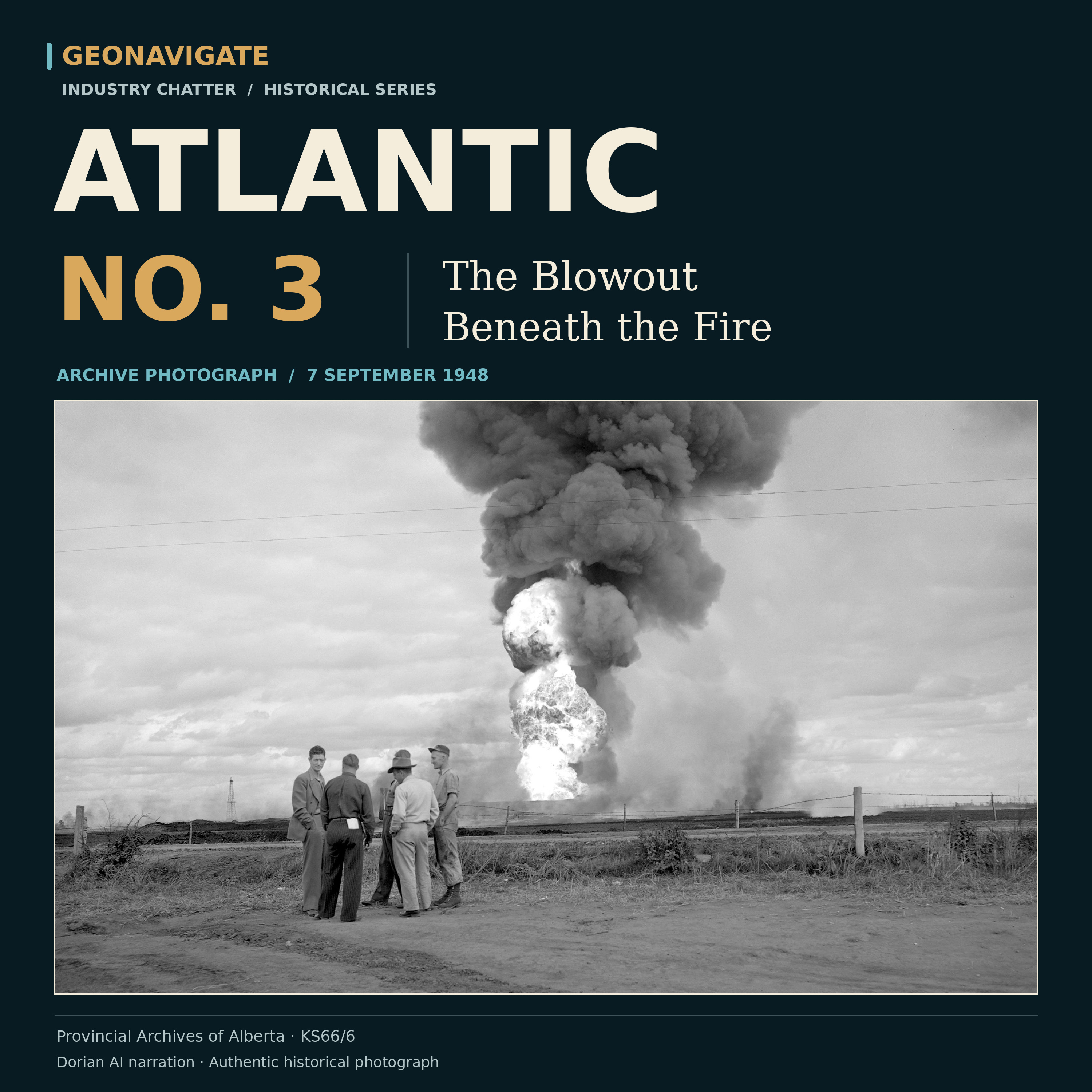
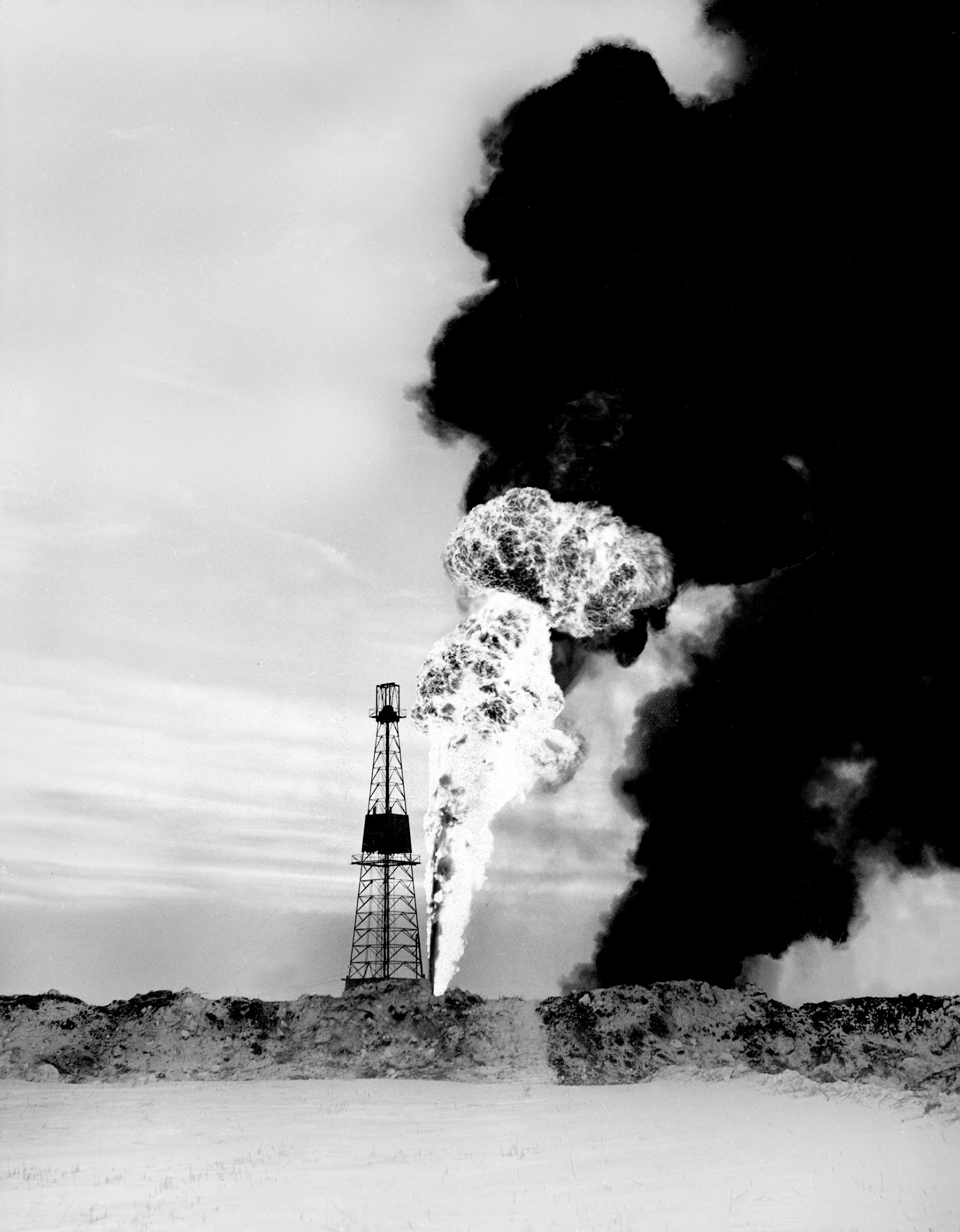
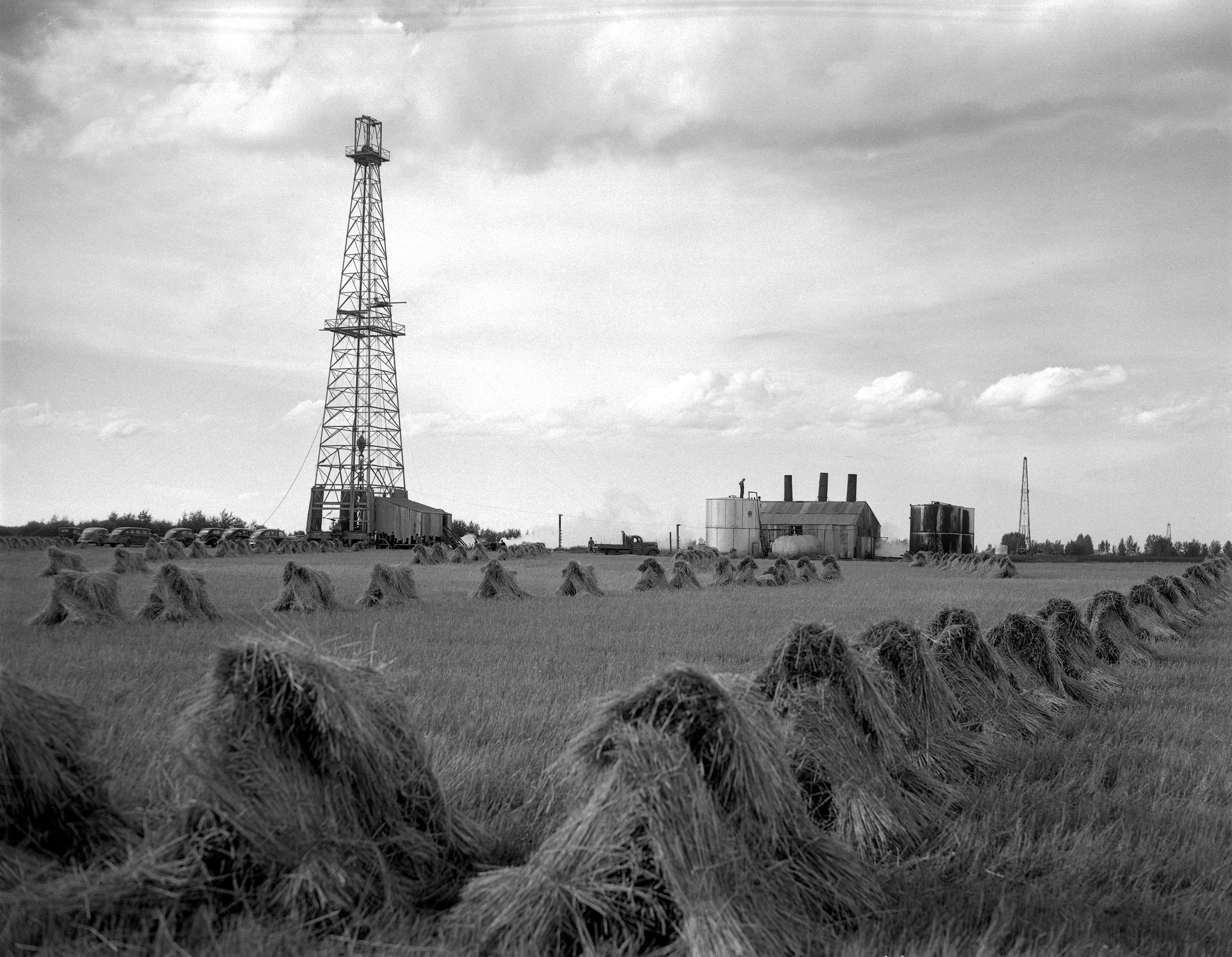
The photograph is dated September seventh, nineteen forty-eight. A dark plume rises above an Alberta oilfield. Below it lies a much longer emergency. Atlantic Number Three had been out of control since March.
The fire would burn for about two and a half days. The uncontrolled well had already occupied crews, engineers and regulators for roughly six months. Those are different clocks, and following them changes the story.
This is GeoNavigate Industry Chatter, narrated by the AI voice Dorian. Our episode is Atlantic Number Three: The Blowout Beneath the Fire. It follows the Leduc discovery into a problem that a successful oil test could never resolve by itself.
We will follow drilling fluid disappearing into the rock, oil finding unwanted paths, workers gathering escaped crude, and two relief wells supplying water to the producing formation. The decisive work extended far beyond the flame visible in the photographs.
Historical images and contemporary reports carry the event. The animated sections explain the underlying physics. A brief, labelled AI recreation supplies atmosphere; the actual geometry of the underground escape paths remains uncertain.
CHAPTER 02
The rush into a connected reservoir
Leduc had opened a new chapter in Alberta's oil industry in February nineteen forty-seven. By the following year, drilling and production were expanding quickly around the discovery. Atlantic Number Three belonged to that developing field.
The well was drilled for Atlantic Oil Company Limited by General Petroleums. Its target included the deeper zone then called D three, the carbonate reservoir now associated with the Leduc Formation. This was distinct from the Nisku, or D two, interval first produced at Leduc Number One.
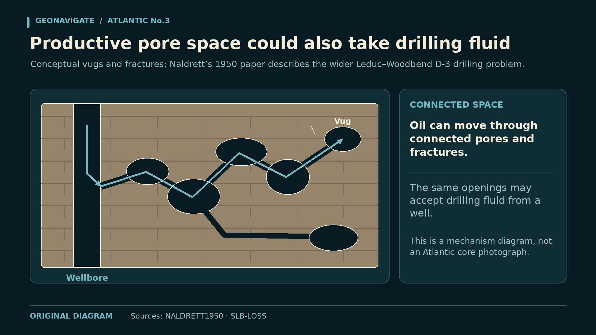
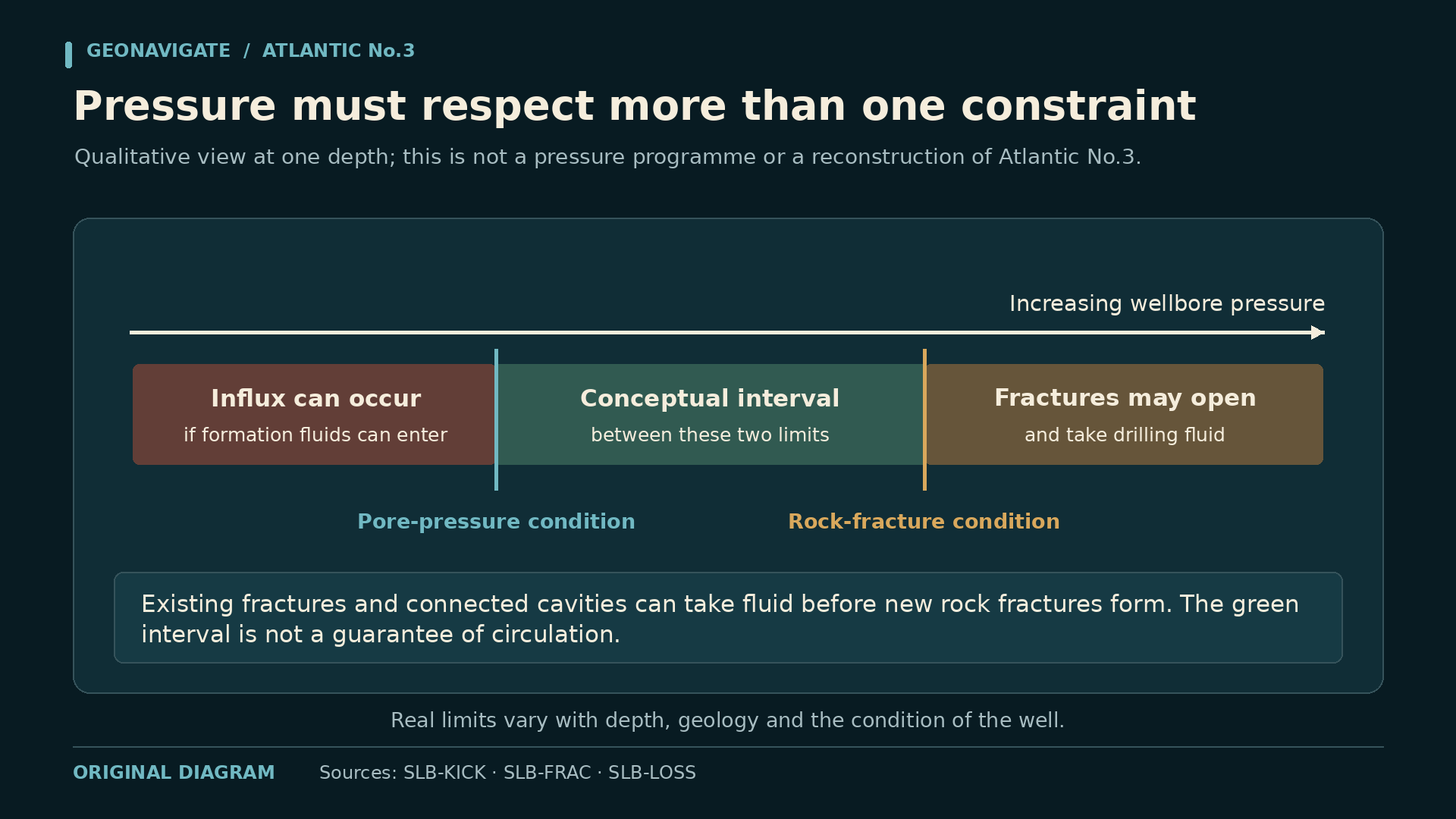
Within a carbonate reservoir, pore space can change dramatically. Some openings communicate through a fine network. Others connect with fractures or larger cavities. The same connectivity that helps a reservoir deliver oil can also allow drilling fluid to disappear from the well.
The rock therefore presented two connected questions. Could it supply hydrocarbons, and could the drilling operation maintain a controlled fluid column while penetrating it? Finding a productive interval did not answer the second question.
For this story, the geological attraction and the drilling difficulty belong in the same picture. D three was a reservoir to be developed and a formation whose behaviour had to be understood as the hole advanced.
CHAPTER 03
When circulation disappears
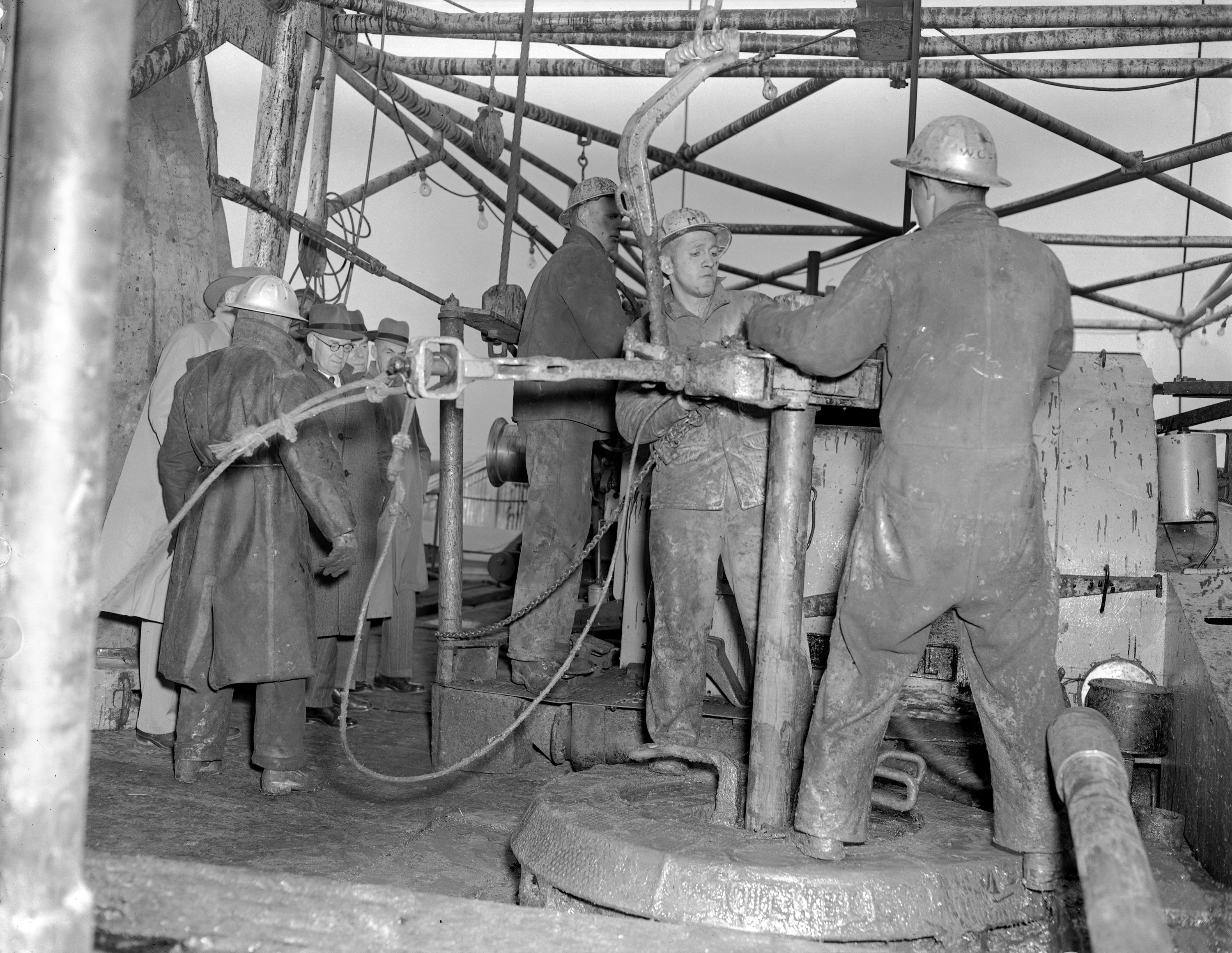
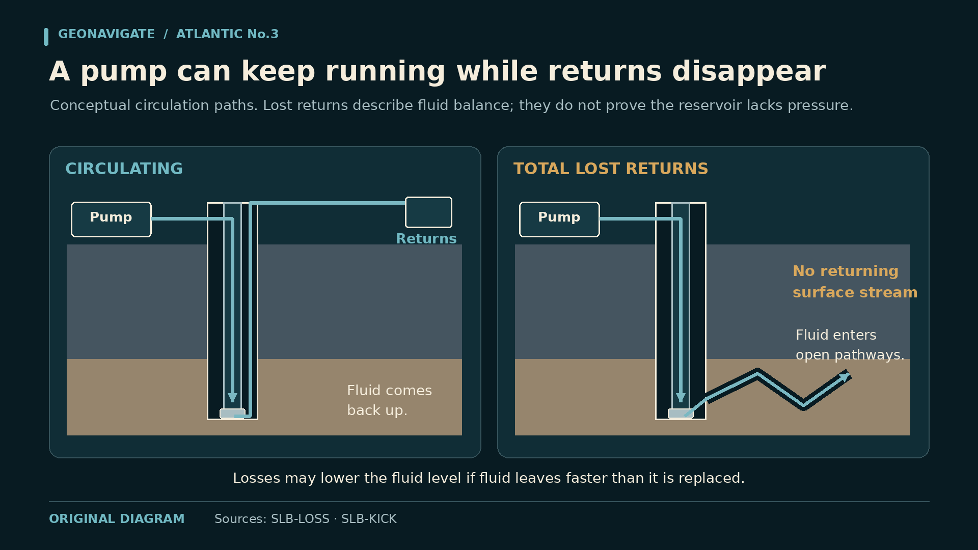
In ordinary rotary circulation, fluid travels down the drillstring, exits near the bit, and returns through the space outside the pipe. The return stream carries cuttings toward the surface. Our circulation animation follows that simple circuit.
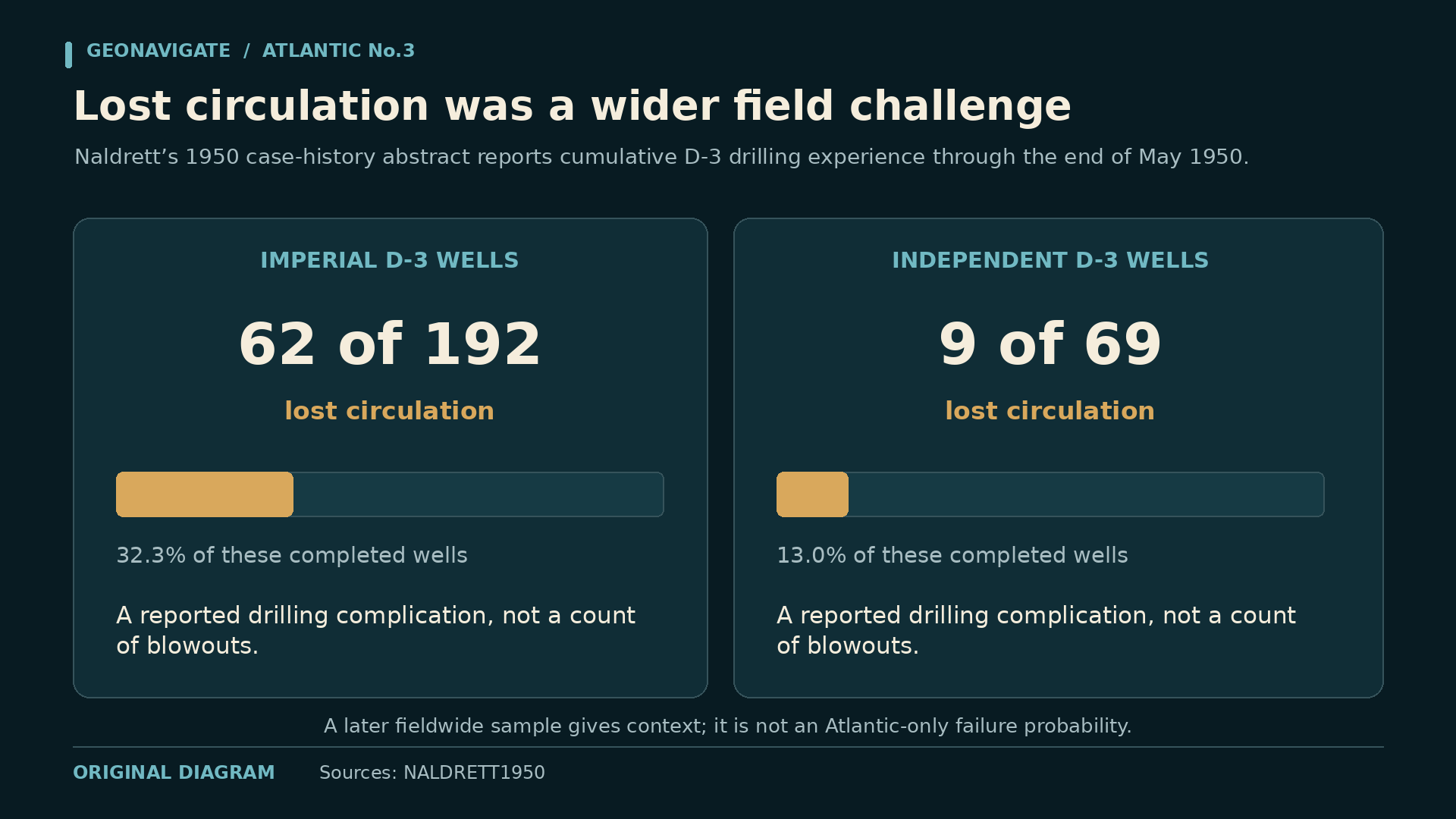
Lost circulation changes the route. Fluid enters openings in the formation instead of returning as expected. Surface returns can diminish or disappear while the pumps continue sending fluid downhole. The important observation is a changing balance between what goes in and what comes back.
Historian Aubrey Kerr's account describes severe losses at Atlantic Number Three and unsuccessful attempts to cure them with cement. It then describes the decision to continue using water. These details come from a later reconstruction of the drilling history.
Water in a well is still a fluid column. The critical questions are its density, its height, and whether continuing losses allow that column to fall. A supply of fluid at the surface does not guarantee that the hole remains full.
The visual sequence keeps those quantities separate. First, fluid takes a path into the rock. Then, if replenishment cannot keep pace, the level drops. The pressure consequence follows from the column actually remaining in the well.
CHAPTER 04
The weight of the column
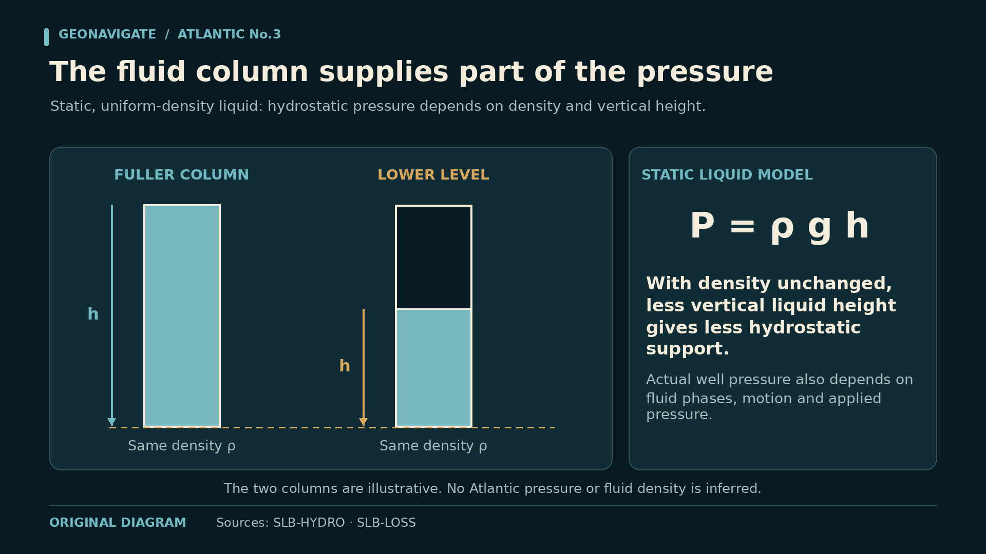
A column of fluid exerts pressure because it has weight. In the simplest static picture, its contribution at depth depends on fluid density and the vertical height of the column above that point.
Our diagram compares two versions of the same conceptual well. One contains a continuous fluid column to the surface. In the other, fluid has been lost and the level is lower. With the same fluid density, the shorter column supplies less hydrostatic pressure at the bottom.
Formation fluids can enter when the well no longer provides sufficient opposing pressure. That entry is a kick. If the influx cannot be contained and controlled, the situation can develop into a blowout.
Actual drilling adds circulating friction, temperature, compressibility and changing fluid composition. The drawing leaves those complications out so the basic mechanism stays visible. It assigns no invented pressure, mud weight or measured fluid level to Atlantic Number Three.
This is the connection between losses and an influx. Fluid can first leave the well into the formation, reducing the pressure support, and hydrocarbons can subsequently enter from a pressured interval. Both observations belong in the same evolving pressure system.
CHAPTER 05
March eighth: a new route for the oil
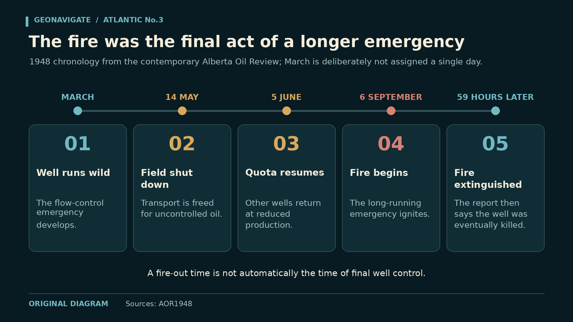
Contemporary newspaper reporting dates the beginning of the Atlantic Number Three blowout to March eighth, nineteen forty-eight. By September, the same reporting would describe the end of that prolonged uncontrolled flow.
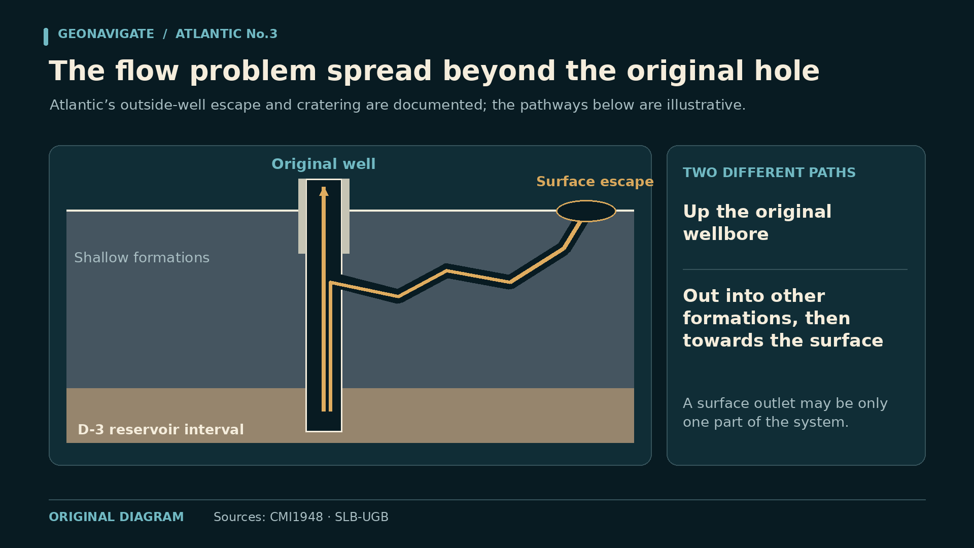
The surface equipment was only part of the problem. Historical accounts describe hydrocarbons escaping into surrounding formations and reaching the surface outside the intended well path. That is why the underground part of this event deserves so much attention.
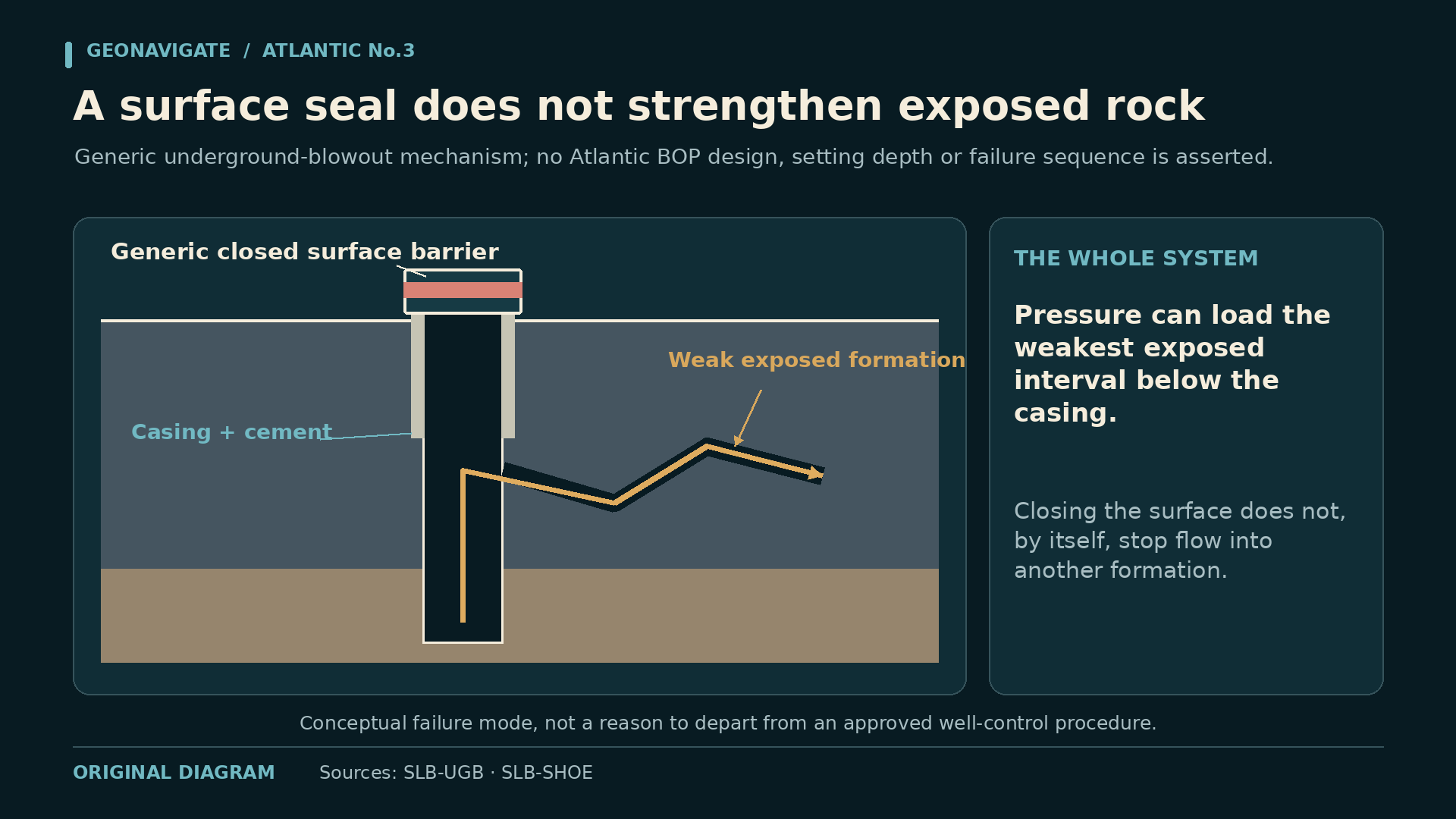
An underground blowout involves uncontrolled movement of formation fluid from one interval into another. It can occur below equipment that appears to have closed the surface route. If another path remains available, closing the top does not necessarily isolate the source.
Our section shows several possible routes in a deliberately simplified geometry. The arrows represent a mechanism, not a surveyed network of fractures beneath Atlantic Number Three. The actual pathways cannot be recovered from a dramatic surface photograph.
Steel casing, cement, the exposed rock and the surface equipment work together as a pressure-containing system. The part least able to withstand the conditions can govern what happens next. Control has to account for that whole system.
CHAPTER 06
The field becomes part of the emergency
Once oil escaped beyond the controlled production system, the emergency spread across the surface. Workers faced crude accumulating on the land while more continued to arrive from below. Collection and removal became continuous work.
In his recorded recollections, worker John Stepanko describes trenches and pits used to gather the escaped oil. His account gives the story a practical scale: ground to excavate, lines to build, equipment to move, and fluid that had to go somewhere.
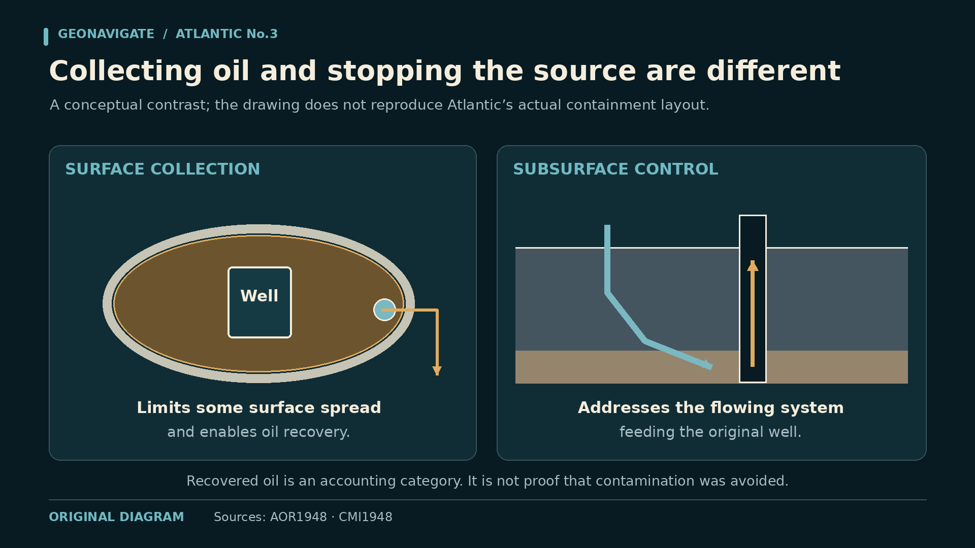
Earthworks could direct oil toward a collection point. Pumps and transport could remove some of it. Those measures addressed the surface consequences, while the formation remained the source of the uncontrolled flow.
Our containment diagram therefore carries two distinct labels: gathering oil at surface, and controlling its underground source. A berm may keep fluid from spreading in one direction without reducing the pressure feeding the escape.
As danger grew later in the emergency, newspaper reporting described workers being withdrawn from the immediate area and ground beginning to buckle. After ignition, bulldozers built earthen barriers to help shield surrounding wells. Surface work had to respond to a hazard whose source lay underground.
CHAPTER 07
A field shuts down for one wild well
On May fourteenth, the Petroleum and Natural Gas Conservation Board ordered the entire Leduc field shut down. Alberta's contemporary Oil Review explains the purpose: make the transportation system, including the pipeline, available to remove Atlantic Number Three's uncontrolled flow.
The same report says the wild well's flow reached as high as fourteen thousand barrels a day at one point. That is a reported peak, not a rate to multiply across the whole six-month event.
Imagine the operational consequence. Producing wells elsewhere in the field had to make room in the transport system for oil escaping from one uncontrolled source. The emergency crossed company boundaries and affected the wider development programme.
By June fifth, the situation had improved enough for other wells to resume production at reduced quotas. That partial reopening did not mean Atlantic Number Three had been permanently secured. The most conspicuous part of the emergency still lay ahead.
The shutdown reveals an often overlooked part of well control: logistics. Collection capacity, pumps, lines, storage and available transport can determine how effectively crews manage an uncontrolled flow while the deeper intervention continues.
CHAPTER 08
The waterline and the relief wells
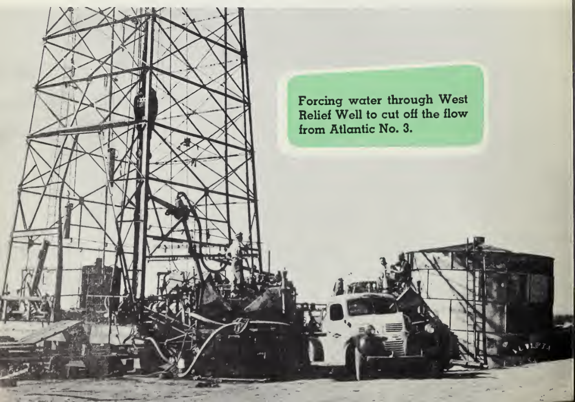
Imperial engineer Tip Moroney helped lead the control effort. Another fluid became central to the work: water. Stepanko recalled workers laying a line from the North Saskatchewan River to supply two relief wells. The task connected a river, a surface pumping system and the producing formation.
The provincial Oil Review includes a photograph of water being forced through the west relief well to cut off the flow from Atlantic Number Three. It is a rare, direct view of the control effort behind the more familiar fire images.
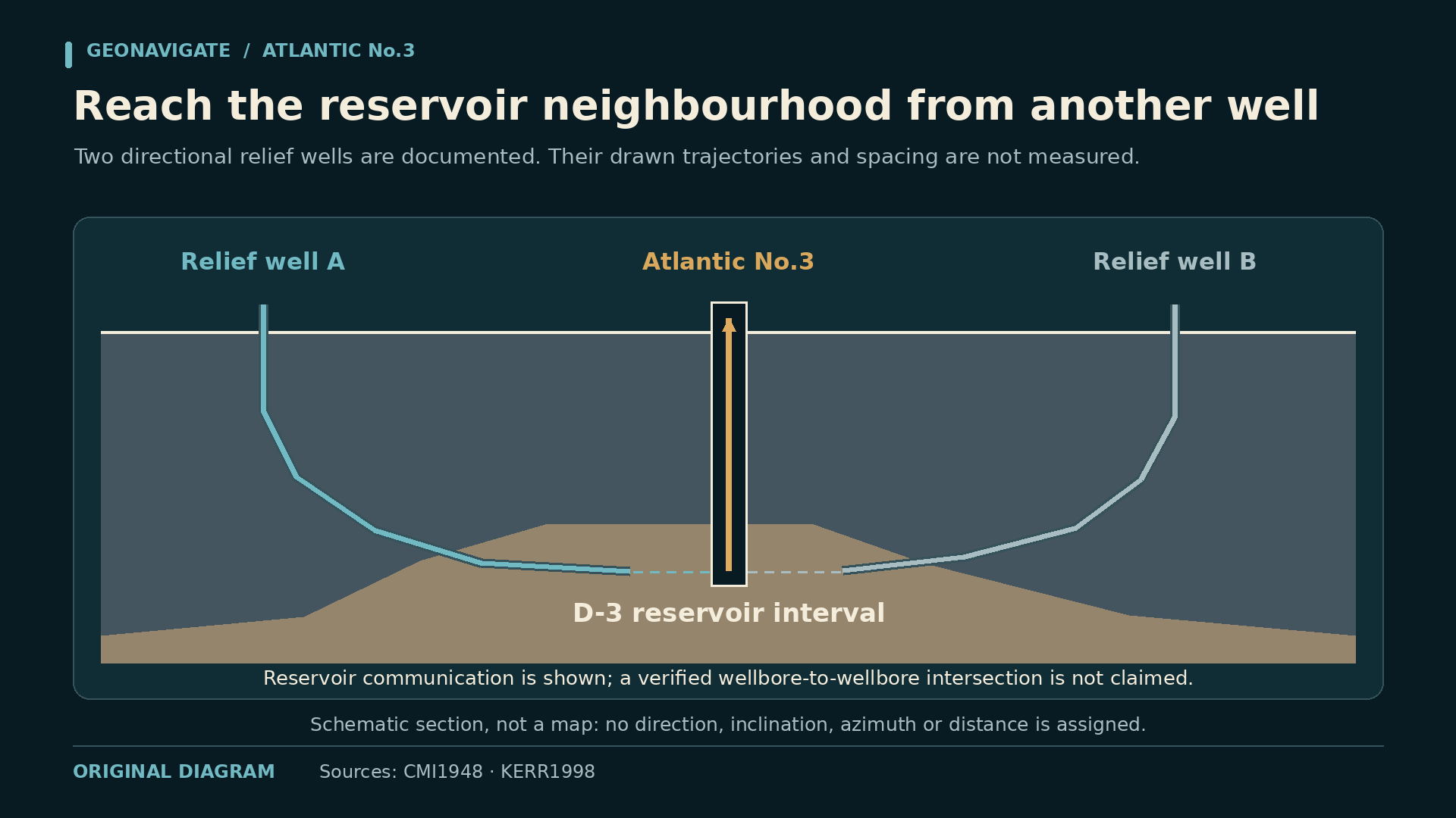
Contemporary reporting describes the two relief holes supplying water to the oil-bearing area. That wording matters. It supports communication through the reservoir; it does not establish a precisely surveyed intersection with the original wellbore of the kind a modern animation might suggest.
The diagram places the wells in a shared conceptual reservoir and labels the spacing as illustrative. Water enters the formation through the relief wells. Its movement depends on the connected paths available in the rock.
Frank Baillargeon's later recollection gives the work a human connection. He remembered helping build Atlantic Number Three's derrick, then returning during the fire with a load of line pipe for the west relief well. He remained on standby through the night. The same well had brought him back for a very different job.
CHAPTER 09
What the water could change
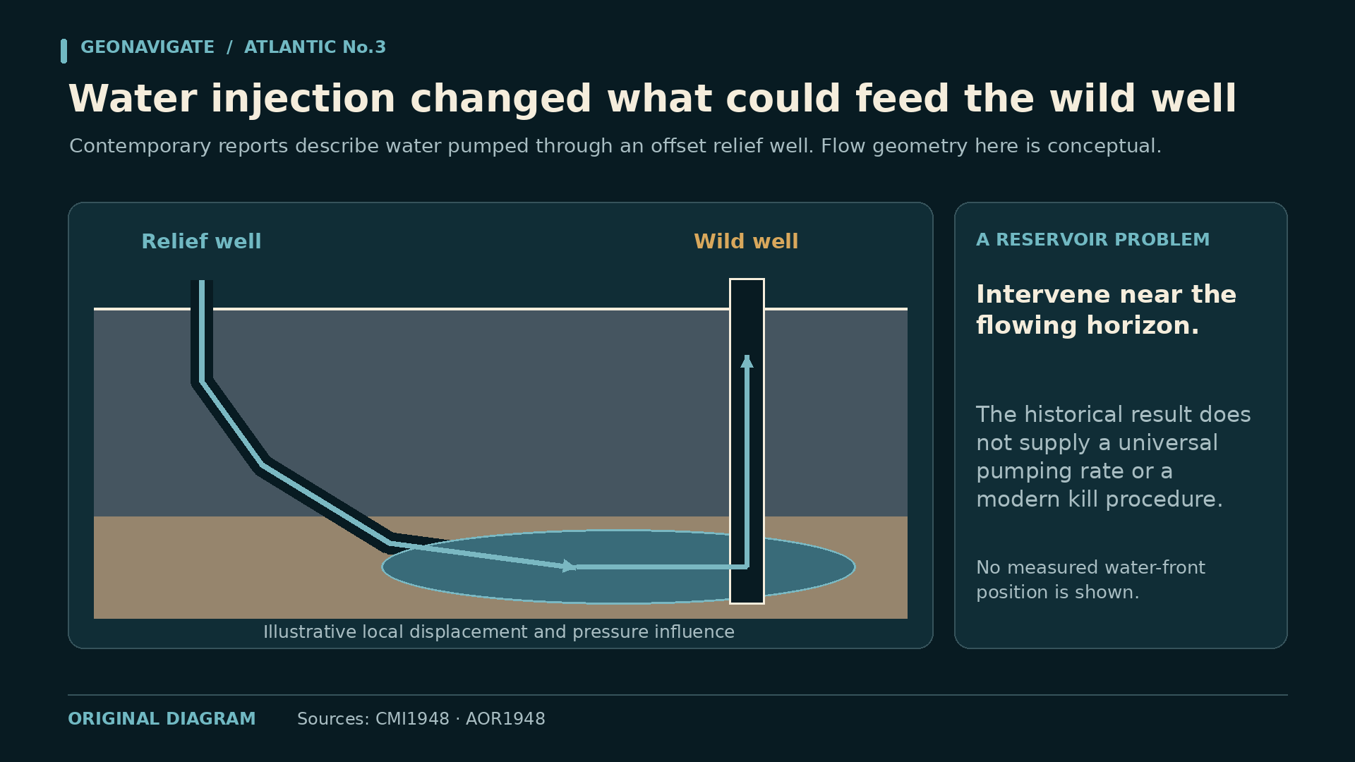
A relief well creates another point of access to the subsurface system. At Atlantic Number Three, the contemporary accounts describe water entering the producing formation through two relief holes during the successful control effort.
The underlying explanation involves pressure and fluid movement. Water entering connected reservoir space can change the pressure distribution and displace hydrocarbons along available pathways. The response depends on where the water goes and how the formation communicates with the escaping well.
Our animation is qualitative. The blue front expands through connected channels, while the oil pathway changes. It is not a history-matched reservoir simulation, and the smooth front should not be mistaken for a measured underground boundary.
A real carbonate can contain preferential pathways, poorly connected pockets and intervals with very different transmissibility. Two nearby points on a map may communicate strongly, weakly, or through a route more complicated than a simple straight line.
The important historical fact is the documented relief-water effort. The important engineering question is how an additional access point can alter the uncontrolled system. Keeping those two levels distinct gives the viewer an explanation without inventing a subsurface survey.
CHAPTER 10
Count the oil that the record actually counts
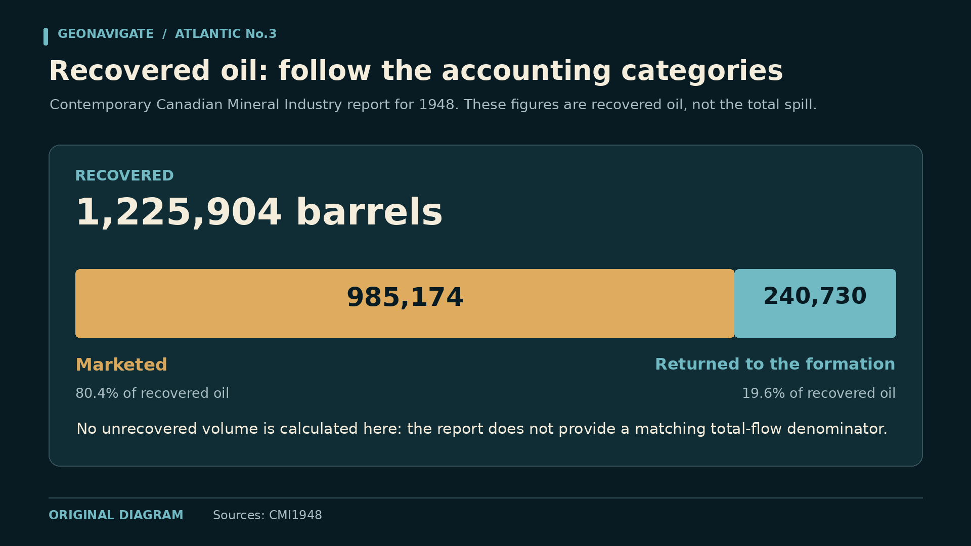
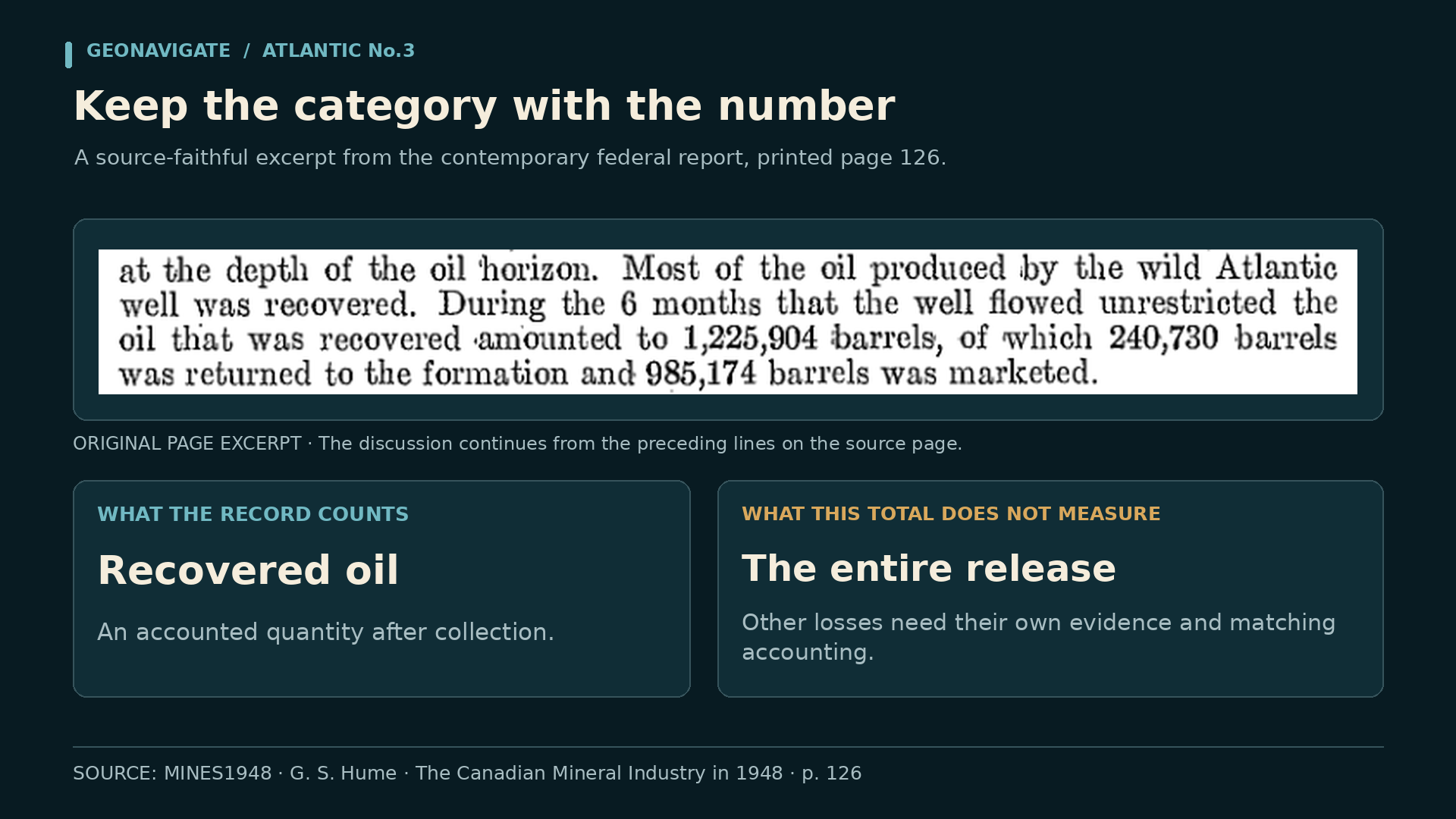
The Canadian Mineral Industry report for nineteen forty-eight provides an unusually useful accounting. It records one million, two hundred twenty-five thousand, nine hundred and four barrels of oil recovered from Atlantic Number Three's uncontrolled flow.
Of that recovered total, two hundred forty thousand, seven hundred and thirty barrels were returned to the formation. Nine hundred eighty-five thousand, one hundred and seventy-four barrels were marketed. Those two dispositions add to the reported recovered total.
The chart keeps all three labels visible. Recovered oil is the accounting category. Oil returned to the formation and oil marketed are the two reported destinations within it. None of those labels means the full amount originally released.
Oil that burned, remained on the land, entered other formations or escaped accounting would require additional evidence. The recovered-oil table does not independently measure those quantities, so our graphic leaves them unquantified.
That distinction changes how a headline number should be used. A precise historical total can be valuable while answering a narrower question than the one a modern reader first assumes. The category belongs beside the number every time it appears.
Chapter sources6
CHAPTER 11
September sixth: the fire
Fire broke out on September sixth. By then, the well had been uncontrolled for nearly half a year. The flames transformed a long-running engineering emergency into the image most people would remember.
The provincial Oil Review records a fire lasting fifty-nine hours. The federal mineral report describes about two and a half days. Those contemporary descriptions agree closely, even though some later summaries blur the fire into the much longer blowout.
The dated archive photograph was taken on September seventh. It anchors our view in the actual event. The short AI recreation is separately identified as an atmospheric illustration, with no claim to reproduce the exact equipment or site layout.
News published on September tenth reported that the flow had ended early the previous day, while cement plugs were still expected. That places the cessation of the wild flow on September ninth and leaves the remaining isolation work distinct.
The sequence is the essential point: months of uncontrolled flow, then a fire measured in days, then the work of securing the well. Each stage had different hazards, different observations and a different meaning for the people trying to finish the job.
CHAPTER 12
Fire out, flow stopped, well secured
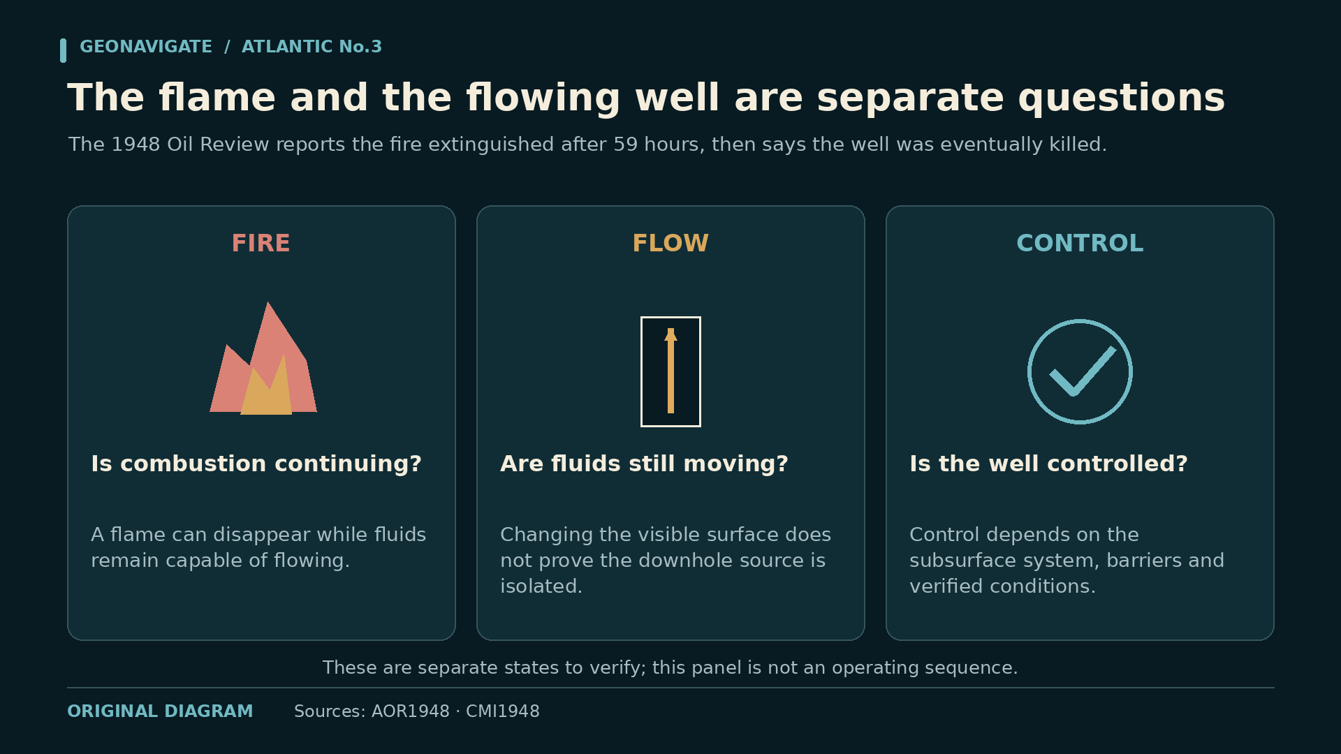
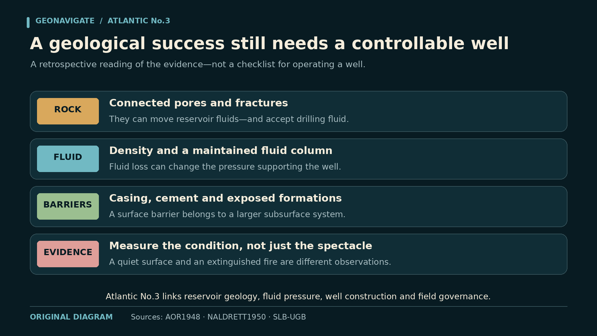
A fire going out is a visible event. Hydrocarbon flow stopping is a pressure-and-fluid event. A well being permanently secured is a barrier question. At Atlantic Number Three, the final chapter has to keep those outcomes distinct.
The September tenth newspaper account reported the cessation of flow and said cement plugs would still follow. That is a contemporary reminder that the disappearance of the plume was not, by itself, the complete abandonment record.
Our final control diagram separates three outcomes: the fire is extinguished, the unwanted flow is controlled, and the remaining work establishes the intended isolation. The reports connect the first two outcomes closely; they do not establish a simple sequence between them. Plugging work was still to follow.
The exact configuration, placement and verification of permanent barriers belong to the well record. This episode does not reconstruct them from a newspaper description or supply invented cement volumes and operating pressures.
For someone reading an old incident today, the useful habit is to ask what each source actually observed. A photograph can document smoke. A report can describe flow. A completion or abandonment record is needed to establish the final downhole condition.
CHAPTER 13
The consequences outlast the headline
The recovered oil also became part of the financial aftermath. A nineteen fifty-three court judgment records that sale proceeds went into a trust account for response costs and approved claims. The flow that had disrupted the field also supplied money toward the consequences.
Alberta's conservation regulator already existed before this blowout. The event did not create regulation from nothing. It became a forceful example of why drilling practice, conservation authority and the ability to intervene mattered in a rapidly expanding industry.
The land also carried a history beyond the fire. Later heritage descriptions record persistent effects on vegetation and agricultural use, while a later regulator publication shows crops at the site. Those dated observations answer different questions.
They do not establish the site's present soil condition, prove that every impact was removed, or justify saying that the land is still barren today. A historical documentary should preserve the dates rather than turn an old image into a current environmental assessment.
That same court judgment records Number Three still shut, while Atlantic's first two wells were restricted to two-thirds of their normal allowable production. The consequences were still being worked through years after the smoke had cleared. A well-control disaster could shape the future of an operator's other wells.
CHAPTER 14
From the flame to the reservoir
Return to that September photograph. The smoke now carries a longer sequence behind it: circulation losses, declining pressure support, uncontrolled escape, surface collection, field restrictions, relief drilling and water supplied from the river.
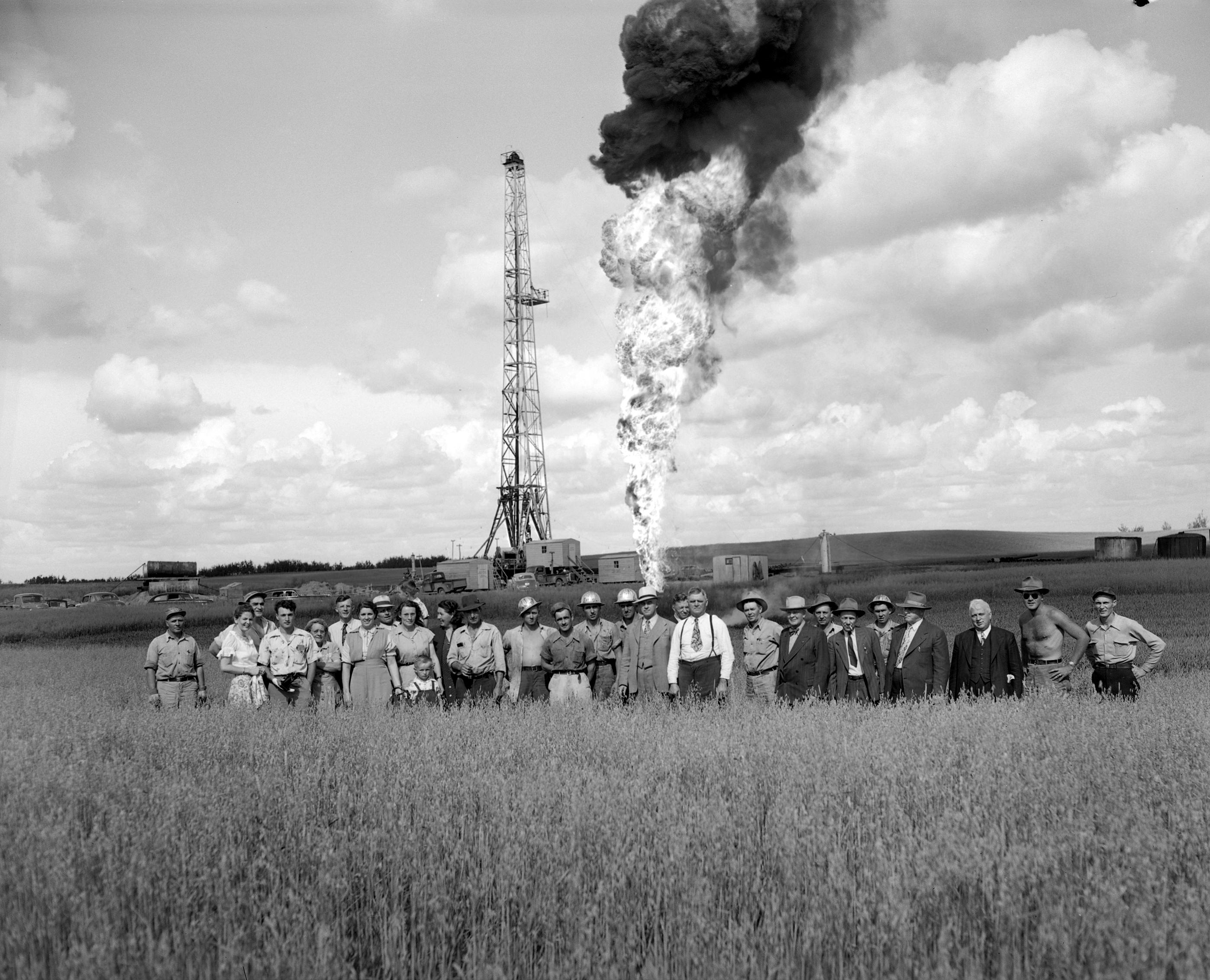
Each source gives us a different view. The archive photograph preserves the visible event. The relief-well photograph records work aimed at changing it. The contemporary reports separate fire duration, control dates and recovered-oil accounting.
For a geologist, this is a story about connected rock and changing fluids. For a drilling team, it is a story about maintaining and understanding the pressure-containing system. For the wider field, it is a story about the infrastructure needed when control is lost.
The diagrams simplify those relationships so we can follow them. Their value depends on keeping measured observations, documented history and conceptual explanation clearly identified. That discipline is as useful in a modern well review as it is in reconstructing nineteen forty-eight.
Atlantic Number Three was finally brought under control, but the photograph alone cannot explain how. The fuller story reaches from the flame down into the reservoir, and outward along the waterline to the people whose work helped end the emergency.